

I have a confession: I maybe kind of get some of my kicks on Route 66. But this wasn’t always the case.
Ten years ago, I was showing a friend of a friend around St. Louis. His name was Lonz, and he was from Spain. Lonz and I hit it off, and he joined my wife, me, and some friends for a long summer walk. From our apartment, we circled Forest Park, stopped for drinks at the Boathouse, and grabbed dinner in the Loop.
Along the way, Lonz spoke excitedly about his road trip along the entire Historic Route 66.
“Wait,” I said, surprised. “You’re following the whole thing?”
“Start to end,” said Lonz in choppy English. “All the miles.”
A week earlier, he’d started in Chicago and driven across Illinois. Now he was focusing on Missouri’s roughly 300 miles. Next was Oklahoma, the Texas panhandle, New Mexico, Arizona, and Southern California. After about 2,450 miles over six weeks, he would reach the road’s end at the Santa Monica Pier.
Lonz assumed that because I lived in St. Louis and was basically a resident on the so-called Main Street of America, I must share his enthusiasm for this iconic road. Truth is, Lonz knew more about Route 66 than our entire friend group.
While his trip sounded like a blast, and I was genuinely interested in history and quirky attractions, following an old highway wasn’t something I’d ever fully considered.

Gary’s Gay Parita Sinclair on Route 66 near Springfield, Missouri. (Visit Missouri)
Route 66 with a Twist
Lonz passed through town during the summer of 2016, and I had just gotten home after boating on an awesome whitewater river out west. Meanwhile, regionally, I was wrapping up work on the guidebook Paddling the Ozarks. Over the years, I’d repeatedly stumbled across the double sixes while chasing other adventures. Sometimes I lingered, but more often I sped through.
During a few visits with Lonz, it increasingly felt like this friendly explorer was showing me a piece of my own country. We visited an exhibit about Route 66 at the Missouri History Museum. I told him about the rapids below the Old Chain of Rocks Bridge, where friends and I kayaked.
The Spaniard explained why he and other international visitors are so enthralled with Route 66. It’s a trip through time along a swath of classic Americana. A quintessential and charismatic glimpse of mid-20th-century U.S.A.
Before continuing west, Lonz joined a few of us for another typical Missouri experience: a float trip. In this case, we paddled Little Piney Creek, an unsung tributary of the Gasconade River near Route 66. Ultimately, Lonz’s enthusiasm was infectious. I decided that, going forward, I would give this historic roadway a closer look.
Ten years later, I can happily report that Route 66 has been worth every wacky stop. However, I realized that for outdoor-focused explorers, a few modifications may be necessary. Instead of driving every mile, my wife and I made a conscious effort to just drop in on Route 66 whenever it overlapped with other adventures. We stopped at a hubcap museum after a river trip. We went for a hike before heading to a microbrewery set up inside a former mechanics shop. For us, adding the “tacky stuff” was far more fun than making the roadway the main event.
This year is the 100th anniversary of the establishment of Route 66 as a U.S. highway, and Missouri is at the center of the action. Celebrations are planned across the state. Many of the classic sites and museums have been updated. Meanwhile, in recent years, some of these Route 66 communities have opened new parks and trails for outdoor recreation.
As a result, you now have more ways than ever to go on your own adventures while rediscovering the historic roadway. (Read on for plenty of ideas.)

Route 66 Neon Park along Route 66 in St. Robert, Missouri. (Visit Pulaski County)
A Highway Born in Springfield
Route 66 was always a bit of an oddball. Henry Ford released the Model T in 1908, making automobiles affordable to the average American. Figuring out where to drive them was a little more complicated. In the early days of motor cars, when horse-drawn wagons were still the norm, the issue was roads. Most cities had some paved streets, whether cobblestone, packed gravel, or a newer surface called asphalt.
For cross-country travel outside of cities, good luck.
Drivers bounced across the countryside, following dirt roads, mud flats, cattle trails, railroad tracks, and even streambeds. To help, a network of informal auto trails was established and maintained by private clubs and local municipalities. One such network was called the Ozark Trails, with its main corridor running from St. Louis through Springfield (Missouri), Tulsa, Oklahoma City, Amarillo, and into New Mexico.
By the early 1920s, public demand led to plans for the nation’s first federal road network. The U.S. Numbered Highway System would feature a grid of paved routes spanning coast to coast. In theory, these mainly two-lane highways would follow specific rules. East-to-west routes would carry even numbers, starting with the lowest in the north, while north-to-south routes would have odd numbers, beginning with the lowest in the east. However, in practice, these guidelines were difficult to follow.
Meanwhile, two influential businessmen, John T. Woodruff in Springfield and Cyrus Avery in Tulsa, strongly supported a unique diagonal route that traced the main corridor of the Ozark Trails. Originally designated as Route 60, this route would connect the industrial city of Chicago on Lake Michigan with the expanding suburbs of Los Angeles and its port on the Pacific Ocean.
Critics noted that this northeast-to-southwest highway would break all the rules on the proposed map, starting near Route 20 and ending near Route 70. As a result, on April 30, 1926, during a meeting of highway officials in Springfield, a new number was selected: Route 66.
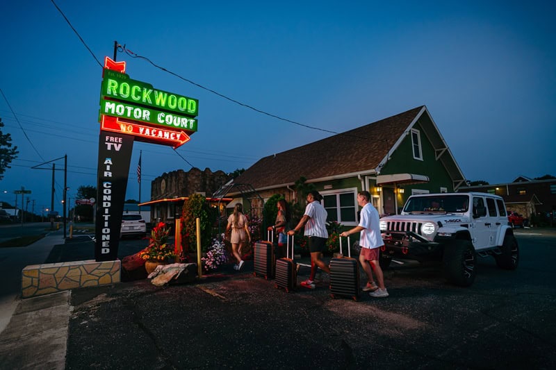
Rockwood Motor Court along Route 66 in downtown Springfield, Missouri. (Visit Springfield)
From Main Street to Historic Route
Upon its founding in 1926, Route 66 became a near-instant hit. Thanks to its booming endpoints and mostly flat profile, it rapidly grew popular for long-distance truckers and people heading west. Signs were put up, and thousands of laborers gradually paved the road. Many small towns sprang up along the route, with their main streets directly on it. This led to the rise of mom-and-pop diners, service stations, and a new type of lodging called motor hotels, or motels for short.
In the 1930s, as the Great Depression and Dust Bowl struck, more migrants headed west seeking new opportunities. The Dust Bowl, caused by prolonged drought and poor farming practices, filled the skies with dust storms and made parts of the Great Plains nearly unlivable for about a decade. It was John Steinbeck who coined the nickname “Mother Road” in his 1939 novel The Grapes of Wrath, which follows the Joad family’s journey from Oklahoma to Southern California, where they face even more hardships.
During World War II, westward migration grew to support wartime industries. After the Allies prevailed, a booming U.S. economy in the 1950s shifted focus to tourism along Route 66. The great American road trip was born, and Los Angeles — home of Hollywood and Disneyland — became a top destination.
Starting in the late 1950s, the creation of the Interstate Highway System, with faster and more direct freeways, caused the decline of Route 66. Sometimes, these new interstates replaced the original road, and other times they bypassed it completely. As a result, the original main streets were cut off from traffic, and commerce and tourists moved elsewhere. Mom-and-pop businesses shut down, and many small towns faced hard times. By 1985, the entire Route 66 was officially decommissioned.
Over the next decades, various groups, communities, and states launched a widespread movement to preserve the original roadway as Historic Route 66. Old buildings were reopened as vintage diners, museums, and tourist spots. Neon signs lit up again. The quirky road trip through classic Americana was back.
***

Running in St. Louis’ Forest Park. (Jennifer Korman, Forest Park Forever)
Route 66 Adventures in St. Louis
The big event in the city will be the Route 66 Centennial Festival at the Missouri History Museum in Forest Park. The free, four-day event will run from April 30 through May 3 and will include outdoor concerts, classic car shows, neon displays, expert speakers, and children’s activities. There will also be food carts nearby. (For a full list of events, visit mohistory.org/events.)
The festival is a great opportunity to explore Forest Park. Consider parking further away and walking along the scenic paths and sidewalks. Or bring bikes and enjoy the 5.5-mile paved cycling loop around the park. At the Big Muddy Adventures dock northwest of the Boathouse, you can rent kayaks and paddleboards to explore the lake. Other free attractions include the Zoo, Art Museum, and Science Center.
For more adventures, head north of downtown and walk across the mile-long Old Chain of Rocks Bridge — known for its infamous 22-degree bend — which once carried Route 66 drivers over the Mississippi River.
In addition, the National Museum of Transportation in Kirkwood will host a special centennial exhibit about Route 66 titled “Roads, River, Rooms, and Reels.”
West of the city, Route 66 State Park in Eureka features a visitor center and offers opportunities for hiking, biking, and paddling. Run the Get Your Butt Kicked @ Route 66 footrace here on July 18.
***

Riding on the Sac River Mountain Bike Trail. (Visit Springfield)
Route 66 Adventures in Springfield
As the birthplace of Route 66, Springfield, Missouri, is hosting the National Route 66 Centennial Kickoff Celebration from April 30 through May 2. In addition to food and specialty vendors, downtown events will include a parade, classic car show, live entertainment, and a rededication of the Jefferson Avenue Footbridge. More details can be found here.
Other highlights around town include the History Museum on the Square, which features regional exhibits and a Route 66 gallery. Another popular stop is the Route 66 Car Museum, which displays over 60 classic vehicles. Scattered throughout the city, murals and sculptures can be seen on self-guided walking tours, including a Route 66 mural outside Bud’s Tire & Wheel at 701 W. College St.
Further adventures await in this part of the Ozarks. You can enjoy paddling trips on the James River, including a scenic five-mile stretch from Kerr Access to Cox Access, featuring beautiful bluffs. Mountain biking options include the Sac River Mountain Bike Trail and Two Rivers Bike Park. Additionally, shorter or longer rides are available on the Frisco Highline, a 35-mile rail trail that is one-third paved and the rest made of crushed gravel.
***

The Route 66 Rocker in Fanning, Missouri. (Visit Missouri)
Route 66 Adventures Across Missouri
If you’re interested in lesser-known places and unexpected attractions across Missouri, Route 66 has you covered. Here are a few spots, listed from northeast to southwest, that you can reach via the original roadway or from I-44.
Meramec Caverns in Stanton and Onondaga Cave State Park near Leasburg are popular Route 66 stops for underground exploration. Nearby, the Meramec River is great for floating.
Cuba calls itself the Route 66 Mural City, while nearby Fanning features the Route 66 Rocker, the world’s second-largest rocking chair (and once the largest).
After paddling the classic float stream of Big Piney River, drive across Devil’s Elbow Bridge — a famous Route 66 landmark.
Route 66 Neon Park in St. Robert features a collection of neon signs that once attracted travelers along the Mother Road. In nearby Waynesville, Frog Rock is a hokey painted outcrop on a bluff overlooking Route 66.
Further west in Lebanon, there’s a free Route 66 museum.
A half hour west of Springfield, in Ash Grove, you’ll find a restored Sinclair gas station called Gary’s Gay Parita.
In the southwest corner of Missouri, Joplin features the Route 66 Mural Park, best known for its 3D Corvette mural, along with other murals around town and inside city hall.
***

Biking through St. Louis’ Forest Park. (Dennis Coello)
Ride Your Bike on Route 66
For a truly immersive experience, try traveling the Mother Road under your own pedal power.
Stretching more than 2,480 miles from Chicago to Santa Monica, Bicycle Route 66 closely follows the original roadway. For Midwestern riders, the Missouri section offers an especially compelling mix of scenery, nostalgia, and small-town hospitality.
After crossing the Mississippi River into St. Louis, cyclists leave the urban bustle behind for rural highways and quiet country roads. The terrain shifts from gently rolling farmland to punchy climbs in the Ozarks, rewarding riders with long views and relatively low traffic. Communities along the way welcome Route 66 travelers, with services generally spaced well for touring cyclists.
The stretch from St. Louis to Joplin carries riders about 330 miles across the state before the route enters Kansas near Galena. Newer tourers should plan for 40 to 50 miles a day and train accordingly, gradually building up from shorter rides at home. Schedule rest days strategically throughout your trip and aim for a spring-to-fall timeframe to avoid colder weather.
A touring bike designed to carry weight is ideal. Panniers and packs typically provide ample storage, and slightly wider tires can help manage varied road surfaces. Because services can be sparse, you should carry repair essentials, extra tubes, and sufficient food and water. You don’t want to risk being stranded because the gas station you planned to stop at is further than expected — or not open at all.
For official Bicycle Route 66 maps and resources, visit the Adventure Cycling Association.
Author: Mike Bezemek is a frequent contributor to Terrain.
Top image: Walking across St. Louis’ Old Chain of Rocks Bridge, which once carried Route 66 drivers over the Mississippi River. (Mike Bezemek)
Leave A Comment