
In addition to being excellent exercise, biking offers a fun way to take in inspiring views. Below are some of the most scenic trails the area has to offer to those on two wheels.
Tunnel Hill Trail
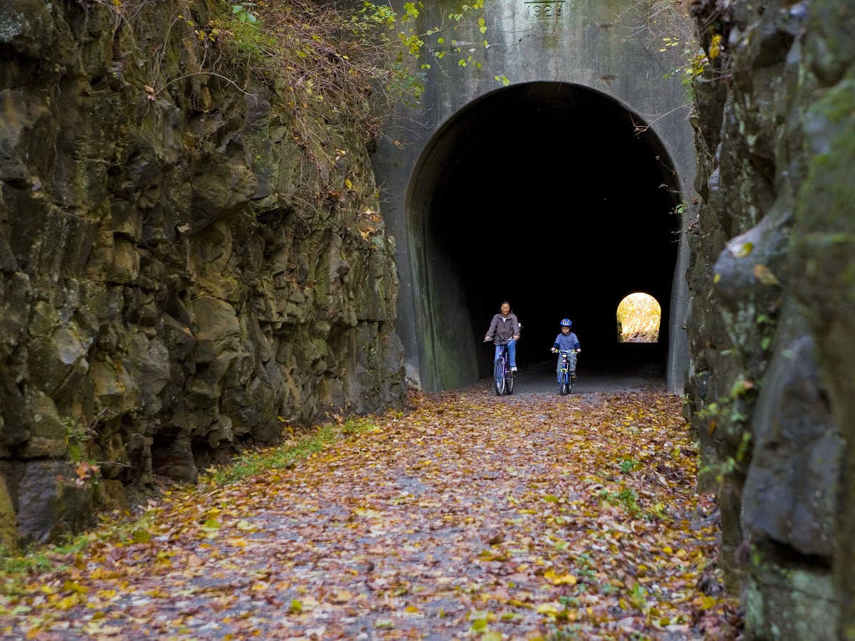
Tunnel Hill State Trail is a 45-mile rails-to-trails path along the old Cairo and Vincennes Railroad in Illinois. The crushed limestone trail, suitable for bikers of all abilities, meanders between Eldorado and Karnak, Illinois. The southern half between Tunnel Hill and Karnak is particularly scenic.
The trail gets its name from the 543-foot-long narrow tunnel at Tunnel Hill — you’ll want to bring a flashlight or bike light to safely get through this. It then takes you through woodland and over multiple trestles crossing streams and ravines and through ponds, marshes, and wetlands.
Between Vienna and Karnak, you’ll pass by the ghost town of Forman. The trail also goes through a section of the Shawnee National Forest, the tree canopy providing plenty of shade in summer.
At the southern end of the trail close to Karnak, you can take a short, 2.5-mile spur to access the Cache River State Natural Area and admire its giant cypress trees and wetlands.
The Katy Trail
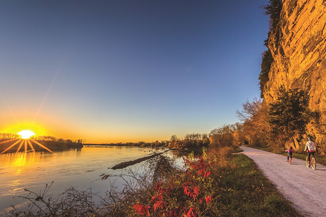
Katy Trail State Park, the longest rails-to-trails path in the US, is a whopping 250 miles, stretching almost the entire state of Missouri from east to west. Most of the Katy follows the Missouri River, passing through picturesque farmland and quaint small towns.
The Katy Trail has 26 trailheads, making it easy to customize your experience and hop on wherever you please. The 7-mile stretch between Defiance and Augusta is one popular option, taking bikers past rolling farmland, limestone bluffs, and plenty of tree shade. Both towns offer opportunities to refuel at breweries and scenic wineries (for the latter, you’ll have to take a quick detour from the trail).
Another scenic option is the 35-mile section between North Jefferson to Rocheport, which takes riders over multiple bridges, through a limestone tunnel, and past towering bluffs.
Rock Hollow and Al Foster Trails
(Great Rivers Greenway)
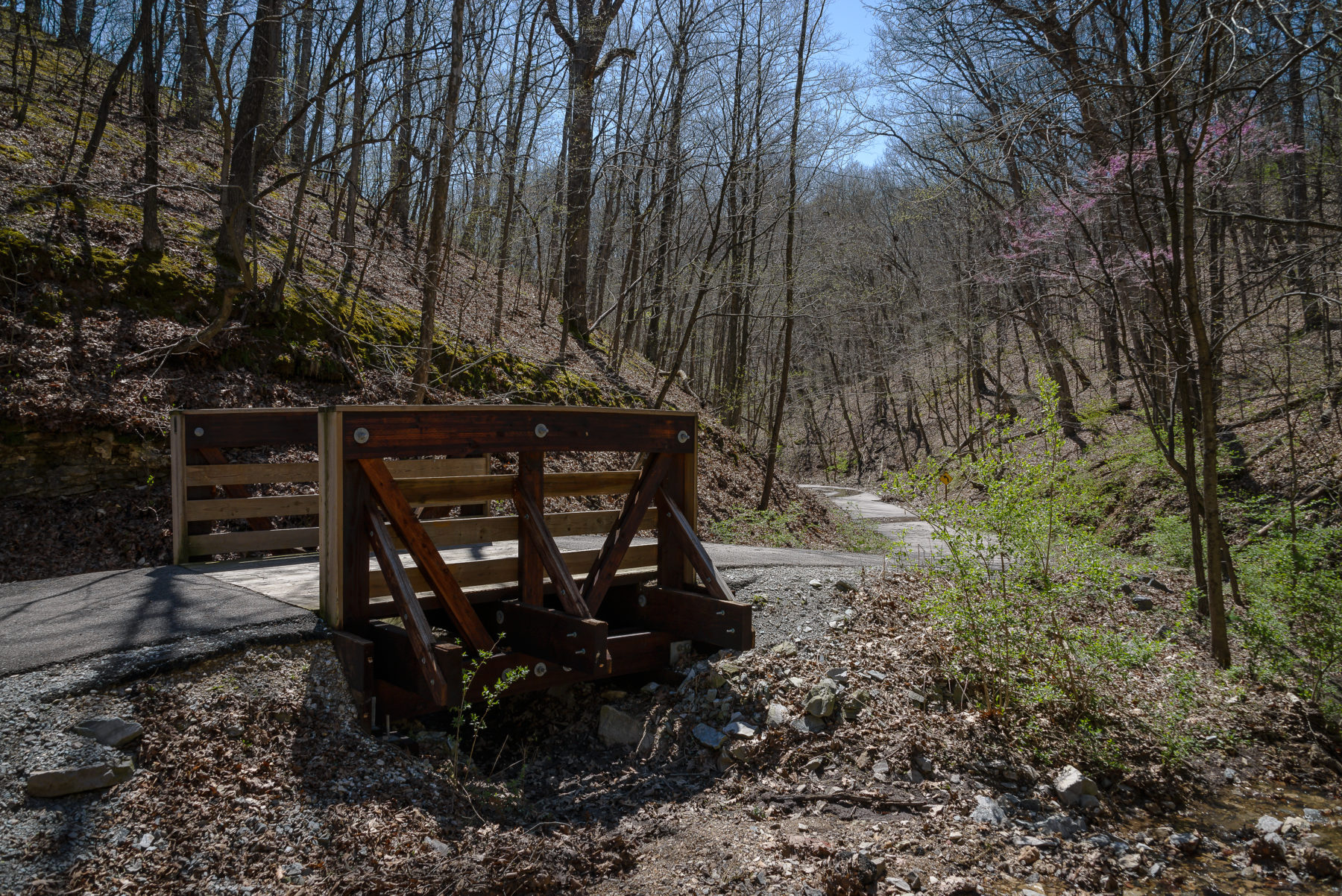
Part of the Great Rivers Greenway network, Rock Hollow and Al Foster trails offer some seriously amazing views in west St. Louis County. From the trailhead at Ridge Meadows Elementary School, you’ll embark upon the Rock Hollow Trail, a 10-foot wide asphalt path that meanders downhill through two high ridges to Al Foster Trail, which offers stunning vistas of the Meramec River and its limestone bluffs.
The round trip is approximately 5.5 miles (longer if you want to explore all of Al Foster) and takes you through woodland and steep rocky terrain, traveling over 13 wooden bridges and past a waterfall, if the conditions are right. The trail is beautiful year-round, most notably in the spring, when bluebells make their appearance, and during fall color. Seth Treptow, communications manager at Great Rivers Greenway, describes the loop as “pastoral, blissful paradise” and a great option for families, who can enjoy a ride on the Wabash, Frisco and Pacific Railroad, a miniature steam train.
Glade Top National Forest Scenic Byway
(US Forest Service)
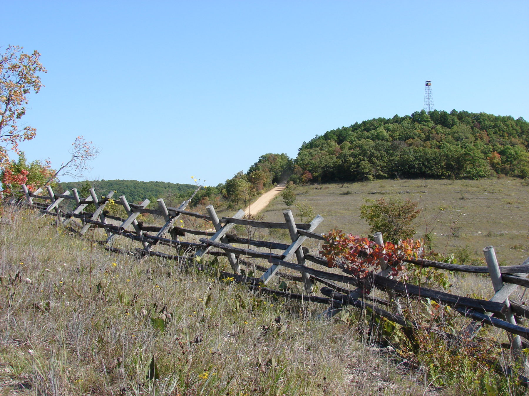
Glade Top Trail, Missouri’s only National Forest Scenic Byway, meanders 23 miles through the Mark Twain National Forest. The gravel trail escorts bikers along narrow ridge tops and through limestone and dolomite glades, offering beautiful panoramic views of the surrounding valleys and Boston Mountains in Arkansas.
You’ll definitely want to hop off at the seven overlooks to take in the scenery. Ava, Missouri is a good starting point. Note: You’ll have to share the road with cars and sometimes even horses. Fall is a great time to tackle this one, as the area’s smoke trees turn a vivid red.
Mississippi Greenway in Cliff Cave Park
(Great Rivers Greenway)
Cliff Cave County Park, located off Telegraph Road in south St. Louis County, offers bikers yet another opportunity to admire riverside views. The 5.1-mile looped Mississippi Greenway trail includes an overlook 170 feet above the Mississippi.
“The upper portion of the trail twists and turns its way through the higher elevations of the park, providing great views and one of the most diverse plant and animal communities in the region,” said Treptow. “The climb between the lower and upper portions of the greenway is probably the most challenging in our entire system of greenways, so it will make you work, but the views more than make up for it.”
Lower sections of the trail are gentler, and the Mississippi Greenway also connects with mountain bike trails, so there’s something here for every type of cyclist.
MCT Goshen Trail
(MCT Trails)
The MCT Goshen Trail is a rail-to-trail, 19.5-mile asphalt path connecting Roxana to O’Fallon, Illinois. It takes bikers through 10 tunnels and over eight bridges crossing creeks, roads, and even an active railroad.
The scenery includes attractive farmland and ample tree canopy, which offers plenty of shade during hot weather. The Goshen Trail also goes through a number of communities, including Edwardsville and Troy, providing opportunities to stop and grab a bite to eat.
“It’s a beautiful ride in the summer,” said David Cobb, GIS specialist with Madison County Transit. “It can be a 90-degree day, but as you head into the tree cover, the temperature drops 15 degrees.”
Author: Stephanie Zeilenga is a regular contributor to Terrain Magazine.
Lead Image: The Katy Trail near Rocheport, Mo., by Dennis Coello.
Leave A Comment