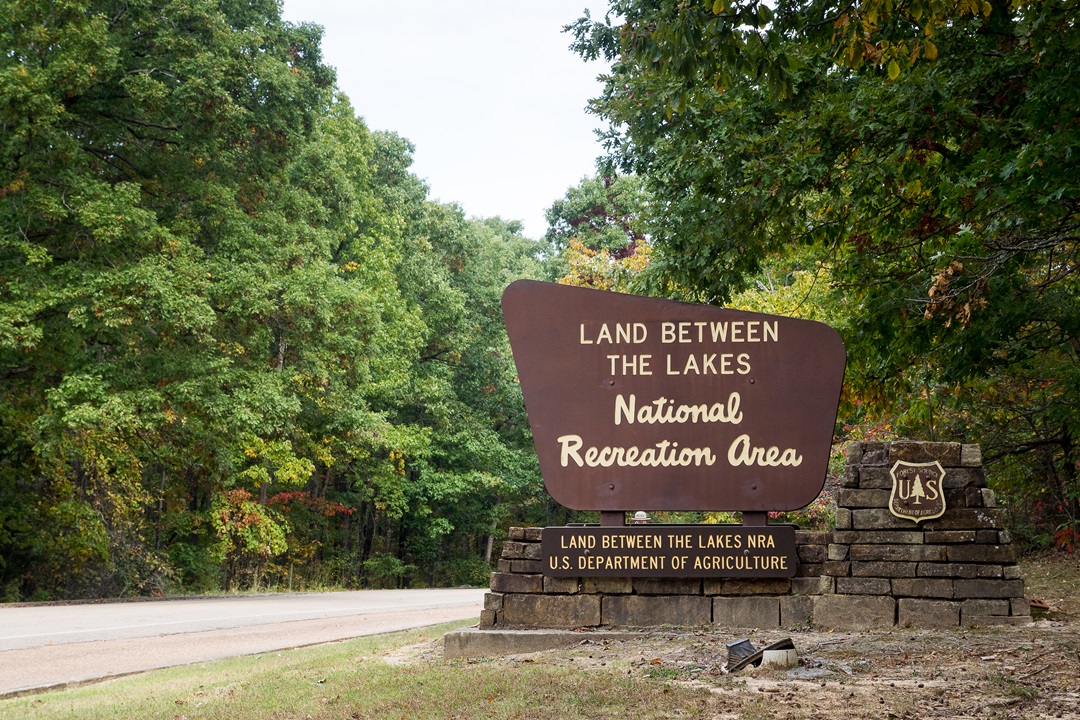
The moment I stepped inside the Golden Pond Visitor Center, I began to understand. On a wood-paneled wall, there were dozens of paper brochures. Seemingly one for every highlight in this vast recreation area. There was even a planetarium in the attached dome theater. Figuring out what to do was going to be tough.
For years, when driving interstates from St. Louis to the Southeast, I passed intriguing brown signs for Land Between the Lakes National Recreation Area. But whenever I searched online, the vibes were mostly reservoirs, shorelines, and motorboats. Maybe an occasional horseback rider or hunter. So, I kept speeding past—with mountain bikes, hiking shoes, and kayaks—to distant mountains.
Yet Land Between the Lakes (LBL) had some promising stats. Over 170,000 acres of forested peninsula, 300 miles of undeveloped lakeshore, and 500 miles of trails. Such big numbers with little explanation were almost a red flag. National recreation areas often surround reservoirs, which tend to become the focus, making inland activities harder to find. Certainly, there had to be some worthy adventures here.
In the mid-20th century, the Tennessee Valley Authority built a pair of large dams on the Tennessee and Cumberland Rivers, creating Kentucky Lake and Lake Barkley. The peninsula was acquired by eminent domain and left in a natural state for outdoor recreation. In 1998, management was transferred to the U.S. Forest Service. Last summer, on a looping road trip between the Ozarks and the Southeast, I dropped by with my camper for four nights. I came away impressed. So, that October, I returned for cooler weather. During these two trips, I studied maps, asked around, and hit the ground for a broad survey of what the area offered. Here’s what I found.
Central LBL: Cycling, Wildlife, and Hiking
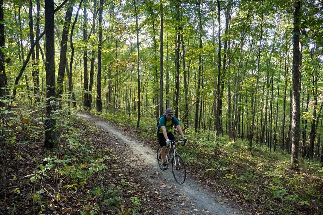
Outside the visitor center, I hopped on my gravel bike. The Central Hardwoods Scenic Trail is an 11-mile route for walking and cycling that crosses the peninsula from lake to lake. While looking for the trailhead, I encountered a young St. Louis family on bikes. We were all disoriented by the lack of signage, but soon we found the way. They decided to head toward the eastern end, where the final 2.5 miles are paved through fields next to the highway.
I focused on the western side, where an 8.5-mile crushed gravel path rolls through hilly old-growth forest. My turnaround point was the Eggner Ferry Bridge, where I took a shady break next to the water. This was a fun ride. Almost any bike would work, and I encountered maybe 10 other people, mostly walking through the woods.
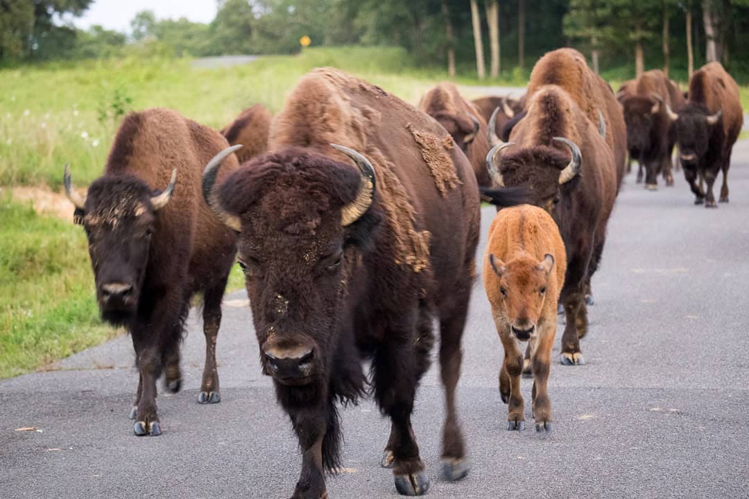
Just north of Golden Pond is the Elk & Bison Prairie. One warm evening, I paid the small fee and drove the three-mile loop through the 700-acre wildlife preserve. At one time, vast herds of these large herbivores roamed grasslands across North America. Due to overhunting and farming, they’re now found in narrower wild ranges or refuges like this one. As dusk arrived, a line of bison marched along a road with less than a dozen cars, past meadows filled with grazing elk and blinking fireflies.
Early the next morning, I embarked on a long hike around the Nature Station Trail System. I started with the 4.6-mile Honker Trail. When mosquitos swarmed, I returned to my truck and restarted the hike wearing long pants and a hooded hiking shirt sprayed with bug repellant. A moderate path led through woods to the edge of Lake Barkley and across Honker Dam, which impounds a large wetland filled with water lilies and birds. Then I continued onto the 2.2-mile Hematite Trail, another moderate loop around a smaller lake. Once again, I encountered only a handful of friendly hikers.
Afterward, I visited this area’s centerpiece, the Woodland Nature Station. An education center led to outdoor gardens and a small rehabilitation zoo. Animals include snakes, raptors, owls, and more. One highlight was the red wolves, which I caught at feeding time.
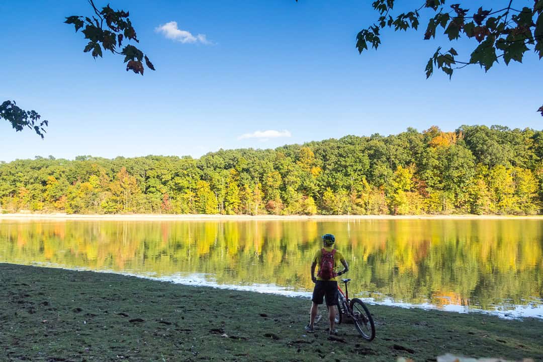
The summer heat was rising, so I drove back to my site at Energy Lake Campground. Throughout the rec area, there are four developed campgrounds with RV hookups, tent sites, and shower facilities. Elsewhere, you’ll find numerous primitive camping areas. I figured an afternoon paddle around this inland lake would be a good way to cool off. After carrying my kayak to the beach, I went for a swim in what turned out to be bathwater. While paddling a hot lap, I kept noticing little periscopes rising above the surface. I initially assumed turtle heads. Floating over a few, I discovered these were actually small water snakes. Non-venomous, yes. But maybe next time I’ll paddle cooler waters in the main reservoir.
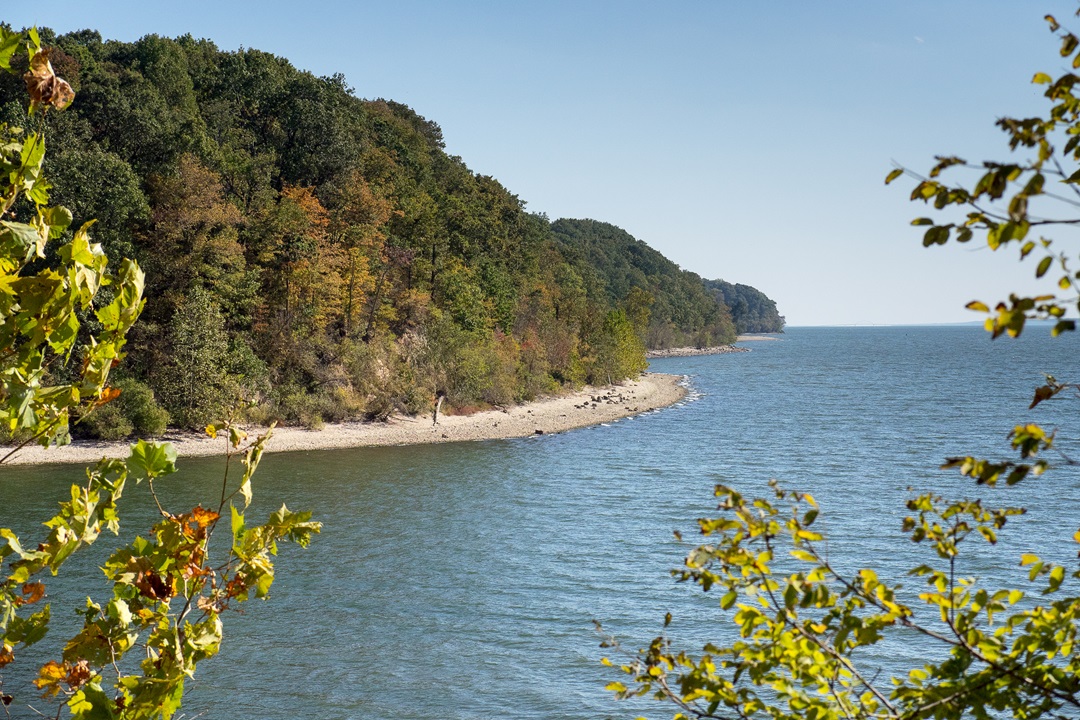
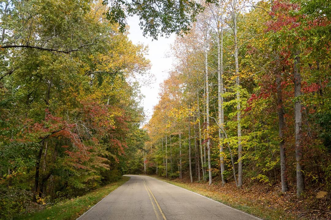
Before resuming my road trip across the Southeast, I made sure to range along the entire Woodland Trace National Scenic Byway. This two-lane road stretches nearly 50 miles, north to south, along the entire LBL peninsula. I made several excursions onto paved and unpaved side roads. Everywhere I went, other than the popular shoreline campgrounds, I saw nearly empty woods. Clearly, there were more adventures to find here, so I started making plans for a cooler weather return.
Northern LBL: Singletrack, Camping, and Paducah
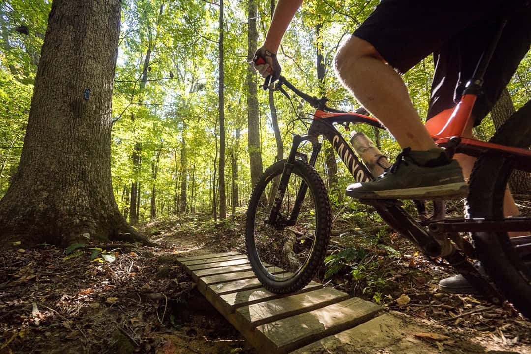
During my summer visit, I managed a morning ride on the Canal Loop Trail. The trailhead is at North Welcome Station. This proved to be the best mountain biking at LBL, with about 14 miles of singletrack. When considering the many connectors, the full loop is segmented into five shorter loops, which allow for customizable rides of shorter or longer lengths.
In the parking lot, I teamed up with an Illinois mountain biker passing through on his drive home. We soon discovered a recent windstorm left some damage. For one thing, the trailhead sign was gone. While trying to find the start, we briefly rode the wrong way on the North/South Trail. This mixed-use route traverses the entire length of LBL, but it has some quirks. The northern 31 miles are mostly singletrack for hikers and bikers. The southern 28 miles are mostly old doubletrack roadbeds, open only to hikers and horses – no bikes. My explorations crossed this long-distance trail a few times, and I remain curious about seeing more.
Eventually, we found the start of Canal Loop and cruised along the lakeshore on a fast cross-country trail with rolling hills and scenic views. This was a surprisingly entertaining ride and one that I would happily return to. When we reached the western bluffs, we discovered dozens of down trees to negotiate. At one point, we walked across fallen trunks, carrying our bikes. Upon returning to the welcome station, I drew a map for the chainsaw crews coming to clean up the trail. After quite an adventure ride, my new friend and I had a discreet beer in the parking lot and shared our favorite trails around the country.
Upon returning that October, I decided to spend a full day re-riding both directions of Canal Loop. With cooler temps, I biked three laps at blazing speeds. Sure enough, the trailhead sign was replaced, all the trees were cleared, and the emerging fall colors were a bonus. A fun trail for beginning mountain bikers to build skills and experienced riders to build their legs.
This time, I had pitched a tent at the nearby Hillman Ferry Campground. That put me in 30-minute striking distance for dinner in the river city of Paducah, Kentucky. On my previous trip, I had picked up food at Just Burgers and taken it to Dry Ground Brewing Co. They have some great beers and are located inside the old Coke plant, a historic landmark. This time I went to Burrito After Dark, a friendly bar and Tex-Mex grill. For a dinner option closer to northern LBL, on a different night, I stopped by the locals’ scene, Between the Lakes Taphouse in Lake City. While I was chatting with an aspiring mountain biker at the bar, an amateur Elvis impersonator took the stage for an impromptu a cappella session. When I asked if he was a hired performer, the bartender shook her head.
“No, he just does that a lot.”
Southern LBL: Historic Forts, Trails, and Devil’s Backbone Natural Area
Driving south into the Tennessee side of LBL, I passed two highlights. The first was Homeplace 1850s Working Farm and Living History Museum, where volunteers in period dress tend the livestock and run the plows on a pre-Civil War homestead. A mile south was the Great Western Iron Furnace. In the mid-1800s, iron ore pits were dug in the area, which was called Between the Rivers at the time. A total of eight limestone slab furnaces were built to turn the ore into iron ingots, which were shipped on barges to market. Only two furnaces remain. The ruins of Center Furnace can be seen near the Woodland Nature Center. The 40-foot-tall Great Western Furnace is mostly intact beside the scenic byway.
For my last two nights at LBL, I set up my tent at Piney Campground. It may have been the fall colors around the reservoir inlets, but this was my favorite campsite at LBL. My legs were dead from three laps on Canal Loop the day before. Still, I decided to tough out a final day of exploring the area by bike.
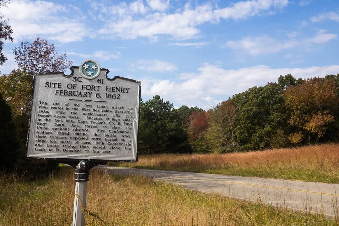
In early February of 1862, the Union deployed several ironclads to attack a Confederate earthen fortification built to control the Tennessee River. Fort Henry was outmatched by these armored gunboats, and the commander soon surrendered. Afterward, General Ulysses S. Grant led a Union ground force eastward, following the retreating Confederate troops. Today these paths are part of the historic Fort Henry Trail System. They’re open to both hikers and bikers, yet I was the only person around on a mild Thursday in mid-October.
Riding away from the campground, I crossed the scenic byway and followed the singletrack Piney Trail for about a mile. Immediately, I recognized these would be rough trails through backcountry forest. I turned north on Volunteer Trail for about two hilly miles that became increasingly overgrown. Eventually, I was walking my bike through vegetation. When I reached Road 230, I rode pavement past the historic fort site. Everywhere I looked, I saw signs of continuing storm cleanup from destructive 2021 tornadoes.
I had lunch by the water at Boswell Landing, before returning on paved roads. Soon I found the trailhead for Artillery Trail, which marks the eastern edge of Devil’s Backbone Natural Area. This route was passable, with a gradual climb and descent. To the west, I could see the ridgeline of Devil’s Backbone Trail. I decided to save that one for a return trip with fresh legs when I could explore the promising trails farther to the east.
For a final dinner out, I went to Blue’s Landing in nearby Buchanan, Tennessee. In one night, I saw more people at this popular Cajun restaurant and live-music bar than on all four LBL trail systems combined.
The last Southern highlight required driving out of the rec area to nearby Fort Donnelson National Battlefield in Dover, Tennessee. Most National Park Service units preserving military sites are focused on driving tours through key battle locations and later monuments. At Fort Donnelson, however, you can walk through this Civil War battlefield on several miles of trails. Perched above Lake Barkley, the earthen fortifications and river batteries were the most interesting stop.
After the capture of Fort Henry, Grant’s troops surrounded Fort Donnelson. On February 15, 1862, a Confederate surprise attack attempted to punch a retreat path toward Nashville. A Union counterattack closed the hole, which led to an unconditional surrender of more than 10,000 troops. In town, I stepped inside the restored Dover Hotel, where the surrender was finalized. Grant had achieved the Union’s first major victory of what would become a long and bloody war.
As I drove east toward Georgia and a weekend with friends, I called my wife to report. The explorations were a success. This hidden peninsula was filled with outdoor opportunities. The main question was when we might return to the lost Land Between the Lakes.
Author: Mike Bezemek is a regular contributor to Terrain Magazine.
Photos by Mike Bezemek.
Leave A Comment