
The Ride the Rivers Century is Trailnet’s premier fundraising ride and helps support the organization’s work to improve biking — as well as walking and the use of public transit — in the St. Louis Region.
This event has seen small changes over its 16-year history, but because of COVID-19, the 2020 edition utilizes Trailnet’s new DIY format, which differs from years’ past. Once signed up, registrants are given access to both the full and metric century routes and may do them as many times as they wish through October 4. This format gives riders the opportunity to pick the perfect day, or days, to ride.
Registration is now open at https://trailnet.redpodium.com/2020-ride-the-rivers.
Riding a century is something on most “serious” cyclists’ bucket list. It’s an achievement, a badge of honor. For those who haven’t yet embarked on this life-changing adventure yet, there are a few things to know. Riding 100 miles, or 62 for the metric century, is not about speed or power, it’s not about carbon fiber or wearing spandex. Long endurance rides like these are about preparation, pace, perseverance, and patience.
Yes, there’s a certain amount of muscle and cardio strength required, but there’s also mental toughness to consider. There may come a point at which your mind tells you that you’re not going to be able to make it to the finish line. When your legs begin to feel like linguine, maybe around hour four, you may ask yourself why you signed up for this ridiculous ride. Phone numbers may start scrolling through your head as you think about who might be able to pick you up.
It’s at this point that mental toughness comes in. Someone once told me, “you can do anything for 15 minutes.” At the end of those 15 minutes, just do another 15. Look 100 feet up the road and find a tree. Ride to that tree. Once you get to that tree, find a point up ahead on the river. Ride to that point…and so on. As long as you’ve been staying on top of your hydration and nutrition, there isn’t much of a difference between riding 75 or 100 miles. Just believe in yourself and think of all of the beautiful things you’re still going to see.
Here’s a preview of what to expect on this amazing ride — both the full century and the metric century.
Full Century Overview
Mile 1 – Trailnet’s Ride the Rivers Century begins in the Streets of St. Charles commercial district, where you can park for free and enjoy pre- and post-ride fuel.
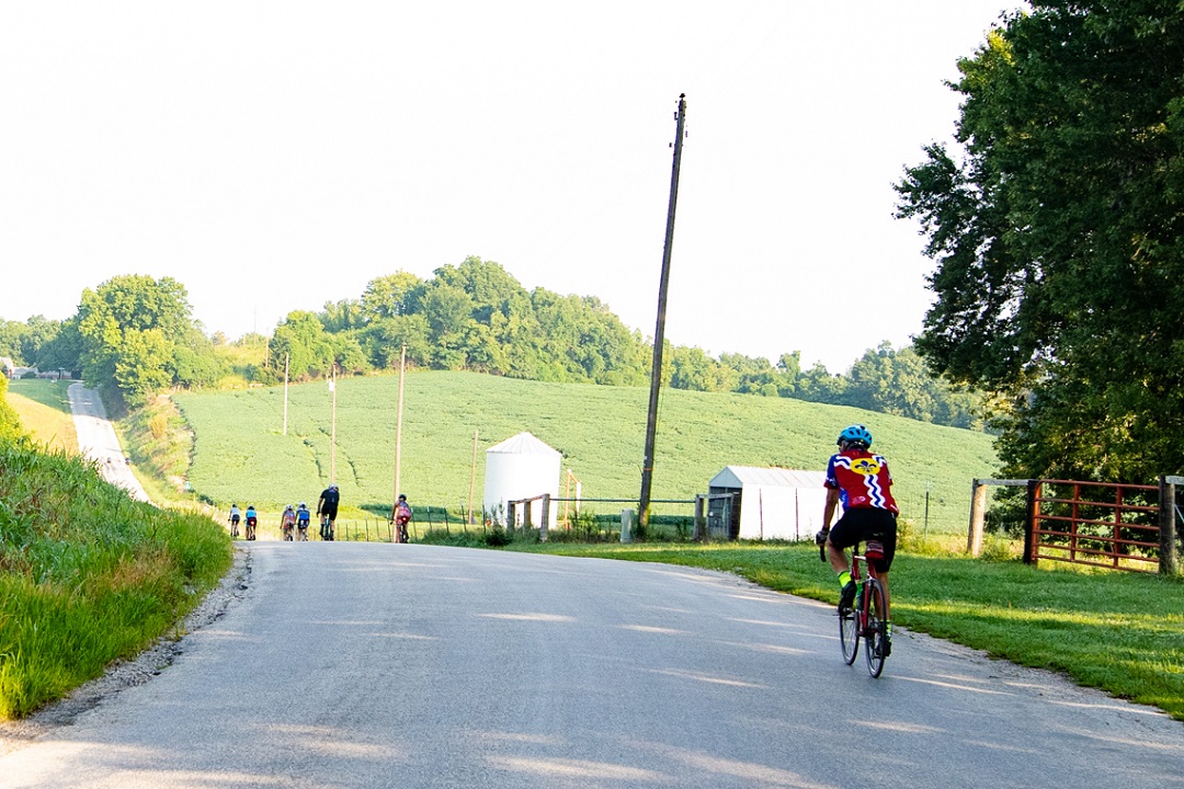
Your journey begins by heading north through Historic St. Charles, paralleling the historic Katy Trail before heading north and west into New Town. Between New Town and Kampsville, the views are deep and wide, except for the occasional fields of tall corn stalks as a reminder that fall is right around the corner.
Mile 13.5 – The Golden Eagle Ferry is the first of two ferry crossings of the day. This ferry shuttles you from flat Missouri farmland across the Mississippi River and into the rolling hills of Calhoun County. In my opinion, this is one of the most beautiful stretches of the ride. The pureness of the landscape helps keep your mind off of the 590 feet of climbing that happens in that 16-mile stretch.

Mile 30 – You then take the Brussels Ferry Across the Illinois River into Grafton. Welcome to Illinois! Once you roll off of the ferry, you hop on the River Road and begin heading south. This stretch parallels the Mississippi River for about 45 miles. The trade-off for this pancake-flat stretch is the possible headwind that rolls off of the river. Don’t forget to bring a spare tube or two, as this stretch has a reputation for punctures.
Mile 48 – Once through Alton, hop onto the calm MCT Trail system and ride the levee to the Historic Route 66 Old Chain of Rocks Bridge, where you cross back over the Mississippi. Welcome back to Missouri!

Fun fact: Trailnet spearheaded the project to restore the Old Chain of Rocks Bridge, which reopened to bicycle and pedestrian use in 1999. The project took four years and is a key example of how your dollars allow us to improve bike and pedestrian networks throughout the region.
Mile 64 – After crossing the Mississippi River (again), you’ll ride 10 miles south on the Riverfront Trail into downtown St. Louis. This paved trail, also known as the Mississippi Greenway, is a dichotomy of industrial and natural beauty, reminding us that The Gateway City was once one of the largest manufacturing depots in the country, shipping brick and steel up and down its river system.
Mile 75 – Here begins the slow and steady climb back towards St. Charles. Over the next 20 miles, you’ll climb 1,000 feet until you cross the Missouri River (again).
At mile 82 you’ll pass through the familiar streets of Forest Park. Take a few minutes to rest your heavy legs in front of the Grand Basin, which is still closed to car traffic. (Imagine how wonderful a world without cars could be!)
Mile 97 – Spin a quarter loop around Creve Coeur Lake before you make one final river crossing back into St. Charles. A quick 2 miles on the smooth limestone of the Katy Trail and you’re there!
Pacing example: 107 miles at 12.6 mph average will take 8:55 hours of ride time
Metric Century Overview
For those who prefer kilometers to miles, the River the Rivers Metric Century (100km) gives you a compact, sportier, 64-mile route. Like a Porsche instead of a Mustang, this route packs the full punch of the hills of Calhoun County but avoids the long slogging straightaway that is the River Road.

You start the ride in Streets of St. Charles and follow the same route as the full century until mile 32 (51.5 km). At Grafton, you’ll take the Grafton Ferry back to St. Charles County, where you’ll breeze through the sleepy old river town Portage Des Sioux (mile 40/km 64) just after the halfway point. Open farm roads will escort you back into civilization, with deep views of farm and field. At mile 65 (km 88), you’ll begin to see signs of big city life, with St. Charles on the horizon. Enjoy the last 22 kilometers and start trying to decide which Streets of St. Charles restaurant will get to fill your belly. Maybe all of them. They’re all great, and you deserve it.
Pacing example: 65 miles at 12 mph average will take 5:25 hours of ride time
About Trailnet
Trailnet is the St. Louis region’s nonprofit walking, biking, and public transit advocacy organization. For more than 30 years, Trailnet has been working within the St. Louis region and across the state to respond to the demand for improved walking and biking networks that attract and retain talent, strengthen our economy, and connect people to the places they love. trailnet.org
Author: Matt Hartman, Trailnet Rides Manager
Photos: Carrie Zukoski, Open Road PR
What about suggested places and distances between water stops on the Century? Thoughts??
Hey Patrick,
Good idea. We’ll look at this for a future piece.