
The GPS on my phone failed me en route to an interview with Jeff Ryan, president of the St. Louis Orienteering Club. Instead of an eco-responsible coffee shop on Clayton Road, I ended up in the parking lot of a preschool five blocks away.
A professional pilot with the navigation skills to match, Ryan seemed bemused by my feeble explanation for tardiness: “I got lost.” In response, he offered an empathetic nod and the suggestion of an ironic smile.
So, he had a sheepish and captive audience for his explanation of the finer points of orienteering, the sport of navigation. Like those of my phone, my navigation skills need some refinement, so maybe I could use a little orientation. If you’ve become too reliant on your not-so-trusty GPS, perhaps you could, too. Not only is orienteering an underappreciated end unto itself, it can serve as a gateway or enhancement to the skills involved in adventure sports.
“Orienteering gives you a chance to get off the trail, get a little lost, find your way back, look around and say, ‘Wow. I didn’t know this was here,’” Ryan said.
A DEFINITION
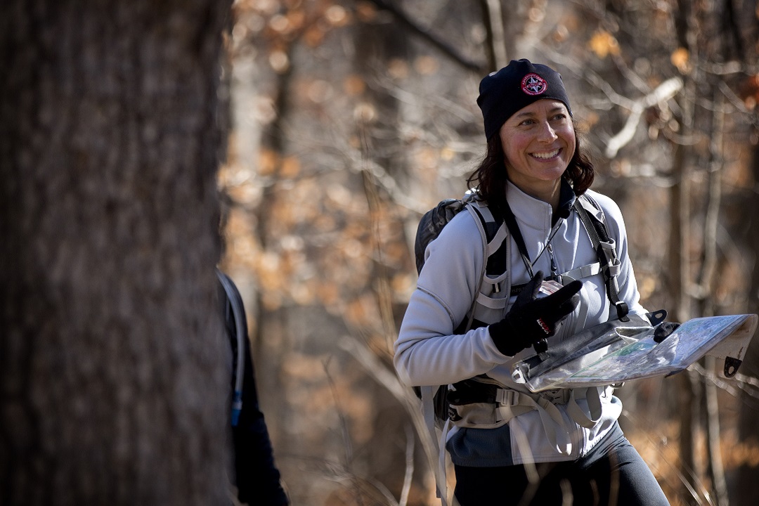
Orienteering is the sport of navigating through unfamiliar territory using a detailed, topographical map and perhaps a compass. The object is to make your way to a series of “controls”, checkpoints identified on the map, and to the finish line in the shortest amount of time. You decide the route. Each control is marked on the course by a triangular “kite” that has a specific stamp or hole punch — or these days an electronic tracking device into which you insert of specialized flash drive — to verify that you passed the checkpoint.
The sport also requires endurance, ingenuity, and decision making. Through orienteering, you learn that navigation is part art, part science, and part personal preference on the fastest way from Point A to Point B.
THE COURSE
The St. Louis Orienteering Club (SLOC) holds events about once a month, each of which attracts 30 to 50 competitors. Winter events tend to be set in backwoods areas, such as Babler or Castlewood state parks. Summer events usually are staged in settings such as Des Peres and Kirkwood city parks or in Forest Park. The group also organized an eight-hour spring event at Lake of the Ozarks State Park, three hours southwest in Osage Beach, Missouri.

The object of orienteering is to make your way to a series of checkpoints or “controls” identified on the map.
SLOC usually sets up at least three courses for each event, color-coded for beginning (white), intermediate (yellow), and advanced competitors (blue, red, and green, depending on length and difficulty). The white courses tend to stay on or near trails, so that newbies can break in slowly — sort of like sticking a toe in frigid water.
SLOC also is responsible for the course maps, excruciatingly detailed topographical surveys that mark the start, finish, and each control, denoted by a circle. The maps feature straight lines marking north and contour lines for each elevation change of 2.5 meters. They also include distinct symbols to identify ditches, depressions, gates, power lines, cairns, buildings, playground equipment, fences, trails, paved roads, and parking lots. The terrain is color-coded to indicate lakes, open land, rough land, orchards, stumps, parking areas, and woods.
The maps will make the eyes of a newcomer swim. Even Ryan admits it can be TMI. But therein lies the challenge. Each competitor picks the features to focus on when navigating from checkpoint to checkpoint, then ignores all the other distracting doodads. If you’re better running in open terrain, for example, avoid the forests, even if you have to trek a little farther. If you notice that a power line runs parallel to your next control, aim for that, then turn toward the checkpoint, rather than meander through the brush that seems more direct but can tangle and scratch your ankles. Sometimes, you get it right. Sometimes, you don’t.
“Using a map to run through the woods sounds so simple,” said David Frei, former SLOC president and adventure racer. “When it goes well, it can be a thrill. When it doesn’t go well, it’s practice for the next time.”
ESSENTIAL GEAR
You don’t need much in the way of gear to get started in orienteering, and SLOC is happy to provide some of the essentials. Newcomers are welcome to borrow the club’s equipment. A family membership is $50 a year, which covers the costs of entry fees, securing permits, insurance, snacks, and maps. Without a membership, events cost $20 per adult and $5 per youth (under 18).
“We don’t give away T-shirts or medals at the finish, but then again, we’re not in this to make money,” Ryan said. “We’re here to have fun and teach people the joy of orienteering.”
Finger stick: This gizmo resembles a flash drive. You insert it in the electronic tracker at each control checkpoint to verify your passing. These cost about $60, but the club provides them at no charge.
Map: Provided at the start of the race. Fold it in quarters to make it easier to use with a compass, described below.
Competitors are on their own for the rest, though the equipment requirements are basic.

Thumb compass (left) and hand compass.
Compass: Especially useful to newcomers who can learn to keep both the compass and the map pointing north. A thumb compass is most efficient, since you can hold the map (folded) in the same hand as the compass and align the map’s north-south lines with the compass arrow.
Shoes: Ryan has seen barefoot competitors, as well as people who bring three or four pairs of shoes, each suited to a different type of terrain. He prefers a good trail shoe. Grips and crampons can be helpful, until the terrain doesn’t favor them.
Long pants: Always, even when the temperature hits triple digits. You’re moving quickly through brambles, thorns, sticky stuff, and, possibly, poison ivy.
Long sleeves: Many competitors advocate them for protection from bugs and sun, though Ryan skips them in hot weather.
Gators: Ryan wears two sets. One protects his ankles, the other his shins.
Whistle: Used only when a competitor is injured — as opposed to lost. Some orienteering clubs and events require them. Though Ryan says he always carries one in adventure racing, SLOC does not require them at its monthly events.

Map case.
Map case: Though not necessary, a map case can keep your paper map dry and safe and easy to find when you need it.
Water and snacks: Optional on the trail, since many events last 60 to 90 minutes.
SKILLS AND ETIQUETTE
Navigation: A good route choice often beats raw speed, so reading the map and plotting a course that suits your skills is essential. The quicker you figure out a way to align the map, compass, and your brain, the better.
Fold the map, the better to hold it. Align the north lines on the map with north.
Endurance: Most courses take a minimum of one hour to traverse, and most people spend the time they’re not figuring out a course or figuring out how they got lost in running.
Flexibility: “You have a Plan A that lasts two minutes. Then, you go to Plan B. Then, Plan C,” Ryan said. “You learn to adapt and embrace change.”
Together or solo? SLOC welcomes newcomers to traverse the course together. “At the local level, if you want to run together, it’s totally OK,” Ryan said. “At the elite level, this is a solo, competitive sport. An extra person will slow you down.”
That’s because there’s more than one route, and each experienced runner thinks he or she knows the fastest way — which it might be for him or her, but maybe not for someone else, who has better climbing skills or runs through boulders faster. To eliminate the temptation to follow the leader, many events feature staggered starts.
Practice: The nature of the sport demands that the trail must constantly change to test navigation skills, so courses change with each event. However, a couple of permanent areas offer you a chance to practice your navigation skills without competitors. One is set up at Beaumont Scout Reservation in High Ridge, Missouri, the other at Rockwoods Range Conservation Area (not to be confused with Rockwoods Reservation) west of Eureka, Missouri.
ENHANCING OTHER SPORTS
Orienteering can be an end to itself. It can also enhance skills for other sports, such as adventure racing, off-road triathlon, and geocaching. Frei competed in orienteering in the late 1980s and took up adventure racing more than a decade later. He thinks the orienteering background gave him more than a leg up on his more tech-savvy competitors.
“A lot of adventure racers love to buy nice equipment and train to get stronger and faster but pooh-pooh navigation skills,” he said. “But people eventually realize how much faster you can go if you know how to read a map.”

On corse at Alpine Shop’s Castlewood 8-Hour Adventure Race. (Bobby French)
Ryan comes from the other direction. A longtime competitor in adventure racing and off-road triathlon with his brother, “We were decent at navigation, but I wanted to get better at the details of the sports.” He gave orienteering a try 12 years ago, when “I didn’t even know it was a thing. But it’s helped with the details.”
His three children, ages 8 to 14, have participated casually, rather than competitively. But he set up a course for one of the kids’ birthday parties, which turned into a hit. “You give them a map and a compass. And, if one of them goes out there, the others get their competitive juices flowing,” he said.
A few people have found orienteering useful for the family-friendly pastime of geocaching, which tends to rely on gizmos. But Frei thinks the fun for orienteers, young and old, of whatever skill level, comes from the sport’s purity, its freedom from technology.
“Following your phone doesn’t mean you know where you are. Following your phone isn’t exploring,” Frei said. “There is an ingrained joy for a human in knowing where he is in the world. Using a really good map and being able to say, ‘I’m here, and here’s what’s around me’ gives you a sense of your place in the universe.”
RESOURCES
The St. Louis Orienteering Club’s website offers more details on upcoming area events, results, maps, and club contact. stlouisorienteering.org
Rockwoods Range Conservation Area includes a practice course. nature.mdc.mo.gov/discover-nature/places/rockwoods-range. For a $5 fee, you can download a map of the course at stlouisorienteering.org/product/rockwoods-permanent-course.
Beaumont Scout Reservation also includes a practice course. stlbsa.org/beaumont-scout-reservation
Author: Kathleen Nelson is a regular contributor to Terrain Magazine.
Featured Image: Dan Singer, courtesy of Alpine Shop.
Leave A Comment