Exposure to nature makes people more likely to care about it and take action to protect it. This is the not-so-hidden secret behind Mixed SOIL, a new initiative that promotes recreation in and preservation of the land between the Mississippi and Ohio rivers.
At the heart of the program is a 420-mile bicycle route that travels 50-percent unpaved roads and orbits the beautiful Shawnee National Forest. The route was designed to take adventure cyclists deep into the southern Illinois backcountry, connecting to state parks and forests, historical monuments, and communities offering food, camping, and lodging. The idea: to encourage bicycle travel in the area and by doing so to inspire thoughtful support of the soil and how we utilize it.
The Shawnee National Forest lies in the center of the route, the gravel roads within it connecting riders to multi-generation farms, modern diners, and a myriad of other local food producers and land managers. The route forms a large loop that starts and ends in front of the courthouse steps in downtown Cape Girardeau, Missouri.
And that’s where our adventure on the Mixed SOIL route begins….
The author in front of the Cape Girardeau Branch County COurthouse. (Tim Volink)
Immediately upon leaving Cape, the Bill Emerson Memorial Bridge took me over the Mississippi River, where I found myself feeling somewhat intimidated staring at the southern Illinois ridgeline directly in front of me.
Crossing into the Land of Lincoln, I followed several flat gravel roads through Cahokia rice farmland. Before long, I found myself leaving the Mississippi River valley behind and climbing into the hills of the Shawnee, eventually arriving at the entrance to Trail of Tears State Forest. It was hard to not think more about those who had lived here before me and their impact on this land.
The Civilian Conservation Corps (CCC) invested an immense amount of energy and resources into the Shawnee National Forest. I rode by several log cabin-style shelters scattered along this ribbon of road and then past some incredibly beautiful rock infrastructure supporting the nearby water drainage. A small part of me felt slightly misunderstood as I filled up my water bottles from the spigot across the street.
Back on state forest road, the route led me into the next swath of Shawnee Forest gravel at LaRue Pine Hills. The public campground laid quietly under the whispering pines as if it were a silent invitation to stop and rejuvenate before venturing further into the wooded area. This stretch of gravel might be one of my favorites, as the road winds along the scenic ridgeline looking out over the Mississippi River valley and across from where my journey began.
In Shawnee National Forest. (Monica Foltz)
Shawnee wine country and its award-winning vineyards frequented the next segment of riding. I found myself continuing north before eventually passing the Little Grand Canyon. This was a great reminder of the diversity of the terrain here, displaying both rich, fertile soil ideal for growing as well as rugged sandstone outcroppings that make up the box canyon.
The varying topography remained a constant sight to see and feel as I followed the route back east, passing Cedar Lake and Touch of Nature Outdoor Education Center before rolling past the towering sandstone walls inside Giant City State Park. I found a much-needed refuge at Cobden’s Iron Whisk, going all in on the bistro’s signature Benny Bowl — served in a cast-iron skillet — with a Sierra Nevada Hazy Little Thing for a boost of morale.
Pedaling east out of town, I knew the route came close to Bison Bluff Farms and couldn’t help but imagine the wild bison roaming this land many years ago. My daydream ended in a hurry just outside of Fern Clyffe State Park when a ripping-fast gravel descent down to Bork Falls demanded my complete attention. Careful not to fall on the wet natural rock face that the road crosses, I climbed back out following the route into Goreville, one of the three largest towns on the route.
Topping off my water was all I needed before saddling up and pedaling on towards Tunnel Hill State Trail. Some incredibly fun and technical doubletrack riding along the River to River Trail brought me right to the Tunnel Hill Trail. I welcomed this change of pace with open arms, enjoying every second of the undulating path weaving under the rows of loblolly pine trees before crossing the Little Cache Reservoir up onto the trail.
Turning north past Sandburn Junction, I rolled up to the actual tunnel from which the trail gets its name. Initially built in 1872 for the transportation of coal, salt, wood, local apples, and peaches, the tunnel serves a much different purpose these days. I quickly reached down to turn on my light to make my way through the aperture. This rail-trail separates the east and west portions of the Shawnee National Forest and serves as a main vein of the Mixed SOIL route. I took full advantage of its gentle presence in between the much more demanding sections of riding that border the corridor.
A washed-out bridge outside the old rail town of New Burnside proved to be a great opportunity to ice my feet in the cold Sugar Creek. This was one of several experiences along the route that might appear to be a burden but actually influenced my experience in a very positive way, providing an unexpected oasis in the southern Illinois backcountry.
Ten more “free” rail-trail miles carried me into Stonefort before the sound of my rubber tires on hardpack chat stopped and I hit pavement. Using an old pump to fill my bottles with water, I made friends with the town’s “guard dog” as I prepared myself to enter the east side of the forest.
Burden Falls Wilderness Area. (Monica Foltz)
Burden Falls Wilderness Area housed some of the most scenic pine-covered gravel roads imaginable, then I climbed up to a paved ridge road that offered a panoramic view of Harrisburg, a town 20 to 30 miles to the north — at least that’s what the elderly farmer I passed shared with me as I hoofed on towards Williams Hill. Just over 1,050 feet above sea level, I both rode and hiked my bike up the long, paved climb to the top of the rise, the highest point on the route.
As I began to make the descent off Williams Hill, it was impossible to ignore the neighboring Garden of the Gods and Eagle Mountains that towered above the town of Herod, now 600 feet below me. Rolling into Harbison’s Country Store to resupply, I leaned my bike against an old wagon wheel that sat out front of the shop, reminded once again of how folks before me explored this very land.
I pedaled by Garden of the Gods National Recreation Area, full of visitors with license plates from every surrounding state, and into the rugged, untamed swaths of Eagle Mountain wilderness. Eventually descending off the backside of Stoneface, a famous natural rock formation jutting out of Eagle Mountain, I rolled along the Saline River before connecting back up with some wildly engaging backcountry gravel near Rim Rock National Recreation Trail.
It was the hottest part of the day, and I began to sweat out the veggie pizza I’d eaten at Harbison’s. I pressed up and over Sparks Hill and shortly after filled up with more water at Camp Cadiz, another historical plot of infrastructure that the CCC integrated into the backcountry on the eastern reaches of the forest.
I finally reached the banks of the Ohio River at Cave-In Rock State Park. The lodge here offered up a timeless buffet of fried local catfish under the watchful eyes of countless photos of Disney’s Davy Crocket lining the walls.
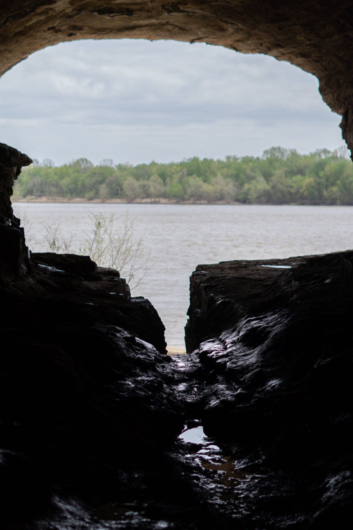
Cave-In Rock State Park. (Monica Foltz)
Following Rock Creek Road through Hastie Rock Quarry turned my attention back to our modern exploitation of this land. Shortly after, I was welcomed back into seemingly untouched stretches of backcountry leading up to an old iron furnace — the only remaining furnace left in the state.
One Horse Gap Recreation Area and a vast span of pines covering the route shaded me as I crossed Lusk Creek into the town of Eddyville. I stopped for a while under the pavilion at Shotgun Eddy’s, a local restaurant and bar nestled in what the town’s signs labeled the “Equestrian Capital of the Illinois”.
A large breakfast off the grill fueled my journey further. I passed the Underground Railroad hideout at Sand Cave before slowing my pace along the much more technical stretch of national forest doubletrack that connected me from Millstone Lake, rich in Native American history, and up through the backside of Jackson Falls, southern Illinois’ premiere rock-climbing destination.
I found myself in a daydream rolling along the stretches of national forest gravel that followed before landing my tires back on the Tunnel Hill Rail Trail inside Vienna, the largest town on route. The local diner was a welcome sight as I made preparations for the final push back towards the southwest.
Arguably the longest flat stretch of riding along the route, I carried on past the Cache River State Natural Area before reaching the Ohio River for a second time in Olmstead, home to an almost $3 billion lock and dam project. Several miles later, I found myself on a levee road following the Cache River once again, this time teaming with wildlife and a couple folks out exploring the river by kayak.
The wildlife presence continued well into Horseshoe Lake State Park outside the small town of Olive Branch. These final stretches of the Mixed SOIL leading back to Cape Girardeau were challenging and certainly embodied a “mixed” perspective to this approach of learning, growing, and exploring by bicycle.
By the time I made it back to the Bill Emerson Memorial Bridge and crossed the Mississippi River into downtown Cape, I felt full of emotions from my adventure. The bicycle is my vehicle of choice for most travel, but this journey confirmed my commitment to it as the most ideal platform to truly feel, hear, smell, taste, and see this land that’s overflowing with rich history, culture, and heritage.
If you’d like to plan an adventure on the Mixed SOIL route for yourself, you can find maps, GPX files, and all the supporting data at mixedsoil.com. The route can be halved, east and west, or broken into even smaller pieces for brief getaways.
Trust me, no matter how you slice it, you won’t be disappointed.
Mixed Bag
Other Mixed SOIL programs include a bicycle-powered compost collection service in downtown Cape Girardeau, Missouri, and a new bicycling event called the Mixed SOIL Hoedown. This weekend festival will include local eats, interactive compost demonstrations at the Cape Riverfront Market, educational presentations on forest history and sustainability, and will launch a group of bicyclists out of downtown Cape on October 28. Learn more at mixedsoil.com/gather/.
Author: Aaron Arnzen is a contributor to Terrain Magazine.
Top Image: One Horse Gap Recreation Area. (Monica Foltz)
Do you have the route mapped out
It’s available on mixed soil.com