Ed Sherman is leery of giving away too many specifics about what visitors should check out within the wilderness areas in Mark Twain National Forest. Specifically, he’s worried about the consequence of writing about a beautiful, unknown place — because then it’s no longer a secret.
“This is a double-edged sword,” explained Sherman, a zone recreation manager with the US Forest Service, which oversees the Mark Twain National Forest. “If I were to tell you that you have to go see this spring or this particular area that has this chunk of history, I’m actually fighting against myself.”
Sherman isn’t just being dramatic. He oversees two wilderness areas, which by design are remote and not clearly marked.
“These are very special areas to the recreationalists, because these are protected to ensure solitude,” said Sherman, who must follow particular protocols such as not using mechanized or motorized tools to manage an area. Rather than a chainsaw, he carries a crosscut saw.
Still, the 17-year Forest Service veteran isn’t exactly bound by the rules of “Fight Club,” so he and a fellow Forest Service manager were willing to talk about the wilderness areas. Well, at least a little bit.
There are “rivers, trails, recreation sites, campgrounds. It is really a recreationalist’s paradise,” said Sherman, who previously worked for the Forest Service in Wyoming and West Virginia.
For those interested in seeing exactly what a wilderness area is, there might be no better place than the 1.5 million acres of Mark Twain National Forest, which is located in southern Missouri and larger than any national forest in the Midwest or New England.
The official wilderness area designation dates back to the Wilderness Act of 1964, signed into law by President Lyndon B. Johnson after eight years of advocacy from Howard Zahniser, executive director of The Wilderness Society, a nonprofit land conservation organization.
“A wilderness, in contrast with those areas where man and his own works dominate the landscape, is hereby recognized as an area where the earth and its community of life are untrammeled by man, where man himself is a visitor who does not remain,” Zahniser wrote in the bill.
Today, the National Wilderness Preservation System features 765 wilderness areas covering more than 109 million acres. The Mark Twain includes seven of them.
Irish Wilderness
Sherman manages the Irish Wilderness, the largest wilderness area within the forest. The name originates with a 19th-century Catholic priest, Father John Hogan, who dreamed “of a place where Irish immigrants could escape the oppression of urban life in St. Louis,” states Forest Service literature.

Camp Five Pond in the Irish Wilderness. (Zach Smith)
Father Hogan found what he sought in the Missouri Ozarks. But the settlers’ oasis was disrupted by the Civil War and the land raided by both Union and Confederate troops. According to the Forest Service, the fate of the settlers is unknown.
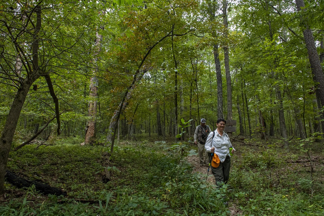
The 16,500-acre Irish Wilderness is accessible from the trailhead for the 18.6-mile Whites Creek Trail. In addition to the Whites Creek, the area also features the Camp Five Pond and springs.
“We have a number of untouched springs that aren’t developed. You’re going to see a spring coming out of the ground that is crystal clear and blue that doesn’t have a road going right up to it and is often off of the trail, so you immediately get this feeling of exploration,” said Sherman.
About 11 miles into the Irish Wilderness, you can reach breathtaking vistas of the Eleven Point River, a 138-mile waterway that runs through southern Missouri and northern Arkansas. You have to earn it, though. It’s at the farthest reaches of the Irish Wilderness, says Sherman.
Rockpile Mountain Wilderness
Northeast of the Irish Wilderness is the Rockpile Mountain Wilderness, which, unsurprisingly, “takes its name from an ancient circle of granite rock, piled by some earlier man on top of the mountain,” according to the Forest Service.

Rockpile Mountain’s namesake feature. (Missouri Division of Tourism)
Jon Breithaupt manages the area, located within the St. Francois Mountains. To summit Rockpile Mountain, you can begin with a 2-mile marked trail near Fredericktown, Missouri. After that stretch, you’ll find a sign alerting you that you’ve reached the end of the maintained portion. If you continue, you’ll likely encounter downed trees and overgrowth before you’re able to summit the mountain, so wear proper footwear, like hiking boots, and bring a first-aid kit and plenty of food and water, advises Breithaupt.
Looking out from the top, “it’s really a sea of green,” Breithaupt said. To the north rises some of the tallest country in Missouri.
Bell Mountain Wilderness
That northern portion of the forest includes Bell Mountain Wilderness, which is named for the family that once lived atop the mountain and is now also managed by Breithaupt. The area is particularly nice for people interested in backpacking, he said. He recommends travelers enter from either the Bell Mountain North trailhead or the Ottery Creek Trailhead.

Scenic views from Bell Mountain. (Mark Nettles)
You can camp atop the mountain, and if you do so in spring, summer, or fall, you’ll have a good chance at waking up to a valley covered in wildflowers.
Paddy Creek Wilderness
Once you pack up and head out, hop back in your Subaru and drive west to Paddy Creek Wilderness, which is named after 19th-century logger Sylvester Paddy.

Big Paddy Creek. (Zach Smith)
Take the 17-mile Big Piney Trail, starting near the town of Roby, Missouri, and duck into caves or dip your toes in the water at one of several creek crossings. Don’t be surprised if you see deer, wild turkey, or even a bobcat in the area.
Piney Creek Wilderness
If you venture southwest from Paddy Creek and pass through Springfield, you’ll reach Piney Creek Wilderness. Apparently, visitors to the 4.2-mile Piney Creek Trail didn’t get the memo about the purpose of wilderness areas, because among the 51 reviews on the online hiking guide Alltrails.com, a substantial portion complained about the lack of trail markers and the unkept nature of the path. Most people still said they enjoyed the experience, though. And who wouldn’t given the forest’s mix of undisturbed ash, elm, walnut, and oak trees?

Piney Creek treetop vista. (US Forest Service)
“There was no sign of a trail at the river, so we bushwhacked to the west side of the loop, following the river and checking GPS frequently,” wrote one reviewer. “Still, the route is beautiful and offers both dramatic views of the mountain ridges and enclosed river valley scenes.”
Hercules-Glades Wilderness
Drive southeast to find the Hercules-Glades Wilderness, which features a mix of tree-covered hills and wide expanses of grassland. On the 6.7-mile Coy Bald Trail near Bradleyville, Missouri, you’ll see a number of established campsites with fire rings near water, including several by a pretty waterfall a few miles in. But here again, a number of people at Alltrails and elsewhere complained about the lack of markings and reported getting lost.

Hercules-Glades waterfall and limestone rocks. (Mark Nettles)
“It’s imperative that you do your research, plan ahead, and prepare,” said Breithaupt. “Make sure you have the right gear, maps, and safety equipment.”
Devils Backbone Wilderness
Finally, take a deep breath and head to the seventh and final wilderness area in Mark Twain National Forest — the Devils Backbone Wilderness, which is what early settlers called its vertebrae-like ridge. The Forest Service recommends you visit in fall, when the sweet gum and sugar maples are in bloom, or spring, when the redbud and azaleas explode with color.
A nice starting point is the Collins Ridge Trailhead, from which you can hike into a forest that looks as though it hasn’t been touched in millennia. Inside, there are a number of nice springs and the North Fork River, which makes for a good companion to sleep next to.

Devils Backbone Wilderness sign. (US Forest Service)
For those who have spent the last year perpetually following directions on how to enter another virtual conference breakout room, what better way to break the cycle than to enter an area where there are no clear directions?
At least that’s what Sherman, the Forest Service manager, would you like to do.
“I really just want people to explore on their own and take the time and get the heck away,” he said. “Disconnect. Unplug.”
Wilderness Area Tips
Given the challenge of hiking long stretches into rowdy terrain, on paths that are often only subtly marked by cairns or cuts in logs, the Forest Service’s Ed Sherman and other wilderness area managers emphasized the need to take safety precautions.
“You’re relying on your own ability to navigate, and often, it’s amazing how unprepared people show up for a wilderness hike. What starts out as a planned day hike, a couple wrong turns, and you’re in for a day and a half or two days,” said Sherman.
Cell phone reception is very spotty in the Mark Twain National Forest, so Sherman implores visitors to inform someone where exactly they’re going. To ensure that the wilderness areas remain tranquil, the Forest Service also limits group sizes to 10 people or less.
“You’re well away from city lights, so if you get a view of that [night] sky, it’s pretty darn spectacular,” said Sherman.
Author: Eric Berger is a regular contributor to Terrain Magazine.
Top Image: Irish Wilderness by Zach Smith.
Leave A Comment