

Spring is (finally) in the air, and with it comes the annual change in the color pallet of our outdoor world. Browns and grays turn to green as leaves unfurl and grass begins to sprout. And as temperatures rise, so do wildflowers, emerging from their wintry slumber to paint the underbrush with dashes of yellow, white, red, and blue.
Whether you’re able to readily identify a bluebell or Dutchman’s breeches, or just like seeing the vibrant hues of spring, we’ve — ahem — hand-picked a bouquet of local natural areas where you can hike amid blooms and blossoms this season.
Shaw Nature Reserve. Operated by the Missouri Botanical Garden, this 2,400-acre natural area in Gray Summit, Missouri, opened in 1926 as “safe haven” for the garden’s orchids, which were struggling at the main facility due to coal pollutants. Over the years, the reserve has grown to include a tallgrass prairie, wetlands for bird viewing, oak-hickory woodlands, several historic homes, and the Whitmire Wildflower Garden. The grounds feature 17 miles of trails through diverse Ozark border landscapes and hosts Alpine Shop’s Shaw Bloom trail run every April.
Myron & Sonya Glassberg Family Conservation Area. Located just south of Eureka, Missouri, this 429-acre woodland preserve is part of the Meramec River watershed and was opened in 2012 to help protect LaBarque Creek and its rare aquatic wildlife. A 3-mile trail loops through the grounds, passing by Buder Lake and a viewing platform from which you can take in the area’s flowering dogwood and redbud trees. Bonus: The Young Conservation Area is 0.2 miles east, and the LaBarque Creek Conservation Area is 1.2 miles southwest; both are great places for wildflower viewing, as well.
St. Francois State Park. North of Bonne Terre in southeast Missouri, wildflower enthusiasts will find isolated glades and scenic valleys in St. Francois State Park. Centered around Big River and its forested, rocky hillsides, the hiking trails here shimmer with color come springtime. Swimming Deer Trail (3.1 miles) meanders along the water before climbing the bluff for great views of the river bottoms and beyond. Other trails — Pike Run (10.7 miles) and Mooner’s Hollow (2.9 miles) — cut through the undeveloped landscape of the Coonville Creek Wild Area. Campsites and shaded picnic areas are available.
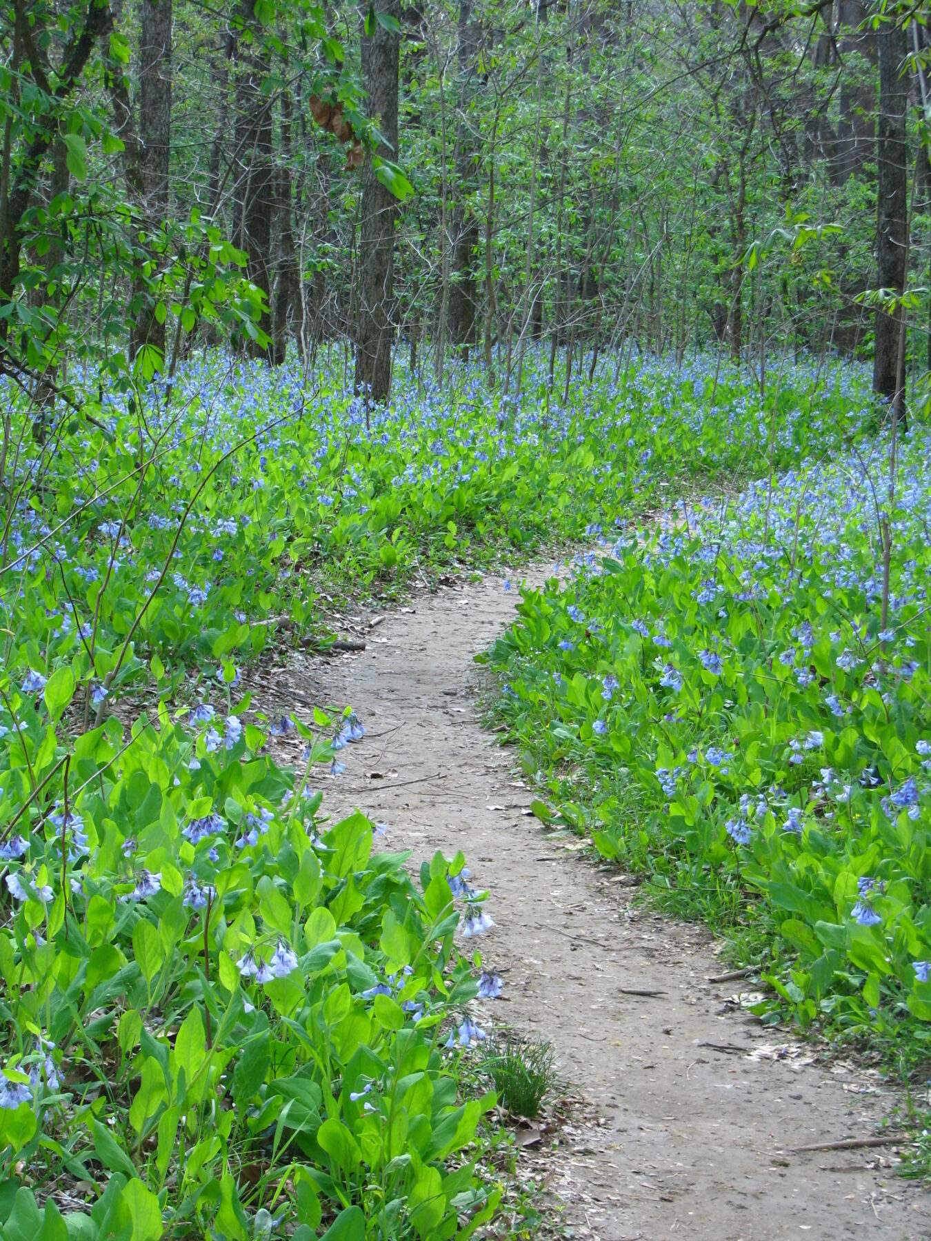
Bluebells at St. Francois State Park. (Missouri State Parks)
Meramec State Park. Just east of Interstate 44 in Sullivan, Missouri, lies Meramec State Park. As the name suggests, the park abuts on the Meramec River, which come springtime provides ample water supply for a bounty of budding wildflowers. There are more than 14 miles of trail here overall. The Natural Wonders Trail is a 1.3-mile loop that takes in the highlights of the park — caves, glades, mature woodland, a spring-fed creek, and beaver meadows. For the more adventurous, the 8.4-mile Wilderness Loop Trail is rugged and remote, with primitive campsites for overnight backpackers.
West Tyson County Park. This St. Louis County Park is an often-overlooked gem, located a few minutes east of Eureka and spanning 673 acres of rolling hillside. The park comprises the western terminus of 12.6-mile Chubb Trail, which was developed in 1985 and connects West Tyson to Lone Elk County Park to the east. Chubb is a rugged trail with moderate elevation changes. It passes by the William Epstein Memorial Prairie project and runs along the south banks of the Meramec River, and come springtime, is alive with wildflowers and blooming grasses.
Valley View Glades Natural Area. The 225-acre Valley View Glades Natural Area is another local gem. Situated just west of Hillsboro, Missouri, this preserve provides the opportunity to see flowering plants like false garlic and slender sandwort come spring, plus far-reaching views of the surrounding hills. A 2.8-mile hiking trail winds through the area, passing woodlands and sprawling meadows alike. The nearby Victoria Glades Conservation Area is worth visiting, as well, especially at sunrise — a large, east-facing clearing provides great vistas of the rising sun.
Salt Lick Point Land & Water Reserve. This 600-acre reserve lies in the town of Valmeyer, Illinois, about a 20-minute drive from downtown St. Louis. At 810 feet, Salt Lick Point is one of the highest spots in Monroe County — climbing the trail to the top provides wide-open vistas of the river plain below. In addition, limestone glades and hillside prairies dot the site, creating an ideal habitat for innumerable wildflower species. More blooms can be found on Johnson Trail, a flatter path that makes its way along the base of the bluffs.
Author: Nick Tilley is a regular contributor to Terrain Magazine.
Top Image: Coneflowers at Valley View Glades Natural Area. (Missouri Department of Conservation)
Leave A Comment