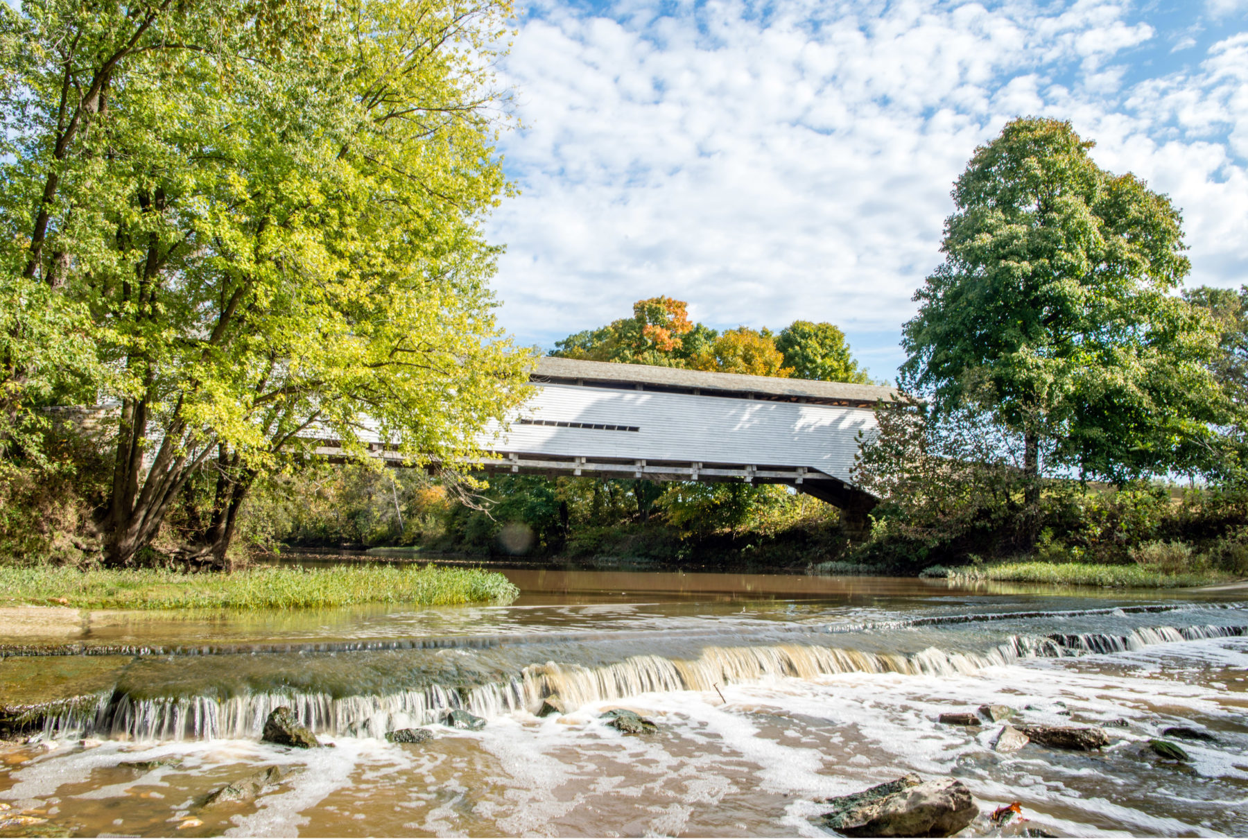
A covered bridge is a time machine.
That first glimpse transports you back 150 years, when it was considered a modern marvel. Enclosed out of necessity, the bridge’s roof and barn-like siding reinforced its integrity and protected the timber infrastructure from the elements. The enclosure also made it easier for farm animals to cross a river without becoming nervous and served as a backdrop for the billboards of 19th-century entrepreneurs. But when railroads and steel bridges made their wooden counterparts obsolete, most were left to weather away — their wood to rot, their stone foundations to crumble.
We’re lucky that a half-dozen of these gems have been listed on the National Register of Historic Places, restored for foot traffic, and are less than 150 miles from St. Louis. In addition, each is a short drive from hiking, mountain biking, camping, swimming, and canoeing venues that make for an outdoor adventure with a twist of history and romance.
Each can bridge your rugged exterior to your poet’s soul.
ILLINOIS
Sugar Creek Covered Bridge, Sangamon County
A sketch of the bridge graces the logo of the Sangamon County Historical Society, so it’s clear that residents of greater Springfield have a soft spot in their hearts for the version built around 1880. Folklore has it that the first bridge was built in 1827 by Thomas Black, who operated a mill and tavern nearby, though it’s unclear whether it was used more by farmers or revelers.
Less than 90 miles from St. Louis, the bridge was closed to vehicles, horse-drawn, and otherwise in 1984 and is situated in Pioneer Park, a 3.1-acre tract owned by the Chatham Park District that includes a pavilion and picnic area.
The park is about 3 miles south of Lake Springfield, a 4,200-acre reservoir surrounded by eight public parks with fishing, swimming, kayaking, paddleboarding, and boating venues. The bridge is also just 10 minutes from Lincoln Memorial Garden, which includes a nature center and six short trails through woodland and prairie landscapes.
Thompson Mill Covered Bridge, Shelby County
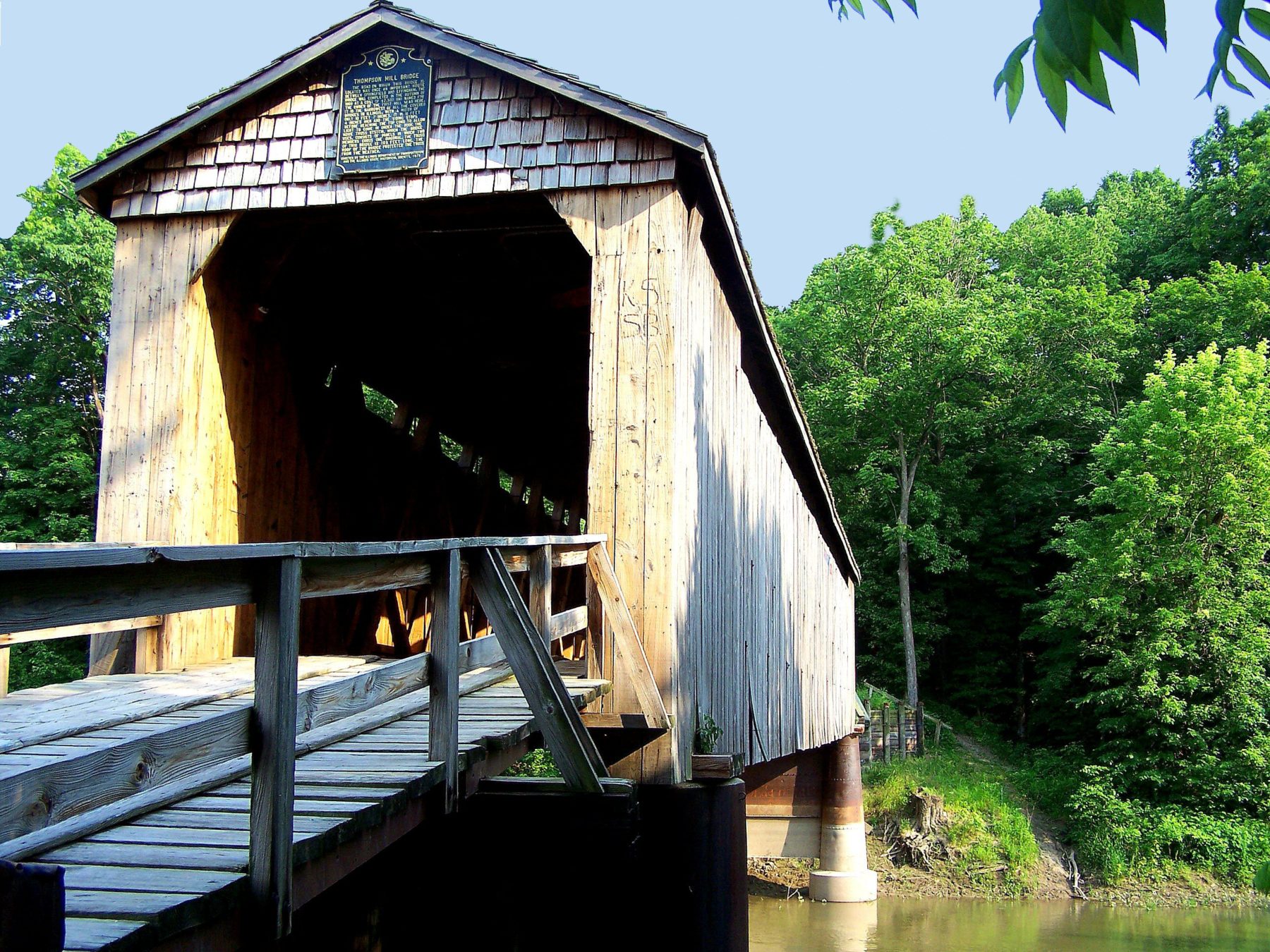
(Shelby County Tourism)
An early example of interstate cooperation: the bridge was designed and partially constructed in Michigan in 1867, shipped to Shelbyville and erected at a cost of $2,500. It crosses the Kaskaskia River a half-mile north of Cowden and 2.5 miles east of Illinois Route 128, about 100 miles from St. Louis.
The bridge was at a bustling crossroads, a stone’s throw from Lillie’s Mill on what passed as a major highway from Springfield to Effingham. Though Shelby County has restored the roof and siding, the original timber trusses remain intact.
The bridge is about a half-hour from Lake Shelbyville, offering more than 1,000 camping and glamping sites, biking along the General Dacey Trail, seven hiking trails ranging from 0.75 to more than 7 miles, and four beaches, as well as canoeing at nearby Kaskaskia River Camp.
Mary’s River Covered Bridge, Randolph County
Imagine you’re a farmer in Randolph County, trying to get your goods to the bustling port of Chester. The Randolph County Plank Road took you only as far as the pesky Little Mary’s River until 1854, when Wilhelm Misselhorn, a German immigrant, constructed the bridge of hand-hewn native white oak. About 65 miles south of St. Louis, the 86-foot span is four miles north of Chester along Illinois Route 150. Restored in 1954, it retains its original stone abutments and some of its timbers.
Just seven miles away is the 1,100-acre Randolph County State Recreation Area, featuring a 65-acre lake with hiking, camping, fishing, and equestrian trails also ideal for cross country skiing. The bridge also is just 12 miles to Piney Creek Ravine Nature Reserve, which we featured in our May/June issue for its hiking and prehistoric art.
If you’re looking for a kitschy stop, there’s the Popeye statue, erected near the Mississippi River in honor of Chester native Elsie Crisler Segar, who created the cartoon character.
MISSOURI
Union Covered Bridge, Monroe County
(Missouri Department of Natural Resources)
Built in 1871 and named after the nearby Union Church, the bridge served travelers for 99 years as a crossing, emergency shelter, and signboard. The original timbers came from local oaks and were fastened together largely with treenails, with just a few bolts and nails. The structure was ramshackle at best in 1968, when the Missouri State Park Board took over maintenance of all of the state’s covered bridges. It was closed to all but foot traffic in 1970 and refurbished most recently in 1988.
A visit to the bridge pairs nicely with a stop at Mark Twain State Park, about 23 miles east in Florida, on the shores of Mark Twin Lake, says Brett Barnes, park manager. The park features 6 miles of hiking trails, camping, lodging, and a public swimming beach. The lake, a reservoir of the Army Corps of Engineers, features hiking, climbing, equestrian trails, and two marinas.
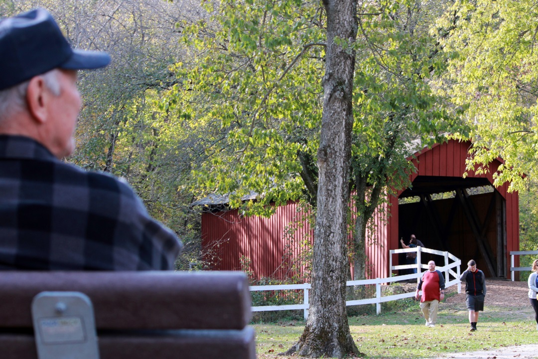
Sandy Creek Covered Bridge, Jefferson County
Once upon a time — in the year 1872, to be exact — Sandy Creek was built as one of six bridges on the original Lemay Ferry Road that connected Hillsboro to St. Louis. Can’t imagine that the others were more picturesque, though. The metal work and most of the timbers are original, and the bridge was open to vehicle traffic until 1984. The 200-acre site features a mile of trails and several picnic spots favored by folks who can’t seem to resist wading in the creek.
Just 30 miles from downtown St. Louis, a trip to the bridge can be paired with a plethora of parks or trails. It’s just 12 miles from the prehistoric remains at Mastodon State Historic Site and a 22-minute drive from Don Robinson State Park. This birders’ haven includes a short, accessible trail and the 2.4-mile Labarque Hills trail that offer stunning bluff and spring views.
Burfordville Covered Bridge, Cape Girardeau County
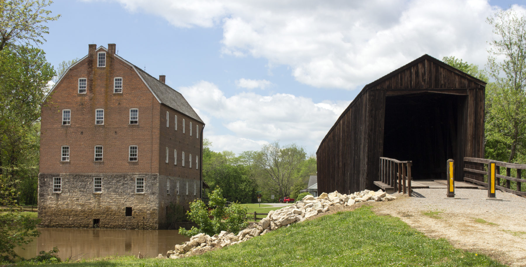
(Kathleen Nelson)
Situated on the Whitewater River, Burfordville is the oldest of the covered spans in Missouri but serves as a mere wingman to the star of the Bollinger Mill State Historic Site, which has been restored as an operating water-powered grist mill. The bridge linked farmers to the mill and the toll roads leading to the markets and port in Cape Girardeau. A record flood in 1986 caused the bridge’s stone moorings to become unstable; repairing trusses and replacing damaged original siding took until 1998. Guided tours of the four-story mill were scheduled to resume June 1.
The site has a 0.7-mile trail, some of which is underwater or soggy if the Whitewater floods. But the sites are 22 miles west of Trail of Tears State Park, which retraces the steps and dark story of displaced Cherokee enroute to Oklahoma in the harsh winter of 1838-39. Trail of Tears has 14 miles of hiking and horse trails and majestic views from the bluffs overlooking the Mississippi.
The Whitewater River doesn’t quite live up to its name for canoeing or kayaking near the bridge, according to John Tansil, a river keeper for the American Whitewater Association. He says local paddlers put in about 6 miles upstream near Millersville, where they must navigate downed trees and strainers.
Author: Kathleen Nelson is a regular contributor to Terrain Magazine.
Top Image: Sandy Creek Brdige in Jefferson County, Mo. (Kathleen Nelson)
Leave A Comment