
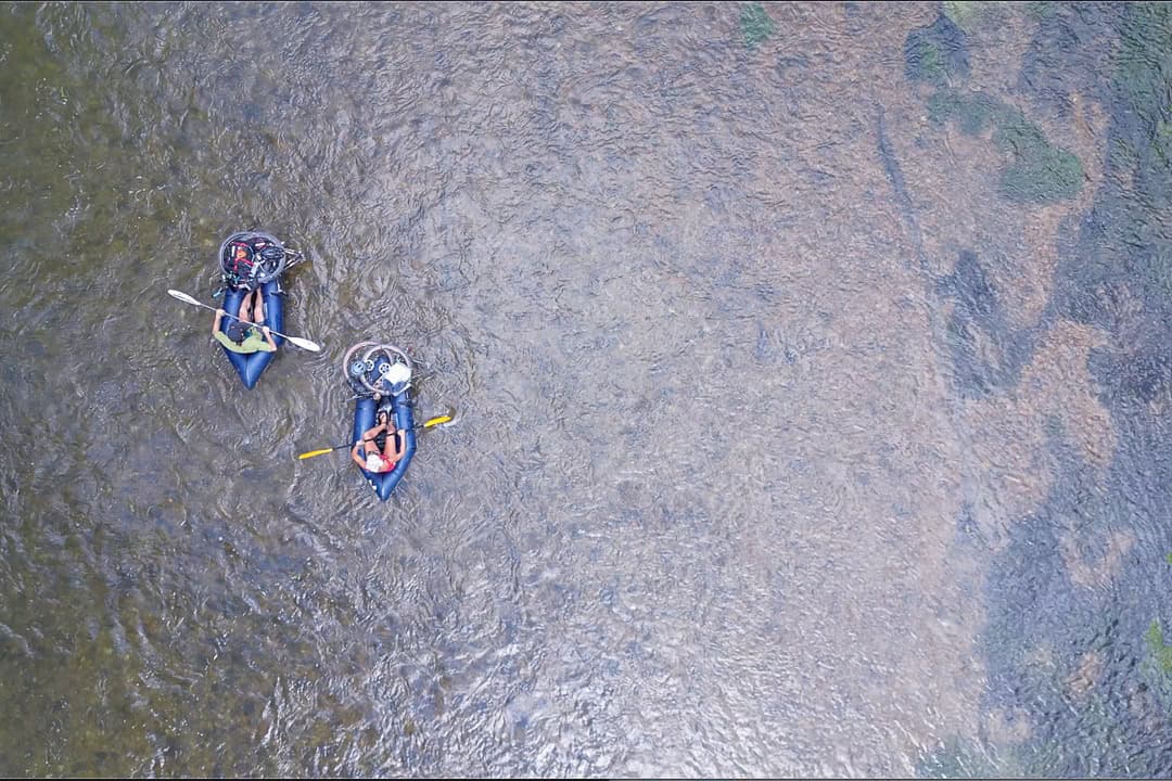
Buried deep in the south-central Missouri Ozarks lie three of the finest spring-fed rivers in North America: the Current, Jacks Fork, and Eleven Point. Woven between them is a maze of gravel and dirt roads, low-water crossings, and forest tracks that feel tailor-made for adventure.
Bring a bike and boat, and the possibilities are endless.
After nearly a decade of exploring the region by bike, foot, and paddle, my partner Monica and I kept coming back to the same question: Could we connect these three quintessential Ozark rivers in one approachable, water-and-woods route? Not just a suffer-fest, but something that balanced challenge, scenery, culture, and fun.
Bikerafting — made possible by lightweight packrafts — allows us to link these rivers in ways that weren’t practical before the sport gained traction in the mid-2000s. In the heat of summer, when the water runs cold and clear, it becomes one of the most refreshing ways to experience the Ozarks.
It took four years, and more than a few failed attempts, to get our route right. Planning a trip like this goes far beyond drawing lines on a map. With hundreds of river miles and countless biking options, every decision matters.
How much paddling is too much?
Which direction makes for better riding?
Where can you camp, resupply, or take a midday swim?
We answered those questions through trial and error. Weather cut one trip short. Time and difficulty derailed another. On one memorable night along the Current, a raccoon made off with nearly our entire food supply.
But with each attempt, the four-day, three-night route sharpened — and so did our appreciation for what we eventually came to call the Three Rivers Expedition.
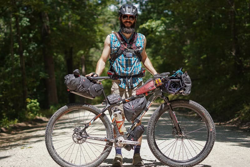
The author, Aaron Arnzen. (Monica Foltz)
Day 1: Van Buren to Round Spring
Approx. 70 miles biking
Van Buren makes an ideal starting point, with easy overnight parking, access to last-minute supplies, and solid options for a post-trip meal. We spent the night just down the road at Big Spring Campground, finalizing our gear and falling asleep to the sounds of the Current and its chorus of late-summer cicadas.
We left early from the Van Buren square the next morning, knocking out a short stretch of pavement — the least inspiring (but brief) riding of the route. Northeast of town, the road turned to gravel and the tone shifted. Carter County backroads carried us northeast into Current River Conservation Area, the first of five conservation areas along the route.
About 25 miles in, we made a worthwhile detour: a half-mile drop to the access point near Paint Rock Bluff. On a hot August day, the chilly water felt less like a break and more like therapy. It’s a spot mostly known by locals, and over the years we’ve come to recognize a few faces — folks who rumble in on ATVs and spend the afternoon in the shade. Seeing them again felt like confirmation that we were right where we should be.
Back on the bikes, we climbed out of the river valley and continued north on a mix of gravel, pavement, and forest roads, eventually crossing Highway 106 into the Roger Pryor Pioneer Backcountry.
For a shorter option, this is a natural pivot point. Just west of the highway, the Powder Mill access offers a chance to drop in on the lower Current River and paddle a scenic 26-mile stretch back to Van Buren over a couple of days.
We continued pedaling north until a wrong turn sent us dropping a few hundred feet into a creek bottom and straight to the mouth of a magnificent cave. It wasn’t on the map, but it was hard to be disappointed. Cool air poured from the entrance as we stood there, catching our breath and confirming what we already suspected: We’d made a navigational error.
After retracing our steps and trudging back up to the main road, we crossed Blaire Creek and chatted briefly with a local who mentioned the cave had once been a gathering spot for dance-offs — a detail that felt right in line with the Ozarks’ sometimes quirky character.
By the time we reached Big Creek around mile 57, the sun was starting to set. Low on water after our detour, we filtered a couple of bottles before pushing on.
The final miles rolled us by Echo Bluff State Park, but our eyes were set on a campsite off the river. We descended into the valley past Carr’s Canoe Rental and crossed the pedestrian bridge high above the upper Current River. It was one of the day’s best views.
At Round Spring Campground, we caught a glimpse of wild horses at last light before settling in. Dinner was simple: dehydrated kale and white bean stew. By the time the stars came out, we were already in our tent and dozing off for the night.
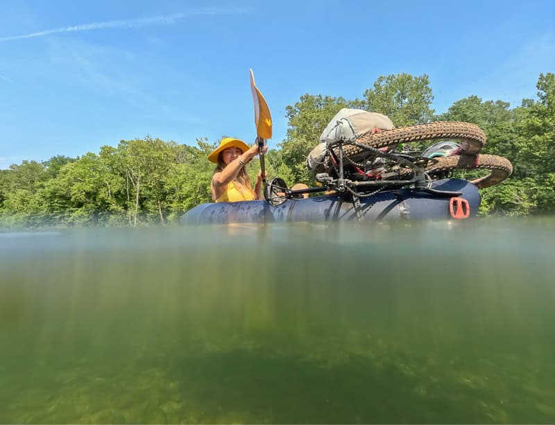
Paddling the Current River. (Aaron Arnzen)
Day 2: Round Spring to the Current River
Approx. 30 miles biking + 9 miles paddling
Morning came with conversation. Our New Hampshire campsite neighbor wandered over, full of questions about the bikes, boats, and how it all worked. It’s a familiar exchange on trips like this, and a reminder of how unusual bikerafting still feels to most people.
We eased into the day with oatmeal and fresh fruit, enjoying the last of our “real food” before the inevitable shift to convenience store snacks. Whenever possible, we start trips this way. It helps both physically and mentally.
Before leaving Round Spring, we pedaled over to check out the spring and cave, delaying the climb out of the valley a little bit longer. Eventually, though, the route tipped upward, and we began the steady gravel ascent into Sunklands Conservation Area.
At the top, we cruised into some of the best riding on the route — rolling terrain through pine groves and rocky soil. After crossing Highway D, we entered Angeline Conservation Area on an incredibly remote and winding seven-mile stretch that builds to a long, exhilarating descent with wide-open views on both sides of the road.
At the bottom, a short but rocky segment along NPS Road 305 delivered us to Alley Spring. We filtered a bottle of fresh groundwater before cruising past the mill, old general store, and visitor center.
From there, the route follows a county road right above Jacks Fork River. Depending on the water level, this is one of our favorite roads to ride in the region.
By early afternoon, we reached Eminence, a welcome oasis. The small town offers everything you need: food, drinks, and a chance to reset. We opted for a sit-down lunch at the Mexican restaurant, talking through the next phase of the trip as we ate. Before leaving, we ordered a few burritos to go and stocked up on snacks and cold beverages.
Extra weight matters less once you’re on the water, so we didn’t hold back.
We transitioned from bikes to boats at the access in town and pushed off into the Jacks Fork under the afternoon sun. After a day and a half of pedaling, the calm drift of the river felt like a reward.
The eight-mile float was unexpectedly quiet. Near Two Rivers Campground, the Jacks Fork merges with the Current, and just like that, we were on our second river. We marked the occasion with a few mid-river swims as the light softened.
Excited to spend night two on the water, we found a nice gravel bar along a beautiful bend in the river and made camp. We dried our clothes by the fire, ate our take-out burritos from Eminence, and enjoyed a few well-earned hoppy beverages.
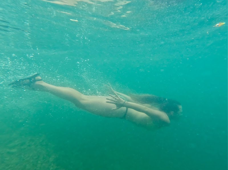
Swimming in the Current River. (Aaron Arnzen)
Day 3: Current River to Greer Spring
Approx. 9 miles paddling + 60 miles biking
We eased into the morning, sipping coffee by the fire, making breakfast, and waiting for the sun to warm the valley.
Once back on the water, we drifted south through Owl’s Bend and the Powder Mill Access, seeing almost no one along the way. Just past the access, we pulled over river left and took a short hike to Blue Spring. At 310 feet deep, this is one of the deepest springs in the country, its vivid blue color almost unreal.
We returned to the boats and floated the final miles of the Current, savoring our time before pulling out at Robert’s Field Access. Like any good transition point, this one called for a break. We spread out an early lunch, snacked, and watched a few boats pass through before shifting back into riding mode.
The climb out of the river valley came quickly. Gravel roads carried us through Rocky Creek Conservation Area and past the historic homestead at Klepzig — a preserved glimpse into the region’s past.
From there, the landscape changed.
Peck Ranch Conservation Area feels bigger, steeper, and more exposed. Known for its elk population, it’s one of the more secluded sections of the route. As we descended the incredibly fun roller-coaster down into Mill Creek, we caught two separate glimpses of the majestic beasts. Brief moments — not long enough to photograph — but enough to captivate us.
More afternoon gravel riding brought us into the town of Winona, our final resupply before the homestretch. We topped off water and grabbed a few last snacks. South of Highway 60, the ride mellowed into long stretches of gravel and dirt roads pointed at the Eleven Point River valley.
Around mile 160, we made a short detour to Falling Spring Mill. The storybook scene feels almost staged: water spilling from the hillside above the historic structure. It’s worth the extra half mile.
From there, we pushed toward Greer Spring Campground, riding through open pasture and along gentle creeks as the light faded into evening. A final crossing at Hurricane Creek led to the last climb of the day — a steady push up to the ridge separating the Current and Eleven Point watersheds.
At Highway 19, we turned and sped down the descent into Greer Spring, losing roughly 400 feet in one mile. The campground sits nestled into the trees above the Eleven Point. No service, no distractions. Just the sounds of the river moving through the valley and the crackle of a small fire.
We set up camp, cracked our last two beers, and took it in. It was our final night out — bittersweet but satisfying. After four years of trying, the expedition was finally becoming a reality.
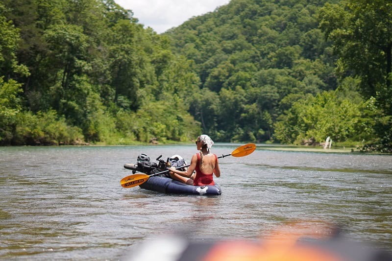
Paddling the Eleven Point River. (Aaron Arnzen)
Day 4: Greer Spring to Van Buren
Approx. 8 miles paddling + 35 miles biking
The final morning was cool. With 55-degree water below, we were more deliberate about staying dry as we made our last transition from bikes to boats at the Greer Spring access.
We launched early, beating the first float trip shuttle drop and claiming this eight-mile stretch of wild river to ourselves. We ate oatmeal from the boats as the fog parted and the steep rock bluffs came into view.
Halfway downriver, we talked ourselves into one last swim above Mary Deckard Shoals. Cold, quick, and worth it.
With about one mile left, we stopped at Turner Mill to top off our bottles for the final push. A few lazy turns later, we reached Horseshoe Bend and our take-out at McDowell Access. We packed down our boats for the last time and reassembled our bikes for the ride home.
After climbing out of the river valley, the final 30 miles back to Van Buren link scenic gravel roads through the Mark Twain National Forest. Near the midpoint, we passed Sinking Creek Lookout Tower before a short stretch on Highway C.
Then came Skyline Drive.
The name doesn’t oversell it. Riding the ridge, the views open to the north, revealing a layered background of hills, forest, and the river corridors we’d spent the past few days crossing. It’s the kind of stretch that makes you slow down — not from fatigue, but because you don’t want to miss it.
Eventually, the road tipped downward. We descended back into Van Buren, crossed the Current one last time, and rolled straight to the Jolly Cone drive-in.
Ice cream cones in hand, we took a moment to celebrate and let it all catch up.
***
Why the Route Works
We’re incredibly blessed to live near this region that is littered with quality mixed-terrain cycling and spring-fed paddling opportunities.
There’s no single “right” way to link these rivers. That’s part of the appeal. But after years of refining it, this version of the Three Rivers Expedition strikes a rare balance: a true backcountry, self-supported adventure that’s still approachable for experienced riders and paddlers.
It can be done in four days or stretched longer, depending on your pace. You can tweak the mileage, swap river sections, or build your own route completely.
That’s the beauty of the Ozarks.
Plan ahead. Respect the terrain. And don’t be afraid to take the long way — especially when it leads to cold water on a hot day.
***
If You Go
When to Go: Spring through fall, with peak enjoyment during the hottest summer days when the cold, spring-fed rivers offer relief.
Skill Considerations: Accessible to experienced cyclists and paddlers. Comfort with river navigation and off-road riding is strongly recommended.
Core Gear Considerations: Packraft, four-piece paddle, and Coast Guard-approved PFD. A mountain bike with 2-inch tires is ideal, though a capable gravel bike can work. We prefer strapping the raft to a handlebar system like the BarYak.
For full route details, gear lists, and planning resources, go here.
Author: Aaron Arnzen is a contributor to Terrain.
Top image: Paddling the Eleven Point River. (Aaron Arnzen and Monica Foltz)
Editor’s note: In the interest of safety, PFDs (i.e., life jackets) should be worn at all times while on a vessel, near open water, or during high-risk water activities.
Leave A Comment