Three friends and I were uphill from the Eleven Point River in the Ozarks, walking along the forested banks of the Turner Spring Branch. Down in the channel, a rusty waterwheel rose 25 feet into the overhanging foliage. It gave off a mysterious vibe, as if it rolled here on its own and was just stopping for a break.
In truth, this steel overshot wheel is one of the few remnants of the old Turner Mill, which was located on this spring branch from the 1890s to 1940s. Few signs remain today, but back then, there was a small village in these woods. About 50 homesteaders made do with a general store, school, and low-water bridge across the river. When the government approved the request for a post office, the residents were so shocked, they called their town Surprise, Missouri.
Before returning to our kayaks, we continued uphill to check out Turner Spring, where around 1.5 million gallons per day burst from a cave in the limestone bluffs. This is the reason a village was here in the first place. Just one of the many perennial springs that keep the Eleven Point running throughout the sweltering summer.
“Whoa, that’s cold,” someone shouted as we waded into the tumbling creek. It was early July, but the spring water felt like snowmelt.
A Great Choice for Overnights
The trip was a reunion for the four of us: Rick, Curtis, Ted, and me. Until several years ago, we were whitewater kayaking regularly. But various obligations like work and family made it harder to meet up at distant mountain rivers. So, we planned a self-supported overnight trip to scheme up some future adventures. The remote Eleven Point National Wild and Scenic River, in the northeast corner of the Missouri Ozarks, was a perfect choice. While shorter day floats are possible, this river is particularly suited to overnights.
On the walk back to our boats, each of us carried a Watershed Ocoee duffel. These roll-top dry bags are designed for whitewater, but they work just as well on float trips. We looked somewhat like a four-man special forces unit whose aquatic mission mostly involved keeping personal items dry.
Back at the river, we hopped in our boats and continued paddling. We’d already come 5 miles from Greer Crossing that afternoon. Our goal was to go another 6 to 8 miles before camping. The current usually moves well out here, which helps with making miles on the 19-mile run to Riverton. The scenery, the wildlife, and the fishing are further bonuses.
Throughout the day, we passed beneath sheer bluffs. We stretched our legs on gravel bars and pulled cans from coolers. We paddled past a family of river otters swimming through a pool. A bald eagle moved downriver ahead of us. A muskrat nibbled its way along the vegetated banks.
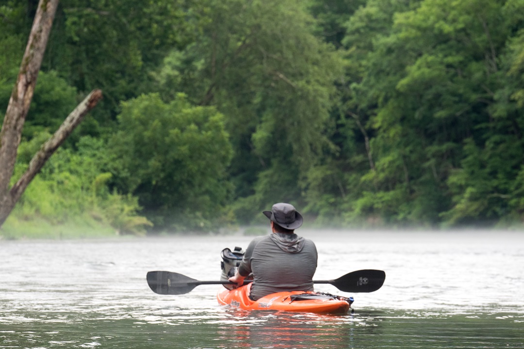
Rick and Curtis occasionally dropped fishing lines into the eddies as we floated past. Ted and I watched and wondered if we’d run out of beer before they caught one. Occasionally, mist formed above the channel. This is called steam fog, created by humid air passing over the cold water. Yet another charm of this enigmatic river.
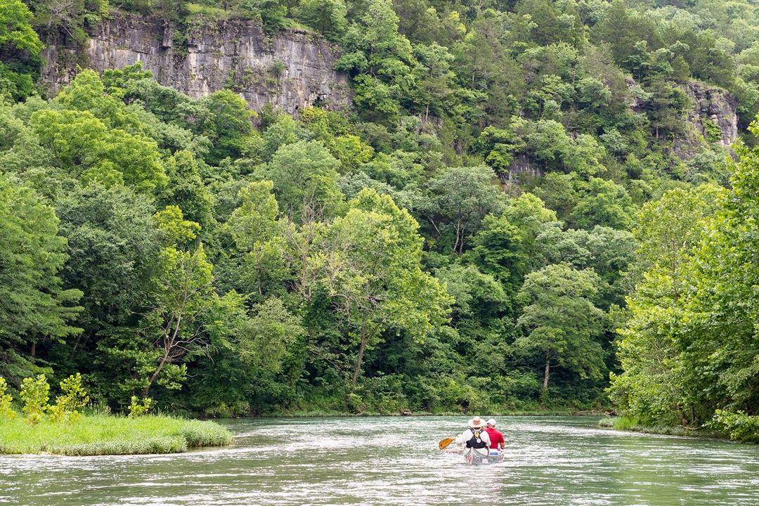
Bluffs along the Eleven Point River. (Mike Bezemek)
An Ominous Impression
The first time I came to paddle the Eleven Point, we arrived after dark. It was Friday night of July 4th weekend about 10 years ago. Driving the dirt road down to Cane Bluff, a pair of oncoming headlights flashed. I pulled aside to let a van with a canoe trailer squeeze past. The driver leaned his head out the window, and we chatted about our plans to camp and paddle for a few days.
“Not sure I’d sleep down there, myself,” he said with a shiver. “There’s tents down there now, but the campers are nowhere to be seen. Everything’s half-built. Like they all upped and vanished.”
We proceeded cautiously to the river access. Before setting up, I grabbed my headlamp and scouted the quiet camping area. It was a typical Ozark night. The sounds of cicadas, crickets, and bullfrogs were deafening. Mix humidity with the van driver’s story and the darkness felt claustrophobic. After examining the boat ramp, I followed some stairs. Near the outhouse, I stopped cold. There was a rope hanging from a nearby tree. I sprayed light across the clearing. Under a collapsed easy-up, there were two legs sticking out. Just steel shelter legs. Phew. I continued uphill and found four half-collapsed tents. There were poles jutting out, rainflies askew, sleeping bags scattered. What had happened here?
Headlights flickered through the trees, and I heard approaching engines. I hustled back to the outhouse, flipped off my light, and observed. A truck and sedan parked. Doors opened, and a group of giggling college kids spilled out. As I walked back to my truck, I was both relieved and mildly disappointed it wasn’t something more sinister. The next morning, their camp was in worse shape. Legs — this time, human legs — stuck out from open tent flaps. Bodies were wrapped in rainflies. A sleeping bag hung from a tree branch. Yet another settlement on the Eleven Point had passed its peak and would soon vanish.
Meanwhile, some friends and I set off from Cane Bluff on a slow-moving section of the upper river. After 7 miles, we passed Greer Spring Branch. With an average discharge of 360 cubic feet per second, it is believed to be the second-largest spring in the Ozarks. This doubles the flow of the Eleven Point, which is why most paddlers start from the improved access at Greer Crossing. On that trip, we continued past the second improved boating access at Riverton to the third and final ramp at Highway 142. In total, these lower 35 miles of the 44-mile Wild and Scenic section are a real gem.
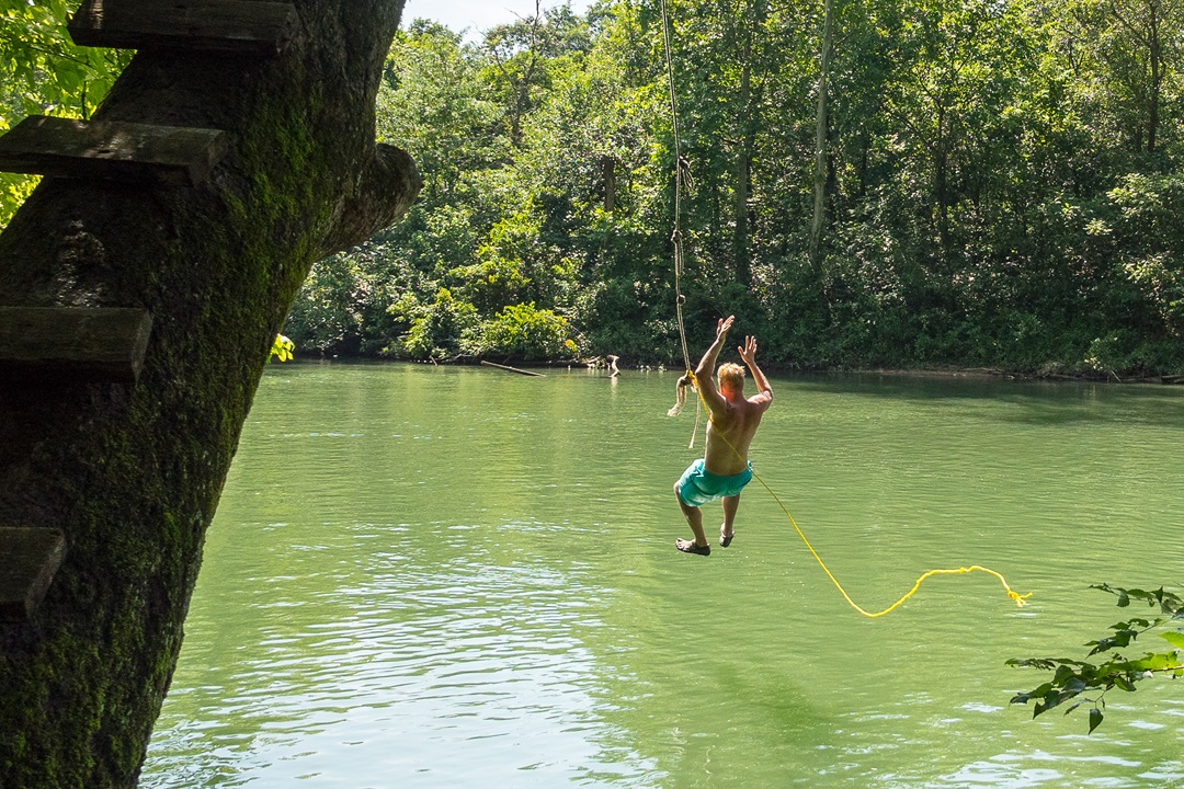
Rope swing on the Eleven Point River. (Mike Bezemek)
A Unique Name of Uncertain Origin
One of the biggest mysteries surrounding the Eleven Point River is its curious name. Several stories attempt to explain the origin, and some seem more plausible than others. One tale suggests that 11 creeks came together to form the river. There are quite a few seasonal creeks in the headwaters, but counting exactly 11 of them requires some convenient math. Another myth targets an 11-point buck said to have been shot along the banks. This could have been a somewhat rare event in a corner of frontier wilderness, but would it warrant naming an entire 138-mile river? Maybe, maybe not.
A third story is the one most repeated. It begins with French trappers exploring northward from present-day Arkansas in the 1700s. A pointe was their term for a wooded protrusion of land or a river bend, which were used as landmarks when navigating by land and water. The theory is that these explorers counted 11 prominent pointes as they traveled upstream from where the Eleven Point joins the Spring River. Sure enough, there are exactly 11 protruding bends in this sinuous river — provided you don’t count the other hundred or so.
That said, the lowest section of the Eleven Point is particularly twisty. Just above its confluence with the Spring River, satellite imagery shows that the channel has changed course numerous times. Some increasingly round meanders were cut off, while others have formed nearby. Hundreds of years ago, it’s possible the French first arrived when there were exactly 11 closely spaced river bends that warranted the name.
Whenever I return to the Eleven Point, I keep my ears open for new stories behind the name. While waiting for my three buddies to arrive for our recent reunion, I heard a new one. It happened at Richard’s Canoe Rental, a few miles south of Greer Crossing on rolling Highway 19. This is one of just two outfitters currently operating that’s authorized by Mark Twain National Forest. The other is Hufstedler’s, which has canoes, cabins, and campsites on Highway 160 in Riverton. While stopping inside Richard’s store for some ice, I spoke with a younger staffer about the name history.
“I got one for you,” he said. “When the forest service first surveyed the river, their compass pointed 11 different directions.”
“It’s a good one,” I agreed.
On my way back to the Greer Crossing campground, I further pondered the name. This new idea was fun, but the U.S. Forest Service was established in 1905, long after the Eleven Point River first appeared on maps. What other theories might be possible? There are around 64 named springs in the watershed, so that doesn’t match up. For now, the river pointe theory seems the most likely answer. Barring the discovery of new information, it’s possible the origin will never be certain.
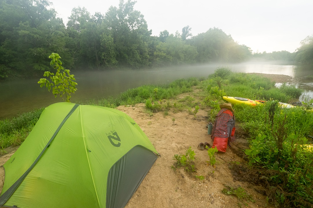
Camping beside the Eleven Point River. (Mike Bezemek)
Camps and Springs
On our reunion trip, we went about 12 miles on the first day. Throughout the National Scenic corridor, the forest service maintains seven established float camps. Dispersed camping is also allowed on public lands next to the river. We stopped around 6 p.m. and made camp on a low bluff overlooking the river. Clouds had been gathering overhead. So, after setting up tents, we strung a pair of rain tarps between trees over our kitchen. Good thing, too.
For a single night on a Class I-II river like the Eleven Point, we could have cooked a real meal. But part of this reunion was planning and practicing for future self-supported whitewater trips, where we negotiate rapids while carrying everything in heavy kayaks. Each of us had brought freeze-dried dinner and breakfast meal packs from brands like Mountain House, Backpacker’s Pantry, and Peak Refuel. These are great for multi-day adventures like backpacking, bikepacking, and paddling, when you want to minimize weight and cooking equipment. All you need is a small stove, ignitor, kettle, utensil, and fresh water.
We got plenty of the last item after the sky flashed. Loud cracks and rumbling thunder soon filled the gorge. For over an hour, we sat under the tarps as a deluge fell. At one point, I set my kettle outside the shelter, and it quickly overflowed with rainwater. Once the storm passed, we managed to restart our campfire. I kept an eye on the river, wondering if it would turn muddy and rise. Instead, the response was minimal.
The next morning, the flow was only slightly higher than the day before. The region had seen a dry spell that season. Despite the intensity of the storms, much of the precipitation seemed to have been swallowed by sinks and seeps of the watershed’s karst topography. After funneling into underground streams, it would eventually reemerge via the abundant springs that supply the Eleven Point.
For our last day, we had just over 7 miles to paddle. A final highlight came at Boze Mill Spring, another historical Ozark settlement that disappeared. We walked across the remnants of a rock dam and inspected the rusty steel turbine from the old mill. We followed a path to the translucent blue pool where the spring bubbles up from the ground. On hot summer days, this is a great spot for a cold swim. But this morning it was cool and cloudy, so we returned to our boats to float the final few miles to Riverton.
Another trip down a favorite river was coming to an end. Once again, we encountered maybe a dozen other groups per day during a prime summer weekend. When considering so many of my adventurous friends have never been here, a final mystery emerges. Why don’t more paddlers know about the Eleven Point?
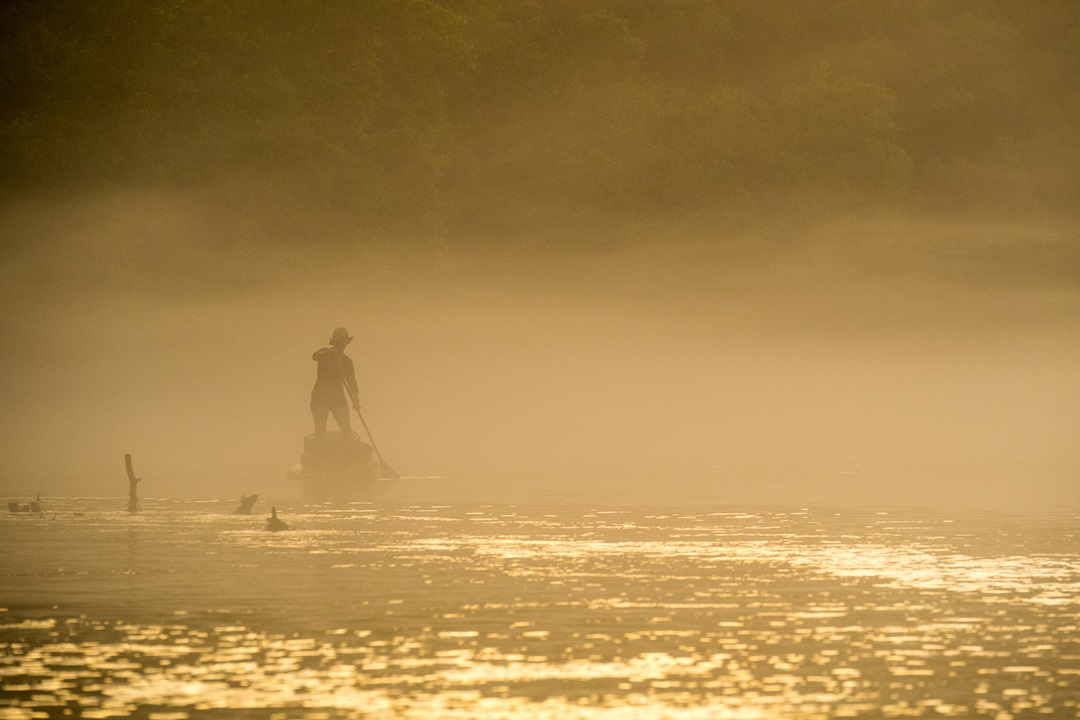
Mist forms above the Eleven Point River. (Mike Bezemek)
Eleven Point River Facts
Official name: Eleven Point National Wild and Scenic River
General location: Ozark hills of southern Missouri
Specific location: Thomasville, Missouri, to State Highway 142 (near Gatewood, Missouri)
Length: 44.4 miles
River classification: Class I and Class II
Length of full Eleven Point River: 138 miles
Website: rivers.gov/river/eleven-point
Author: Mike Bezemek is a frequent contributor to Terrain.
Top image: Steam fog on the Eleven Point River. (Mike Bezemek)
[…] This spring-fed river in the Missouri Ozarks is not only in the national wild & scenic rivers system but it’s filled with mysteries: the ruins of lost towns • a tale of vanished campers • a pervasive fog and karst topography • a name of enigmatic origins. Learn more at Terrain Magazine! […]