
- Nine places prefect for cross-country skiing in the St. Louis area
- Cross-country skiing tips for the St. Louis area
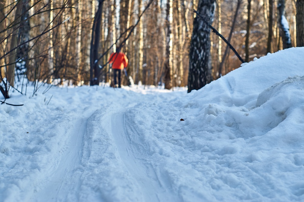
We can’t think of a better winter test of balance and endurance than cross-country skiing. However, lack of consistent snow can reduce the sport to a daydream in these parts. You could blame it on extreme weather, climate change, or global warming.
Greg Echelmeier, owner of Old Mountains Gear Exchange, refuses (editor’s note: the store unfortunately closed after the Covid pandemic). He recalls the polar vortex in early 2014 that dumped plenty of snow and gave him the chance to strap on his sticks for a trip to the grocery store and an impromptu session of reindeer games with the neighborhood kids at Deer Creek Park, just blocks from his store in Webster Groves. “Nothing like it,” he said.
Ever the optimist, Echelmeier keeps himself prepared for another vortex year after year. And it’s paid off. He reported selling four pair of snow shoes and three sets of cross-country skis in one week in mid-September.
So, just in case Echelmeier proves correct and Mother Nature cuts us a break, we decided to offer up some of the best local routes for cross-country skiing. Keep our fingers crossed!
Where to Go
“In store, we refer members to Shaw Nature Reserve or Forest Park,” said Susie Stevenson, former outdoor programs and outreach marketing coordinator for REI St. Louis. She also sends customers to powderproject.com, one of REI’s free apps. “Local people submit the trails, the information is reviewed and verified, then it goes public on the site. Anyone can do it, and it is one of the ways we try to connect local members in the outdoors.”
Echelmeier isn’t too particular. In addition to Deer Creek Park, he recommends the St. Francois Mountains, located about 90 miles south of St. Louis in Iron County, or “any green space, unless there’s a sign posted that says, ‘No Skiing.’”
If that advice seems a little too general, here’s a list of area trails that specify cross-country skiing among the recommended activities. Consider them a good place to start.
Hawk Ridge Trail, Queeny Park
This 4.4-mile trail circles the park, crosses through woods and fields, and overlooks ponds, lakes, creeks and an animal pasture. The terrain is rolling, with a few challenging slopes. Be prepared to share the trail with devoted runners, especially on the weekends. Shorter options in Queeny include the Owl Creek (1 mile) and White Oak (.6 mile) trails.
Stinging Nettle Trail, Castlewood State Park
Measuring 4.8 miles with a view of the Meramec River along a good stretch, the slopes are easy rollers for bikers but a challenge for skiers. The trail is a little wider than most singletrack, making it a good choice. With a half-foot of snow, you’ll have little to worry about from the trail’s namesake nettles.
Grant’s Trail, St. Louis County
As a former railroad right-of-way, the wide, level, 16-mile path is ideal for newbies to the sport. The terrain won’t remind you of Robert Frost’s “Stopping by Woods on a Snowy Evening,” but it’s a nice mix of neighborhoods, open space, bottomland, and parks, with nine access points with parking. If you want to throw in a hill, take the spur from Grant’s Trail into Clydesdale Park.
Shaw Nature Reserve, Gray Summit
Head to the Maritz Trail House, which connects to a half-dozen treks ranging from 1 to 2.5 miles through hillier portions of the reserve that include forest, glade, prairie, and river overlooks.
Forest Park, St. Louis
Even with more than a half-foot of snow, you can expect lots of company from runners and cyclists on the 5.6-mile bike path. The golfers take a break, though, and the 27 holes of the Norman K. Probstein Golf Course offer more solitude and fewer ruts for smoother gliding.
Fisherman’s Trail, Bee Tree Park
True to its name, this .8-mile loop in south St. Louis County circles the lake. It’s flat, with a gravel base and open to the sun, so bring your shades.
Confluence Trail, Madison County
Mostly flat, this 20.5-mile asphalt path between Alton and Granite City in Illinois is part of the Madison County Transit (MCT) trail system and offers lots to gawk at: the Clark Bridge, Wood River Creek Bridge, and views of the Mississippi River. You might get lucky in January and join the company of eagles, who patrol the river for food.
Ronald J. Foster Heritage Trail, Madison County
You won’t get bored on this flat, 12.2-mile stretch of MCT asphalt trail between Glen Carbon and Marine, Illinois, which includes wooden bridges, railroad tunnels, scenic prairie shoulders, and historic markers.
West Alton Trail, West Alton
Even in decent weather, this 2-mile path between West Alton and the Clark Bridge isn’t used as much as you’d think, perhaps because cyclists criticize it for lack of maintenance. With six inches of snow, though, the flat terrain provides nice views of the bridge and wetlands, and connects to the Confluence Trail.
Cross-Country Essentials
On a flat, relatively smooth path over grass or dirt, 4 inches of snow is barely enough. If you’re trekking over gravel, pebbles, or rougher terrain, you’ll need at least 6 inches — 8 if you want to make sure you don’t scratch or ding the bottom of your skis.
The necessary gear includes skis, of course, of which there are a surprising variety. Some, like touring and classic skis, are suited for groomed trails. For our ungroomed fields and steeper terrain, look for skis that are shorter and wider with full-length metal edges.
Different types of skis combine with different types of bindings and boots, though each allows for your heel to move freely. And you’ll need poles, which come in a variety of lengths.
Dress in layers to keep warm, stay fueled and hydrated, and be sure to take it slow and steady. Hats and gloves are a must, and consider ski goggles or, at minimum, a good pair of sunglasses with lots of coverage to minimize wind and glare.
Kathleen Nelson is a regular contributor to Terrain Magazine.
Will Queens Park bevgroomrf for classic skiing this weekend? Thank you.
Today’s snowfall is great opportunity to CC ski. Heading out