
Over the course of one day in late July 2022, the St. Louis region experienced a record-setting deluge of rain that swamped neighborhoods and flooded hundreds of homes along miles of streets throughout the Midwestern city. While known as the confluence of two of North America’s greatest rivers, the Mississippi and Missouri, much of the worst damage was concentrated along the path of a lesser-known stream, the River des Peres, a waterway long ago forced by human hands into a gargantuan concrete-lined ditch that snakes its way through the dense heart of a metropolis.
Long the brunt of jokes among natives about its often-bedraggled appearance and so heavily altered that many believe it to be a completely artificial creation, the River des Peres reminded mortals that day that it is very much still alive and a real force of nature to be reckoned with a century after its supposed taming.
History of River Des Peres
“I would say that while we rightfully have a tendency to focus on the macro influences of the Mississippi, Missouri, Illinois, and Ohio in the development of St. Louis, smaller navigable waterways like the River des Peres are underappreciated with regard to their importance to the development of the City,” said Andrew Weil, executive director of Landmarks Association of St. Louis and an expert on the history of the river. “These were actually the scale of rivers that supported the ecosystems that formed the bedrock of the fur trade.”
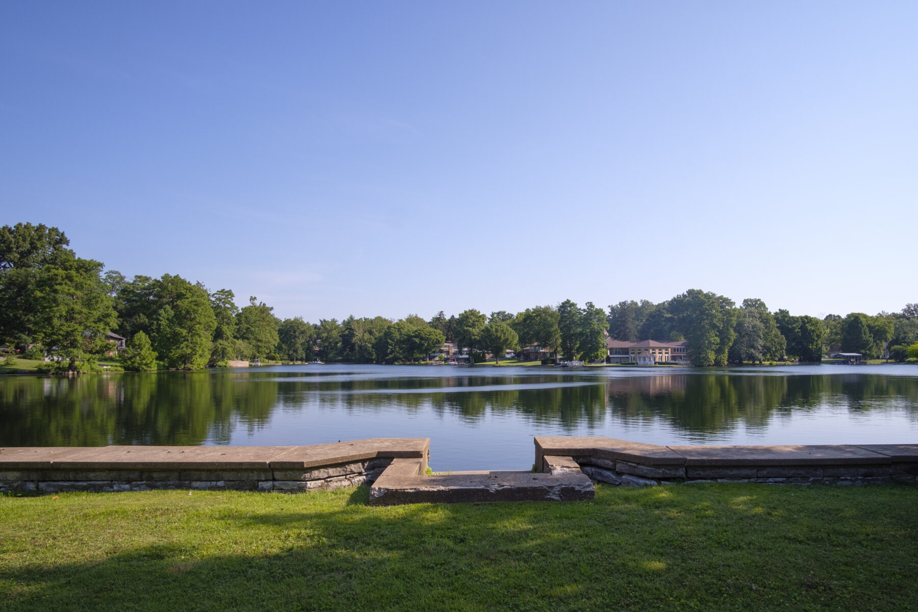
The River des Peres was once indeed an idyllic ribbon of water that wended its way from what is now the suburb of Overland. For over a century, it remained a pristine if intermittent stream. But the alteration of the natural flow started early, when the owner of the headwaters, Henry Laughlin, built a massive earthen dam across the ravine at its source in 1897, creating Lake Sherwood, fed by spring water that had once created the river.
Today, the River des Peres is now permanently cut off from its source except when heavy rains cause water to pour over the dam’s spillway. During the 1904 Olympics, a concrete diving platform, which still survives to this day at Lake Sherwood, hosted athletic events the same year as the famous World’s Fair in Forest Park. During the fair, planners temporarily placed the stream in a culvert.
Concrete diving platform from the 1904 Summer Olympics. (Jason Gray)
Miles to the south at the mouth of the watercourse, Weil explains how the River des Peres played a role in the very foundations of the St. Louis region: “The outfall of the River des Peres was the site of the first European settlement in the St. Louis area, where a community of Jesuits [“des Peres”] set up shop at the end of the 17th century. The valley of the Mill Creek [and the River des Peres both] drained and eroded the surrounding uplands exposing caves and springs that supported our fledgling brewing industry.”
In between the headwaters and mouth, as the City of St. Louis grew westward, clayworks and other industries grew up along its banks, and the once pristine river became an open sewer. Forest Park and other toney neighborhoods to the upriver further strangled the river’s course, and when heavy rains came, the waters jumped the banks, flooding large swaths of the city.
The waterway had become a “menacing open sewer” in the eyes of a 1921 St. Louis Post-Dispatch newspaper article on the city’s effort to pass a bond issue to harness the River des Peres in a series of tunnels and culverts. From 1924 to 1933, St. Louis forced the river into a network of single or double tunnels starting at the city limits, all the way under Forest Park before opening up into the broad concrete ditch that ends at the Mississippi River. The firm of Homer & Shifrin designed the ambitious plan.
At the time of their construction, these tunnels were revolutionary, says Jarek Czernikiewicz, chief engineer at the Board of Public Service of the City of St. Louis and former employee of Horner & Shifrin. Previously, the brick sewers of the city had been of a much smaller diameter, and likewise, while there had been bridge spans of much greater breadth, the new tunnels required engineering of new widths in concrete in between the two that had never before been constructed.
While Czernikiewicz laughs when reminiscing at his first impressions of the River des Peres, “I thought it looked like a moat,” he has now come to respect the incredible amount of ingenuity that went into designing the flood control system.
Except for several historic floods, including the 500-year event in 1993, the harnessing of the River des Peres has largely worked. Indeed, a century later when the River des Peres faced first a 500-year and then a 100-year rain event a week apart at the end of July 2022, the system largely held up to the onslaught of the heavy rains that inundated the region. (Nearby creeks not part of the original design of the River des Peres fared much more poorly.) But it came at the cost of what had once been a natural stream being turned into the main trunk of a giant sewer system.
“These smaller rivers were key to making the current site of St. Louis attractive to Native people and the Europeans that came along and scouted it in the 17th century and ‘settled’ it in the 18th,” said Weil. “Then, of course, urbanization made these natural watercourses liabilities rather than assets due to flooding, and we have what we have today.”
Creating Clean Water
Sean Stone of the Metropolitan St. Louis Sewer District provides a stark fact: the United States landed on the moon before the City of St. Louis began treating sewage entering the region’s waterways. But the story of the River des Peres transforming from being a “menacing open sewer” to becoming, ever so slowly, an asset for the region begins at the Lemay Wastewater Treatment Plant, located on the south bank of the huge drainage ditch just west of the mouth of the river. While it might seem like an unlikely location, the Lemay plant is one of the largest in the US outside of Los Angeles, Chicago, or New York.
The location was logical for engineers. “There are two ways you can move water — with pumps or gravity. One of them is a lot more reliable than the other. It’s also free,” Stone explained, referring to gravity. “So, we build our plants where the water naturally flows.”
Looking down at the slowly moving soup as it runs through the waste treatment process, Stone remarks on the changing challenges of turning that brackish stew into crystal clear water. “In the initial days of the pandemic, when toilet paper was in such short supply, we saw a tremendous increase in a number of flushable wipes. Flushable wipes are not flushable.”
In the past, sewage would just be dumped into the River des Peres, where it would eventually find its way into the Mississippi River. Now, however, every one of those flushable wipes has to be removed along with every other solid that made it by the plant’s screens.
“The solids are sinking to the bottom,” Stone said, “and the fats are being skimmed off the top.” Microorganisms help to finish off the purifying process, and in less than a day — 17 hours — water that has left consumers’ drains is now ready to leave the plant, cleaner than Mississippi River water.
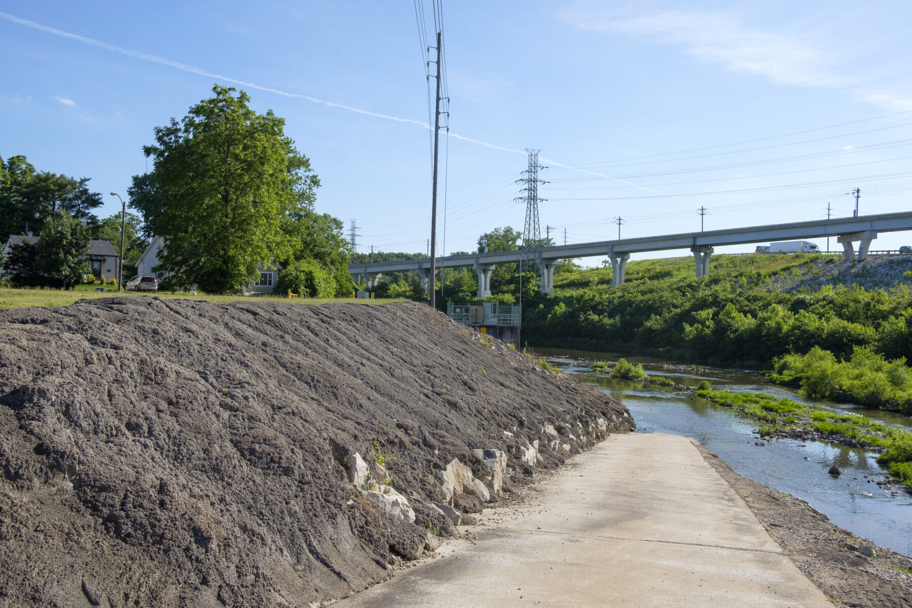
Infrastructure along the River des Peres. (Jason Gray)
Back in another quarter of the sprawling wastewater complex, there is still work to do after the water has been purified. The solid wastes are incinerated in giant furnaces, with little to no smoke rising from the smokestack that towers over the plant. The little bit of yellow smoke that is barely visible to the human eye actually is from Mississippi River mud, wafting into the air.
“We’re reusing the water that we treat; we’re using water to clean things around the plant,” Stone said. “Our mission is spelled out to protect the public’s health, safety, and the water environment through responsible management, wastewater, and storm water. It’s a noble mission. And it really drives everything that we do.”
Approximately a mile away from the Lemay Treatment Plant, on the north bank of the River des Peres, lies one of the most innocuous but critical buildings in the infrastructure of St. Louis. While gravity brings the wastewater of a vast network of the region down to the River des Peres, this pumping station moves the effluence that final mile over to the treatment plant across the river — in fact, 90 to 95 percent of all the waste that passes through Lemay first passes through here.
While the pumping station looks to be only a few stories tall outside, when entering, the visitor discovers that the underground portions plunge over 100 feet into the earth in a space reminiscent of the tractor beam scene on the Death Star from the original “Star Wars” movie. Behind thick concrete walls and massive steel pipes, the waste of a metropolitan region moves under high pressure, with the hum of powerful pumps providing the background music.
Greenways and Green Spaces
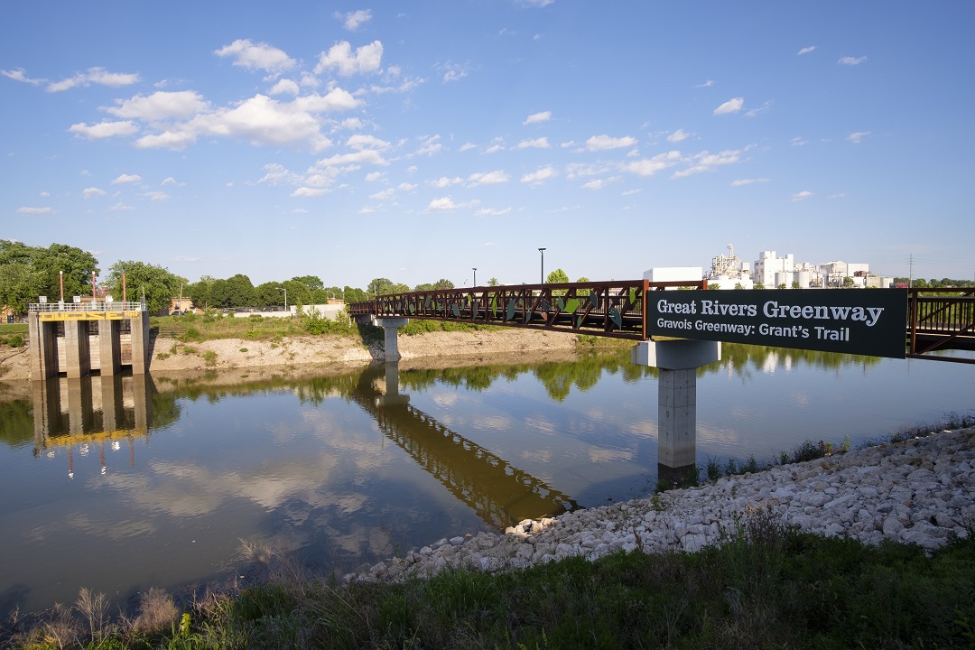
Up above ground and water, Emma Klues, vice president of communications and outreach at Great Rivers Greenway is looking down from one of the many pedestrian bridges the public agency has built across the region as the water flows by sluggishly underneath and the roar of rush hour traffic drowns out.
“It’s not the most pristine habitat, but I always see wildlife here,” Klues said, looking out over the rock and concrete walls of the River des Peres in the section one mile west of its confluence with the Mississippi. There are signs of a revitalization, as native plantings, birds, and animals are beginning to replace the austere stone embankments.
The River des Peres Greenway, a combination pedestrian and bicycle path that follows the path of the valley, was actually one of the original segments of what will one day be a planned 600 miles of greenways throughout the St. Louis region, with 128 miles of greenways built to date.
“We are doing conservation projects as we build the greenways, restoring streambanks and installing wetlands and rain gardens to make these places close to people,” Klues explained, “instead of having to get in your car and driving 40 miles. Greenways are for everyone. We want everyone to use them.”
A key component is educating people about their natural resources, Klues continued: “We really try to show people what we’re doing while we’re doing it. Why plants are helpful, how they help manage storm water.”
Long term, the River des Peres Greenway will hook up with the Centennial Greenway by way of Forest Park, further connecting the region’s network of trails and paths. One of the goals of that connection, Klues hopes, is that people will begin to understand that the river goes underground northwest of Forest Park and then emerges to the south.
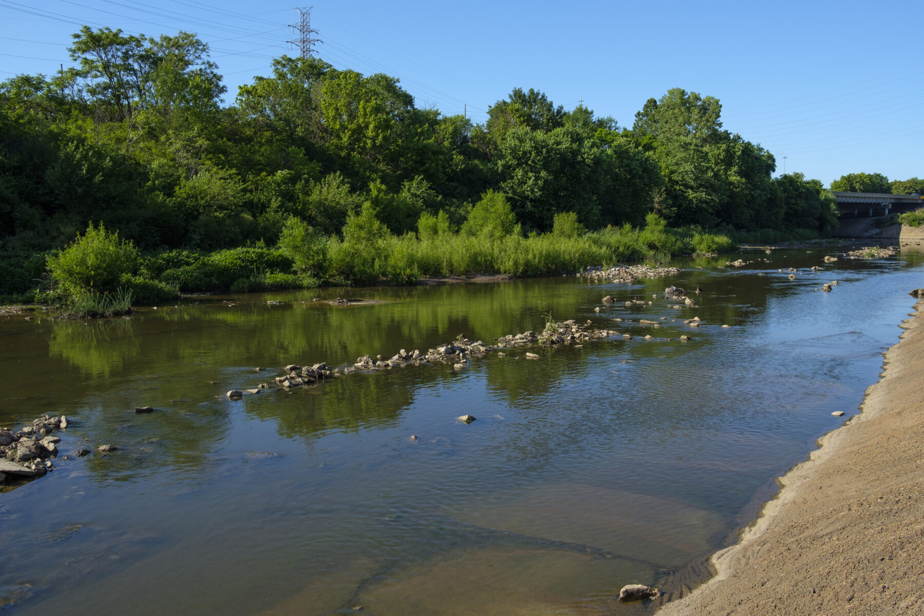
A successful wetland portion along the River des Peres. (Jason Gray)
Ironically, while the River des Peres Greenway comes so close to the Mississippi, there currently is no access to that major river. At the northwest corner of the confluence is the site of the former Carondelet Coke plant, a massive brownfield site only recently remediated in the last decade. But the area is rich in history: besides the original Jesuit settlement, James Eads once built ironclads for the Union Navy during the Civil War in nearby Carondelet.
The last, short piece of the River des Peres Greenway to connect to the Mississippi Greenway (near River City Casino) is a construction project that should begin in the next six months. The Mississippi Greenway already connects south to the historic Jefferson Barracks County Park along the river, so people can watch barge traffic and the mighty waterway as they move along the greenway.
Ultimately, however, Great Rivers Greenway represents a different outlook on the River des Peres than the region’s forefathers: instead of attempting to conquer the waterway, the new attitude is one of embracing and working with the stream’s natural strengths and beauty. The River des Peres does not have to be a “menacing open sewer,” as some people perceive it.
Klues succinctly summarizes this new outlook of working with, not against the environment: “Nature is going to nature.”
Author: Chris Naffziger is a contributor to Terrain Magazine.
Top Photo: Gravois Greenway crossing over the River des Peres by Jason Gray.
I don’t understand how the headwaters were at Sherwood Lake? The headwaters are now currently shown to be sourth of Page in an industrial park just west of Warson. There must have been two forks that merged just northeast of Olive and 81st street, I guess either could have been called the headwaters, but now they are south west of Lake Sherwood
If you look at sherwood lake the spillway is at the NW corner of the lake. the spillway outflows into what was the original headwater of River Des Peres. It may fall into a pipe that runs to the SW. It is impossible to tell where it runs to because of all the development in the area but it isn’t inconcievable considering the meandering path of the river but it surely follows the lay of the land. Topographically you can see what could be the original river path that more or less follows the west side if I70 that cuts through/under Overland Plaza. There could have been a fork or bend just NW of Rothwell Heights Ln and North of Clay Pip9ing Systems and whjat lies to the west of that is all man made. With all thats been developed over the years unless there is a very old map that could be overlayed on a current one it is impossible to tell.
Fascinating article, Chris! Very well done. I wrote about the challenges of putting the RDP underground in Forest Park in a book about the 1904 World’s Fair many years ago. Our history with the RDP is a great story, kind of a microcosm of people’s relationship with natural systems writ large.
Horner and Shifrin both worked for the City at the time of construction. Their engineering firm was not founded until 1933.
I grew up along the River Des Peres: our backyard ended where the narrow flat area above the River started. That was on Wabash Avenue, 1954-62. It was a great area for a kid to explore: interestng rocks along the banks, and animals of many kinds. DDT trucks went through in the summer, driving along the concrete areas along either side. Not everyone can say they grew up next to a sewage river!