
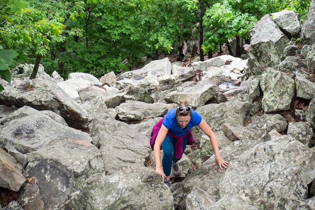
The ascent was a challenge. We were scrambling up a slope of tumbled boulders. Breathing heavy. Dripping sweat. Grabbing hand and toe holds wherever we could find them. Craning our necks skyward, we scanned for routes to the summit.
It was the third week of a cross-country road trip, one that had started motel-bound with brief but intense cases of COVID. Once recovered, we’d resumed making adventurous stops, just at a somewhat mellower pace than usual. Shorter hikes to natural arches, slot canyons, and ruins around Bear Ears in Utah. A backcountry driving tour through Colorado’s San Juan Mountains on our way to Mesa Verde. Exploring volcanic landscapes and cinder cones at National Park System units in New Mexico. After years of skipping it, we finally visited Alibates Flint Quarries in Texas for a ranger-guided tour.
However, this most memorable of mountains that we were currently climbing wasn’t located in any of those classic western states. While studying our route on her phone the day before, my wife had spotted an intriguing stop: Pinnacle Mountain State Park, right outside of Little Rock, Arkansas, with its pyramid-shaped namesake rising to just over 1,000 feet. After hours of driving across the Great Plains, we assumed this might offer a decent spot to stretch our legs. Instead, it turned out to be a great place for a full-body workout.
As we mounted boulders of quartzite sandstone on the East Summit Trail, a sporty woman came rushing down from above. She seemed oddly annoyed that we were in her way, possibly because she was tracking her time. We let her pass, and a few minutes later we emerged from the trees onto a bedrock summit where some fellow hikers were resting.
The view in all directions was stunning. To the east, the Arkansas River meandered toward its confluence with the Mississippi. To the north was the hazy outline of the Ozarks. To the west was Rattlesnake Ridge, a feature of the Ouachita Mountains, bursting sharply from densely forested hills, which rolled onward to the horizon. We sat for a windy break watching vultures soar on the updrafts.
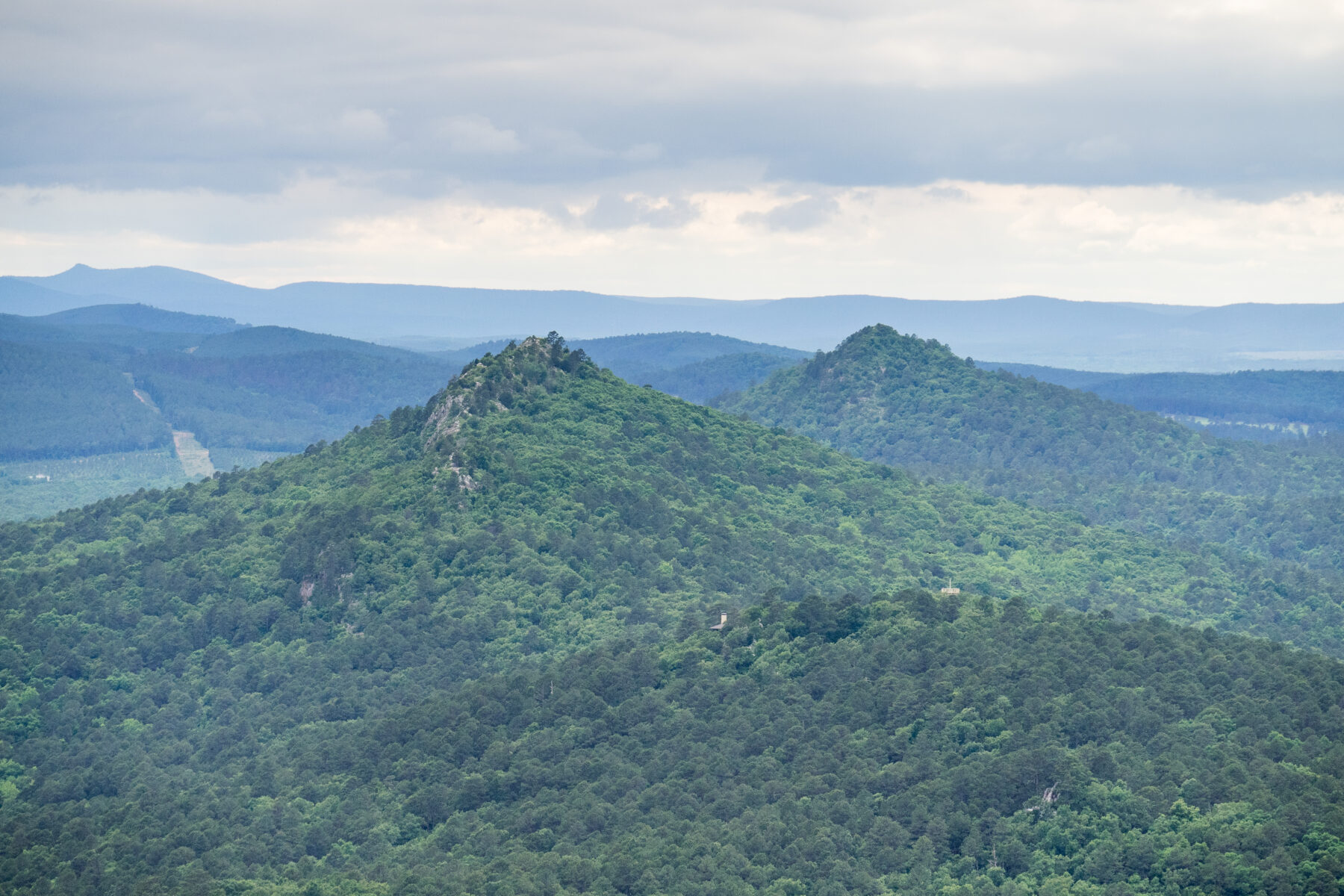
View of Rattlesnake Ridge and Ouachitas from Pinnacle Mountain. (Mike Bezemek)
Heading down the more gradual West Summit Trail, we encountered a steady stream of afternoon summiteers. At the bottom, we followed the Base Trail along the Little Maumelle River. After a wrong turn onto an unnamed side trail, we ended up looping through the park arboretum. Interpretive stations shared information about area ecology, while a bright red cardinal swooped from tree to tree ahead of us. Though we didn’t have time, nor bikes, the park also has several mountain biking loops, and it’s the eastern terminus of the 223-mile Ouachita National Recreation Trail. With dusk approaching, we walked back to our truck along the main park road but agreed we’d definitely return if passing through.
Then we did what we always do when visiting Little Rock — which is twice. We went to get Greek food. Our friend Douglas, a math teacher, has a theory that every metro region has one type of affordable cuisine that it does abundantly well. Whether it’s due to diasporas or regional tastes, you’ll find an exceptional number of these places. Where we all live near Myrtle Beach, it’s Japanese Hibachi. When my wife and I lived near the Delmar Loop, in St. Louis, it was Thai restaurants. Growing up around northern California, I think it was Mexican burrito shops. On our previous stop in Little Rock, I’d noticed a high number of Greek places, so we decided to check out another one. We picked up gyros, falafel, pitas, tzatziki, and hummus. Then we went back to the hotel for a quiet night.
Early the next morning, we continued our dash across the state, heading southeast along the Arkansas River. Ever since we moved to the Southeast Coast and started using I-40 to cross the country, we always make it a point to return to this region. Sometimes we detour north into the Ozarks, with favorite trips including paddling at Big Piney Creek or the Current River in Missouri. Other times, we checked out cities and trails around Little Rock, Fayetteville, and Fort Smith (see September/October 2021).
On this trip, we were traveling with a National Park System map, which shows the location of all 423 units. This includes not just national parks, but monuments, preserves, seashores, and battlefields. This map is a great way to find new adventures, and sometimes you just have to take a chance and go. Recently, the map had pointed us to the excellent El Morro and El Malpais, two national monuments west of Albuquerque, plus Alibates Flint Quarries north of Amarillo.
A few days before, I’d spotted an intriguing dot down in the soggy southeast corner of the state: Arkansas Post National Memorial. I’d heard about this frontier fort many years before when, one day, I’d sat up and said out loud, what’s an Ozark anyways? While researching the history behind the place name, I’d learned about Arkansas Post but somehow missed the fact it’s now a preserved historic site one can visit.
After following a levee road, we drove through the lush riverside landscape of the 757-acre grounds and parked. Upon entering the visitor center, a friendly ranger rushed forward to greet us. Working at a park unit that recently has been averaging less than 30,000 visitors per year, she seemed pretty enthusiastic to have her first guests of the day.
“You must be passport people,” she said, referencing the popular booklets that enthusiasts will get stamped at every National Park System unit they visit.
“We’re National Park System map people,” I said, with a knowing look, thus declaring this to be a thing.
The ranger launched into a spirited orientation about the memorial, the exhibits, the artworks, the rivers, the history, the ruins, the walking paths, the Civil War cannons, the gift shop, the weather. It was very sweet, and I actually think she’s still talking to this day. But after 15 minutes, we politely excused ourselves to check out the bathrooms.
After touring the fascinating museum, the outside grounds were where Arkansas Post really came alive. A walking path led us past a reconstructed fort palisade to the old townsite.
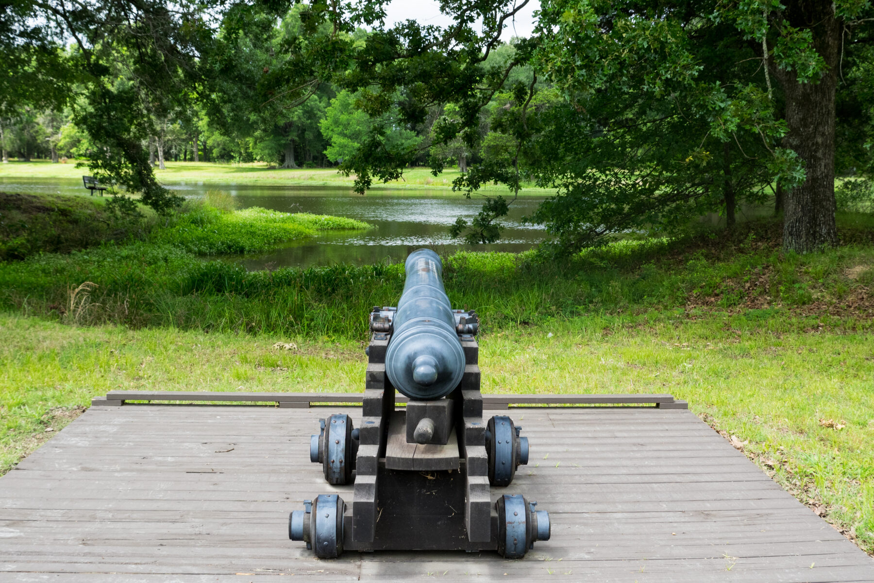
Civil War cannon at Arkansas Post. (Mike Bezemek)
What’s an Ozark Anyways?
During the summer of 1686, a French trader named Henri de Tonti established the Poste de Arkansea near here. The word Arkansea was the French version of an Algonquin name for the local Quapaw tribe, with whom the French developed friendly relations trading European goods for beaver furs. For short, French settlers called the early post aux Arcs, meaning roughly “at the Arkansas.” One story says this term, pronounced “ooze ark,” eventually came to refer to the larger region, including the mountainous plateau now called the Ozarks. That said, another version says the term aux arcs, meaning “at the bend,” refers to a sharp meander in the Arkansas River near the town of Ozark, Arkansas. One of these stories is likely the origin, and perhaps both are true.
For about 15 years, a small population of traders and enslaved workers kept the trading post operating. But low profits meant that by the turn of the 18th century it was mostly abandoned. During the 1720s, the site was reestablished as a French military post, with action seen in several wars involving various European powers and Native American tribes. At times, the post location was shifted upstream or downstream due to flooding.
In 1763, France ceded the region to Spain, which used the rivers as fur-trading routes. The Spanish established Fort Carlos at the original site, where it operated for about 40 years. During that time, an outlying battle of the American Revolution was fought here, with British partisans and Chickasaw Indians being repelled by the Spanish and Quapaw allies.
At the turn of the 19th century, the region was briefly regained by France but soon sold to President Thomas Jefferson as part of the Louisiana Purchase. In 1819, the post was briefly named capital of Arkansas Territory, which two years later was moved to Little Rock. But the townsite at the post lingered for nearly 40 years more, mostly as a river port for slave labor and plantation cotton.
During the Civil War, Arkansas seceded and the post became a Confederate fort, manned by 5,000 rebel troops who were tasked with defending the capital. On January 10, 1863, a fleet of Union gunboats began a bombardment. Around 30,000 blue coats overran Fort Hindman by the second afternoon. The post would never recover after the war. Today, the buildings are long gone but the waterfront townsite is marked by walking paths and information signs.
After pacing through the grid of old streets, we paused at one of the few lingering features, a 19th century cistern. Then we looped around a peninsula on the nature trail. We passed through a pleasant riparian forest, crossed the bridge over Alligator Slough, and inspected some Civil War cannons near an old Confederate trench. All in all, it was an impressive site with a fascinating story — definitely a place worthy of a detour if you’re passing through the region.
Hopping back in our truck, we cranked up the air conditioner and pulled out the maps. From here, we’d follow the Great River Road south along the Mississippi to Vicksburg National Military Park. There, we’d get the chance to board one of the few surviving examples of those Union gunboats that invaded the Arkansas Post — yet another promising site selected from, you guessed it, the National Park System map.
Author: Mike Bezemek is a contributor to Terrain Magazine.
Top image: Scrambling up Pinnacle Mountain in Arkansas. (Mike Bezemek)
Leave A Comment