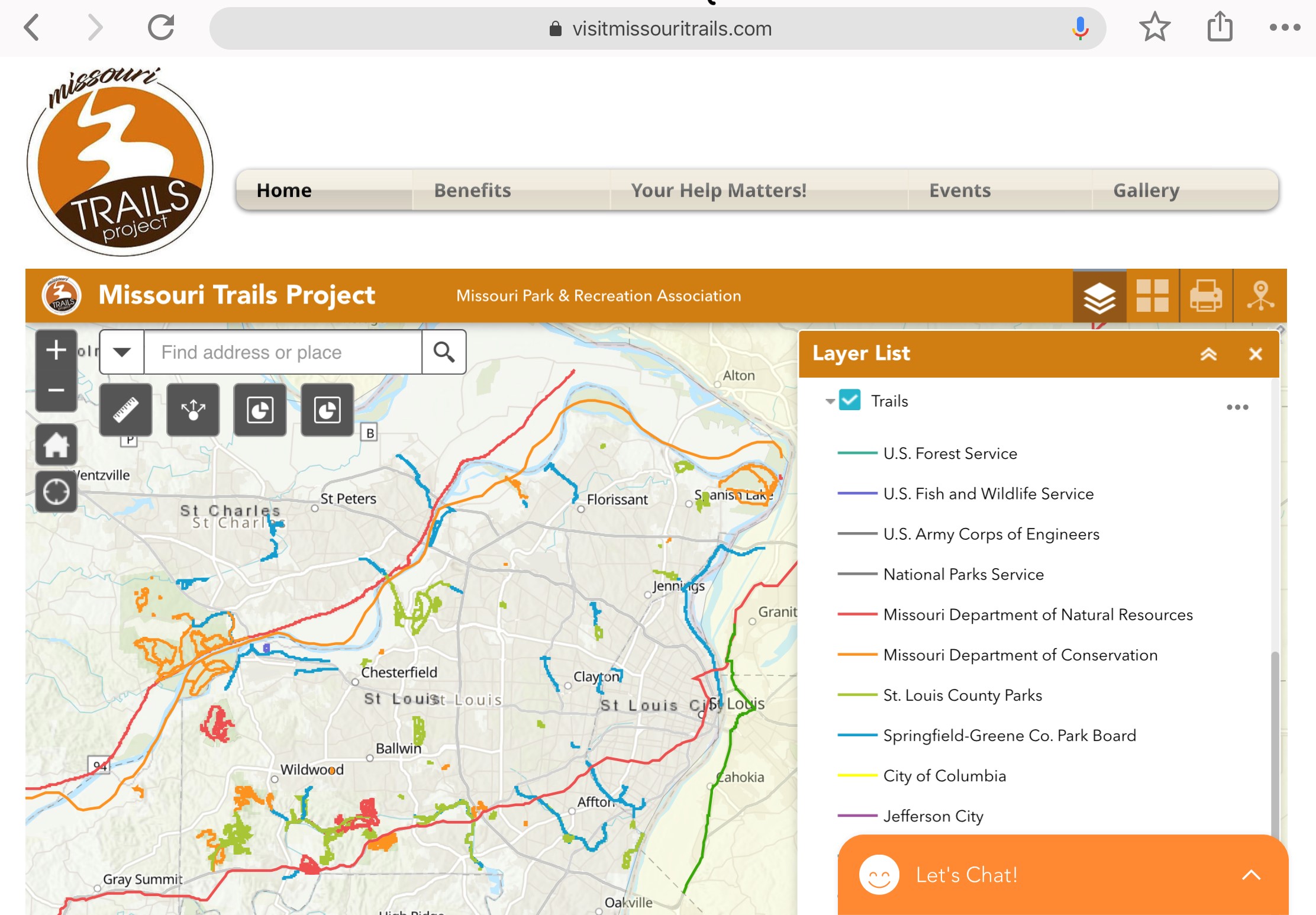
After nearly eight years in development, an interactive website consisting of more than 5,400 miles of trail in the Show-Me State officially launched in late January. The Missouri Trail Project, a product of Missouri Park & Recreation Association (MPRA), collaborated with trail managers and partners to amass what it believes to be the largest collection of online trail data for Missouri in one interactive map for walking, hiking, bicycling, equestrian, mountain biking — even boating. “However people choose to recreate, this is a one-stop resource for planning and enjoyment,” said MPRA Executive Director Gary Gates.
The site allows users to locate, identify and learn all about trails across Missouri (and some neighboring states) to help residents and tourists alike plan trips without potentially having to use multiple online resources from multiple organizations. A secondary use of the website is to assist in the identification of future opportunities to build and connect even more trail.
The Missouri Trails Project was financed mostly through a Recreation Trails Program Grant and donations from partners such as Great Rivers Greenway, Clayton Parks & Recreation and many more. MPRA is seeking funding partners for future phases of the project, which could include a native app and expanded functionality like emergency alert notifications. visitmissouritrails.com
Leave A Comment