
The first time I learned about the Buffalo River, we stumbled across it while passing through. Before we were married, my wife and I met after moving to St. Louis, and we began exploring the surrounding region. During a summer road trip toward the Gulf Coast, we drove through Arkansas for the first time with camping stops planned near the Pedestal Rocks Trail and at Hot Springs National Park.
On the way south, Highway 7 dropped into a sizeable valley and crossed a surprisingly high bridge over a scenic bluff-lined river. Being a dedicated paddler with poor time management skills, I did what comes naturally when crossing an unfamiliar waterbody — ignoring that we were running late, that my wife was hungry, and that dusk was approaching, I screeched to a halt near a sign for the Buffalo National River. While she watched me like I was crazy, I began wandering around the darkening area. I yelled out that I’d find info and come right back, but really I was searching for any rapids that might be in sight. From a National Park Service (NPS) kiosk, I came away with one of those glossy folding maps and the knowledge that there were about 150 miles of river to explore.
Hiking to the Pedestal Rocks the next morning was pretty nice. Hot Springs National Park was interesting enough, more like a nature area within city limits. There were a few decent hikes, and a history tour, but all the hot springs were inside bathhouses. We moved on after a night with no regrets. But, in hindsight, the best takeaway from this first foray into our neighboring state was that the Arkansas Ozarks were worth returning to, and high on the list was learning more about the Buffalo.
A River Surrounded by Reservoirs
If not for what happened 50 years ago in the rugged northwest corner of Arkansas, much of the Buffalo River might very well be gone today. Take a look at a topographic map of this region and you’ll see the rugged ridges and hills of the Boston Mountains running from west to east. Encircling this elevated landform, on almost every side, are a series of long and winding reservoirs. From the early 1950s to mid-1960s, five reservoirs were built on the White River and its North Fork tributary: Beaver Lake, Table Rock Lake, Lake Taneycomo, Bull Shoals Lake, and Norfork Lake. During that same time period, two reservoirs were built on the Arkansas River, plus one each on the Little Red River and the Illinois River. By the late 1960s, the Boston Mountains and free-flowing Buffalo River were surrounded on all sides, and dam builders like the Army Corps of Engineers began looking for new opportunities.
Stunning bluffs on the middle Buffalo River. (Mike Bezemek)
By the time the threat of dams arrived, the Buffalo watershed had already seen several eras of human history. For thousands of years, small groups of Native American nomads and farmers lived along the river. The last groups were the Osage and later Cherokee, both forcefully relocated by the US Government to Indian Territory in present-day Oklahoma. The first European visitors were likely French trappers, who named it the “Buffaloe Fork of the White River” after the now-extinct woodland bison that grazed throughout the lush valley.
By the time of the Civil War, there were under 10,000 residents in the Buffalo watershed, mostly working small family farms. Several decades of logging and mining (primarily lead and zinc) occurred around the turn of the 20th century. Most resources were exhausted by the 1920s, and the population peaked at over 20,000 before steadily declining throughout the next 50 years and leveling off back under 10,000. During the boom after World War II, recreational activities like canoeing and fishing became increasingly popular.
Next came the era of big dam building in the US, and several hydroelectric and flood control projects were proposed on the Buffalo River. The first dam would have been built a few miles above the confluence with the White River, in what later became the Lower Buffalo Wilderness. At maximum levels, this reservoir would have flooded the river for 55 miles to downstream of Highway 65 near the Tyler Bend Visitor Center. A second dam would have been built near Highway 65, capable of flooding the valley for about 40 miles upstream to near Pruitt — where my wife and I stumbled across the river many decades later. There was even talk of a dam near Hemmed-in Hollow, which might have reduced the tallest waterfall between the Rockies and the Appalachians (200 feet tall!).
Preservation: A National River
While some locals saw economic potential from new reservoirs, others saw benefits in leaving one of the last free-flowing Ozark rivers entirely undammed, including paddlers, anglers, and campers. By now, the post-World War II boom had brought thousands of families into the outdoors. From water level, they had discovered the natural beauty of the Buffalo, staring up at limestone bluffs rising hundreds of feet overhead. For similar reasons, two nearby Ozark streams in Missouri — the upper Current River and Jacks Fork — were protected in 1964 as part of Ozark National Scenic Riverways.
After a fierce public debate about the future of the Buffalo, the preservationists prevailed and the governor of Arkansas concurred. In March 1972, 100 years after the creation of Yellowstone, congress authorized a new park: the Buffalo National River. This NPS unit would preserve natural and recreational qualities of the Buffalo for future generations to enjoy. By the time my wife and I passed through several generations later, the river remained much as it had been for thousands of years. And the Buffalo never disappointed when I returned many times for paddling trips, sometimes with my wife, sometimes with friends, and one time on my own.
Three Districts to Paddle
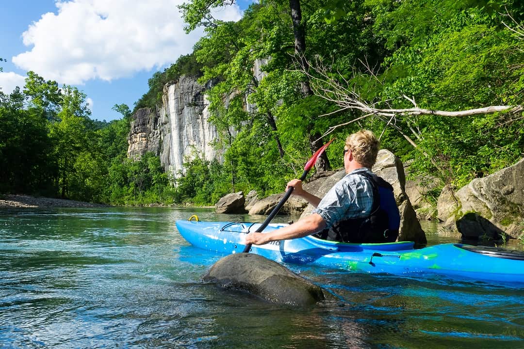
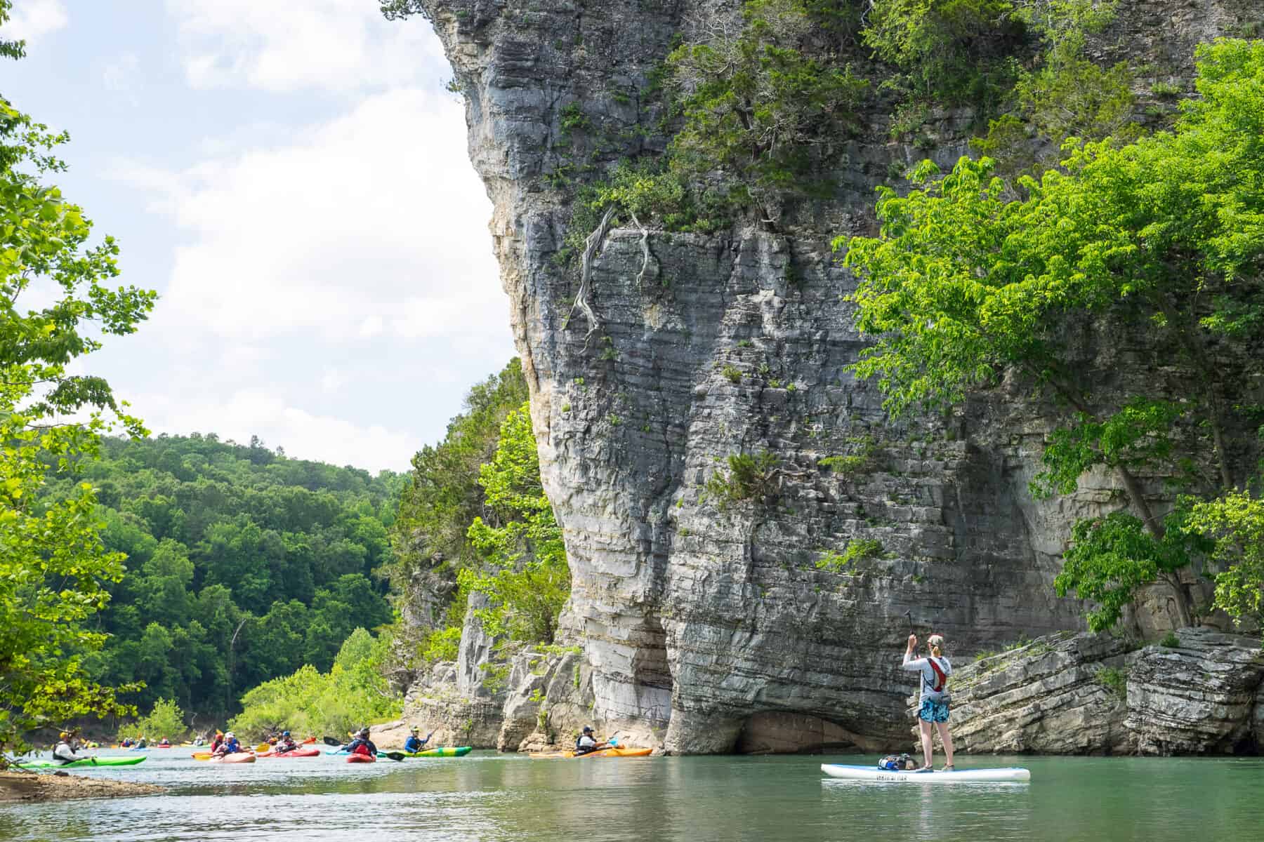
Over its roughly 151-mile course, the river is divided into three districts helpful for planning purposes. The upper Buffalo is mostly rain dependent, offering runnable water levels in the winter and spring. The gradient is higher, with frequent class II rapids to navigate. The most popular section passes through the Ponca Wilderness, starting either from Ponca or Steel Creek and ending at Kyles Landing. Some of the most dramatic cliffs, like Roark Bluff and Big Bluff, are found along this section, as is the 200-foot waterfall at Hemmed-in Hollow. For a quieter experience, you can continue another 25 miles down to Carver, with five more access points along the way.
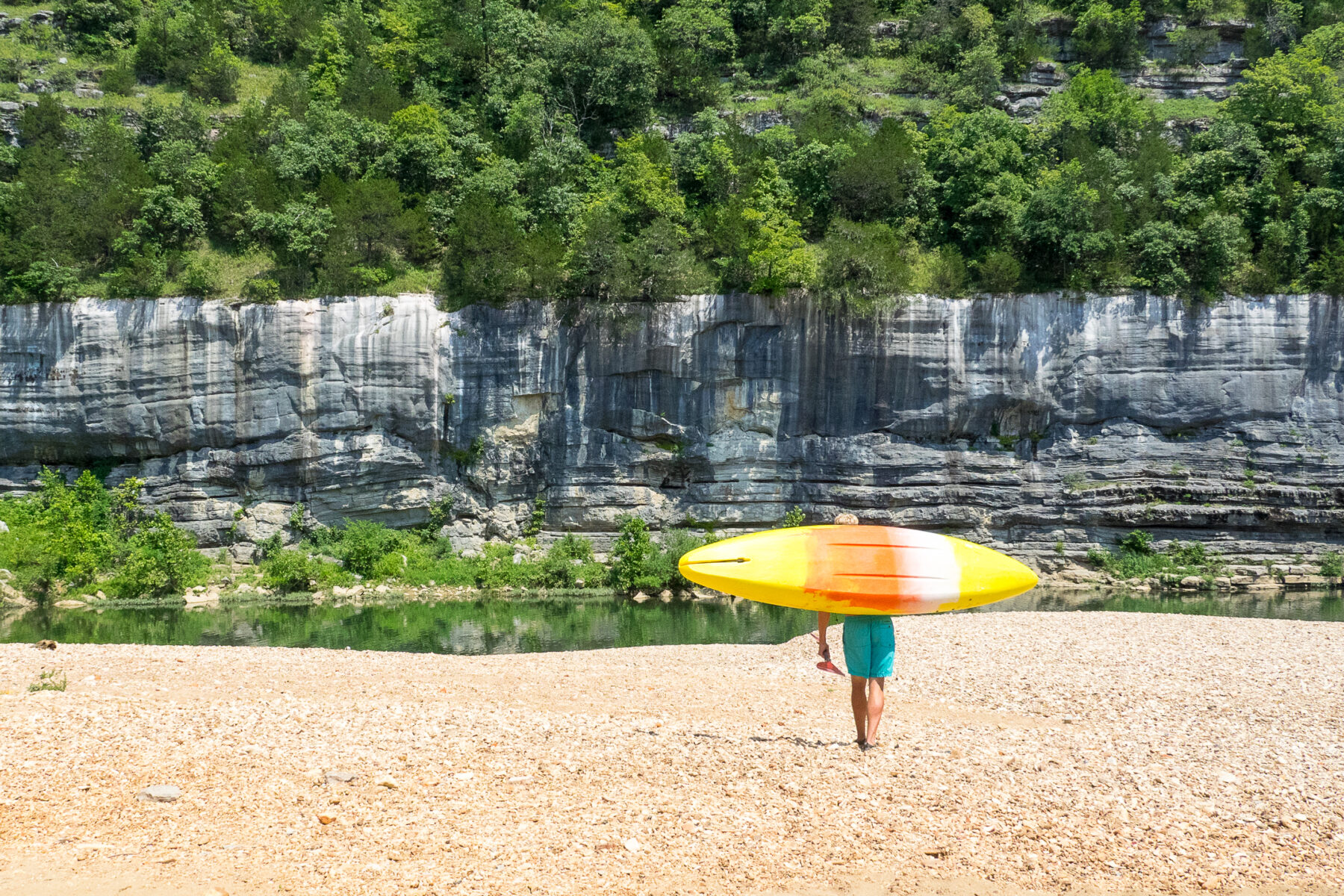
Painted Bluff at Buffalo Point Lower District. (Mike Bezemek)
While the upper Buffalo typically dries up during late spring, the middle and lower sections benefit from larger runoff catchments and continue running. The middle Buffalo includes roughly 50 miles from Carver to the Maumee South and North access points, with about eight possible day runs of varying length and a mix of valley and bluff scenery.
The lower Buffalo is the final 45 miles from the Maumees down. Several runs are possible, with a popular day trip being either from Dillards Ferry or Buffalo Point Campground to Rush. The river is deeper and slower down here, but the terraced bluffs rise in heights equal to the upper river. One of the biggest adventures on the entire river starts from Rush Landing and passes through the vast Lower Buffalo Wilderness, the largest in the Midwest, for about 25 miles before the Buffalo confluences with the White River.
Additional Adventures
Elsewhere along the Buffalo National River, more opportunities for adventure await. A number of hiking trails can be found throughout all three districts, including the 37-mile Buffalo River Trail, popular for day hikes and long-distance backpacking. The park has 11 campgrounds of various size, with a mix of walk-up and reservable sites. Other activities include fishing, horseback riding, and exploring the Boxley Valley Historic District near Ponca and a zinc mining ghost town near Rush.
Throughout 2022, the park service is planning events to celebrate the 50th anniversary, with the next option being Park RX Weekend on October 8 and 9, focused on the health benefits of the river’s natural resources. Check out the website nps.gov/buff for more information and an events calendar. But even if you don’t visit during the Buffalo National River’s 50th year, you’ll luckily have more chances. Whether you go during the 51st year, the 52nd, or the 60th, the Buffalo National River will remain due to the preservation efforts of the National Park Service.
The 50-Mile Challenge
Celebrate the 50th anniversary of America’s first national river by becoming a 50-Miler!
In honor of Buffalo National River’s 50th anniversary, the park challenges you to log 50 miles of physical activity at Buffalo National River in 2022. You can conduct your activities anywhere in the park throughout the year, and every finisher will earn a certificate and patch.
Activities should be self-propelled: walking, running, hiking, biking, swimming, and paddling all count towards the 50-mile goal.
Visit nps.gov/buff/getinvolved/50-mile-challenge.htm to find mileage log form that you can use to track your miles, or you can make your own log for submission. Once you complete your 50 miles, email your completed form(s) to buff_events@nps.gov or mail to:
Buffalo National River
50-Mile Challenge
402 N. Walnut Street, Suite 136
Harrison, AR 72601
A certificate and commemorative patch will be mailed out monthly to participants who complete the challenge. You have until January 31, 2023, to submit completed logs. Please call the Buffalo Point Ranger Station at 870-449-4311 with any questions.
Author: Mike Bezemek is a contributor to Terrain Magazine.
Top Image: Paddling the upper Buffalo River. (Mike Bezemek)
Leave A Comment