When thinking of classic Missouri shut-ins, the first name that comes to mind is likely “Johnson.” But if you want to experience something truly unique, head 50 miles east of Johnson’s Shut-Ins State Park to the Amidon Memorial Conservation Area. This is where you’ll find Missouri’s only known pink granite shut-in, Castor River Shut-Ins.
Those who have spent time in the St. Francois Mountains in southeast Missouri have likely come across the predominant reddish-pinkish rock known as rhyolite. This igneous rock was formed billions of years ago when the region was an active volcano range. Both rhyolite and granite are formed from cooled magma, the difference being that rhyolite forms above ground and granite forms below ground. Being composed of granite means that these pink shut-ins (i.e. rocks) were once underground and have been exposed to the surface through millions of years of erosion.
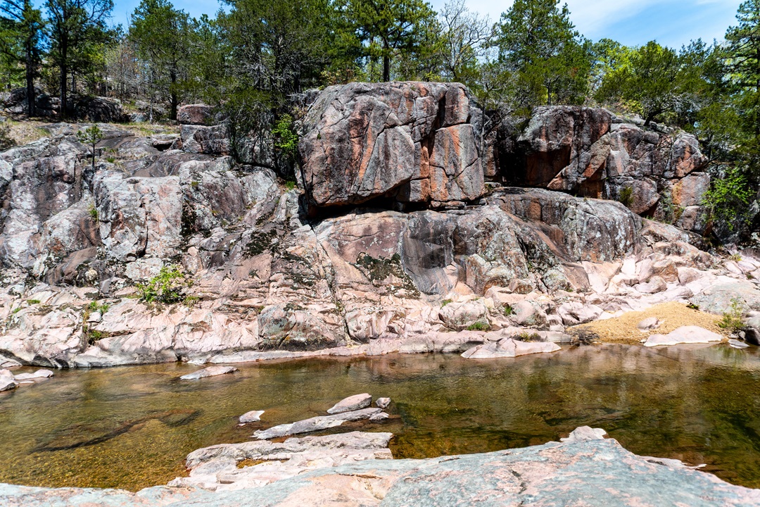
The pink granite of Castor River Shut-Ins. (Michael Shepherd Jordan)
The main stretch of shut-ins is roughly 600 feet before taking a 90-degree turn south for another 250 feet. The primary stretch cuts through a 20-foot-tall canyon of pink granite and features the standard boulders, pools, riffles, and small rapids perfect for hopping across and splashing in on a summer day.
There is also a 1-mile hiking trail to explore (AllTrails users, search “Cedar Glade Trail”). An informational kiosk titled “Granite Glade” directs potential hikers to the trail, which leads up a short hill to a glade with a decent overlook (it’s above the tree line, at least), then meanders through the cedars before looping back around to the initial fork for the shut-ins or parking lot.
But to truly gain a feel for the beauty and scope of Castor River Shut-Ins — and to learn more about the geological properties — check out the video at the top of this article.
Then, read on for more details. And start planning your trip.
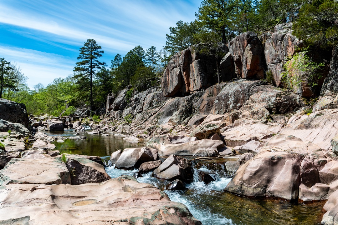
The small rapids of Castor River Shut-Ins. (Michael Shepherd Jordan)
Getting to Castor River Shut-Ins
Coordinates:
- Parking Lot: 37.568897, -90.154971
- Shut-Ins: 37.569084, -90.150630
Directions to Castor River Shut-Ins: From downtown St. Louis, take I-55 south to Exit 174B toward US-67 Bonne Terre/Farmington. Continue on US-67 south until the MO-72/US-67 BUS exit toward Fredericktown/Acadia. Take MO-72 east about 3 miles to Highway J. Turn left (east) onto Highway J and continue for 4.6 miles to the junction with Highway W. Turn right (south) onto Highway W and go 2.4 miles to the end of the pavement. Turn left (east) on CR 208 and drive 1.1 miles to the junction with CR 253. Turn left (north) on CR 253 and proceed 0.9 miles to the parking area and trailhead on the right (east) side of the gravel road.
Amenities: Parking, hiking trail.
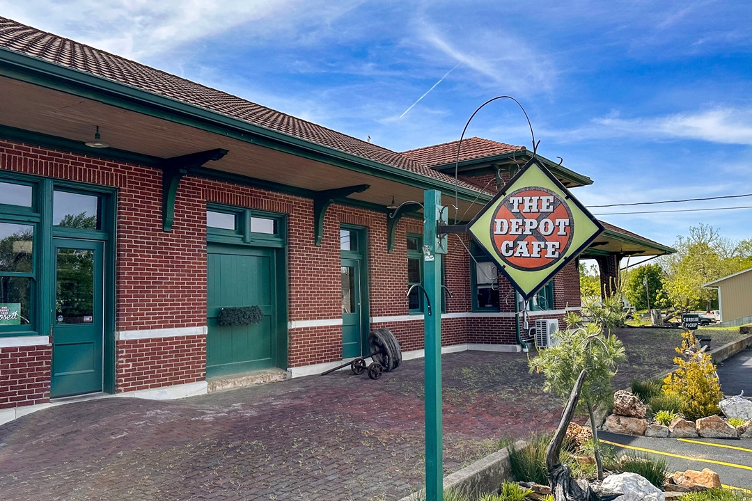
The Depot Cafe in Fredericktown. (Michael Shepherd Jordan)
Eat Here: The Depot Cafe
Leaving Castor River Shut-Ins will most likely take you through Fredericktown. If you’re feeling hungry, swing by The Depot Cafe, a historic Missouri Pacific Railroad Station transformed into a restaurant serving American fare for lunch and dinner. It also offers rotating specials, but if you’re there on a Saturday, get ready for the Apple Bourbon Pork Chops. Open Wednesday through Saturday.
Author: Michael Shepherd Jordan is a contributor to Terrain Magazine.
Top image: Michael Shepherd Jordan.
Leave A Comment