Vistas of cornfields and soybeans are plentiful in Illinois, but head south to the rolling hills and dense forest of the Illinois Ozarks and you’ll find scenery that’s quite different. Little has changed here since early European settlers made their homes along the lush shore of the Ohio River during the late 1700s. This is a land of natural beauty, pleasant diversions, and rich history.
The counties of Gallatin, Hardin, Pope, and Saline make up the eastern region of Southernmost Illinois, an area tucked between the Mississippi and Ohio rivers at the extreme southeast corner of the Prairie State. Never heard of Southernmost Illinois? That’s OK, you’ll never forget it once you’ve been there.
We planned our trip for late September, so that we could enjoy the changing fall colors as well as the sights. Our cabin at Cave-In-Rock State Park was tidy and clean, nothing fancy but eminently comfortable and boasting unbeatable views of the Ohio River. Over the course of two days, we visited a dozen places that were never more than a couple of hours’ drive down a country road.
Here’s what we saw, with some recommendations on how to get the most out of your own visit.
Robbers and River Pirates
Cave-In-Rock State Park is named for the 55-foot-wide hollow that was carved out of the limestone rock by the winds and waters of time. Over the years, it served as a refuge for frontier explorers, gamblers, outlaws, and river pirates, then was purchased by the State of Illinois in 1929 and became a tourist attraction hosting thousands of visitors annually.

Cave-In-Rock in winter.
After walking the gravel path to and from the cave on the edge of the Ohio, take a hike on the park’s other trails, which offer views of barges and bluffs and allow access to a secluded fishing pond. The Cave-In-Rock Ferry invites you to ride (for free!) on the only Illinois ferry crossing the river. Finish the day off with a southern-style meal at the Cave-In-Rock Restaurant and Lodge.
A Divine Rock Garden
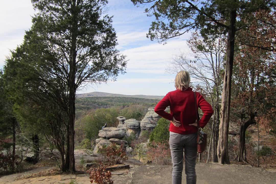
See the towering rock formations and cliffs at one of the most visited sites in Shawnee National Forest. Garden of the Gods Recreation Area in Saline County is home to oft-photographed Camel Rock, Anvil Rock, Devil’s Smokestack, and other fascinating features. Climb the Observation Trail up top and the Wilderness Trail down below, which cuts through 3,300 acres of relatively undisturbed natural area.

Garden of the Gods Recreation Area.
Stop at Garden of the Gods Outpost for souvenirs and ice cream on the way out of the park — and be sure to hop across the road for a selfie with Sassy, a locally famous 7-foot-tall statue of Sasquatch. You can overnight nearby in a deluxe tree house or log cabin at Timber Ridge Outpost & Cabins. Sign up for a guided hike or mushroom foray while you’re there.
History and Industry
The eastern region of Southernmost Illinois has no shortage of interesting attractions for history buffs.
The Rim Rock National Recreational Trail in Hardin County leads you on a short hike to an ancient Native American walled settlement. (You can also navigate Fat Man’s Squeeze and Ox-Lot Cave while there.)

Rim Rock Trail.
Step back to Civil War days at the Illinois Iron Furnace, where “pig iron” was smelted at the first charcoal-fired furnace in the state, now on the National Register of Historical Places. It’s also located in Hardin County, adjacent to a secluded stream and swimming hole.
You can learn about the Illinois State Mineral, Fluorspar, at the American Fluorite Museum in the town of Rosiclare. The town’s Main Street houses the Rose Clare Craft & Antique Mall with 19 booths of vintage jewelry, furniture, collectibles, and more. One block away, the Rosiclare River Walk offers spectacular views of the Ohio River.
From One River to Another
Take your exploration of Southernmost Illinois to a new level of adventure by tackling the River-to-River Trail, a 160-mile route that starts at Battery Rock on the Ohio River and ends in Grand Tower, Illinois on the Mississippi River. Alternatively, you can start in Elizabethtown; be sure to try the fried catfish at the E-Town River Restaurant (a floating eatery with plus-size platters) before heading out.

River-to-River Trail.
Every April over 2,000 runners cross this land between the rivers in the River to River Relay. The trail serves the Shawnee National Forest and passes through plains, bluffs, bayous, and hardwood forest. Even if you don’t expect to conquer the entire route, it’s worth a trip to experience the scenic hills and hollows the trail bisects.
Author: Brad Kovach is the editor/publisher of Terrain Magazine.


Leave A Comment