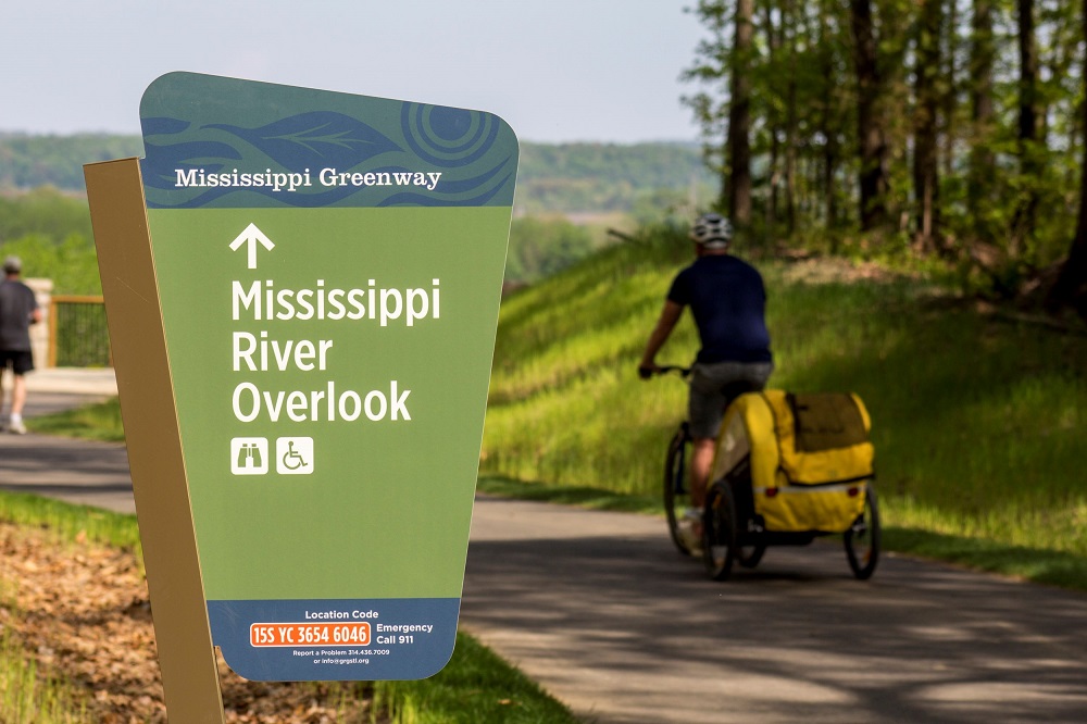
Cliff Cave is a park transformed. Since we last wrote about it in our May/June 2017 issue, this richly historic property has benefitted from a $4.3-million expansion that opens the park up to people of all ages and abilities — and adds a soaring overlook with panoramic views of the Mississippi River as it slices through the floodplains and wooded forests south of St. Louis.
The project, which took about 18 months to complete, extends the existing 5-mile paved greenway that runs along the Mississippi two miles up the bluff, climbing three switchbacks before eventually connecting with the bike lane on Telegraph Road. The path is wide and even, lined in areas with attractive retaining walls, fencing, benches and landscaping. (According to Great Rivers Greenway, managers of the project, more native trees and shrubs were planted than were removed during construction.)
“The expanded greenway allows people of all ages and abilities to see everything this incredible park has to offer. From the soaring bluffs and wooded hillsides, to the breathtaking views of the Mississippi River — Cliff Cave Park’s natural beauty is more accessible for all to explore and enjoy.”
— Susan Trautman, CEO of Great Rivers Greenway
A highlight of this portion of the greenway is a new, 70-foot bridge that spans the spring-fed creek flowing from the mouth of Cliff Cave, linking the lower and upper sections of the park. Printed signs along the path describe the formation, history and ecology of the cave, providing a self-guided walking tour for visitors.

210-foot pedestrian bridge
Not far from the cave, another mile of paved path branches off to the east and climbs up to the new overlook, but not before crossing over Cliff Cave Road on a striking, 210-foot pedestrian bridge. A new parking lot north and west of the overlook has restrooms and water available.
Off-Road Attractions
The 525 acres that Cliff Cave Park occupies offer more than paved pathways and lovely views. Off-road enthusiasts (hikers, bikers and equestrians) can enjoy nearly five miles of natural-surface trails that range from fast and flowy to rocky and technical.
Spring Valley Trail consists of two loops: an outer one and an inner one. The two loops are tied together by three short connector trails that allow users to weave a variety of routes in either direction. The mostly packed-dirt trail can be tight and twisty or flat and fast, and circumnavigates several sinkholes that attract deer, squirrels, rabbits and fox.

Bluff Trail
To get to Spring Valley Trail from the lower parking lot, take the paved greenway up the switchbacks to the trailhead on the hilltop. From the new upper parking lot, ride down the paved trail, cross the pedestrian bridge and then climb the switchbacks. Those familiar with the old entrance to Spring Valley Trail, which cut across the creek and then climbed a steep hill to the top of the cave, should note that this is no longer accessible with the new layout.
Bluff Trail has the best technical features and begins near the overlook with four newly cut switchbacks that lead down to a series of large, exposed rocks. The trail then transitions back to mostly packed dirt as it winds its way back up to the overlook.
Getting There
From downtown, take Interstate 44 West toward Interstate 55 South until you reach the Interstate 255/270 exit toward Chicago. Jump on I-255 East and continue until you reach Telegraph Road. Exit at Telegraph and drive south for a few miles, then turn left at Cliff Cave Road. Look for the new upper parking lot on your left or continue until you reach the terminus of Cliff Cave Road at the lower lot adjacent to the Mississippi Greenway.
If you’re coming from St. Charles, merge onto Interstate 70 East and take I-270 South to I-255 East. Then, follow the directions above to reach the park.
Those coming from Jefferson County should take I-55 North to I-255 East and pick up where the directions leave off above. Those comng from Illinois should take I-255 West to the Telegraph exit and then proceed south to Cliff Cave Road.
~~~~~~~~~~~~~~~~~~~~~~
Trail Information
Length: Three trails add up to roughly 12 miles throughout the park — 7 miles (Mississippi Greenway), 3.75 miles (Spring Valley Trail) and 1.2 miles (Bluff Trail)
Type: Linear and looped
Surface: Paved, natural surface and gravel
Rating: Beginner/intermediate
Best for: Running, walking, hiking, bicycling and equestrian (natural surface only)
Parking: Available at the upper lot off Cliff Cave Road or the lower lot along the Mississippi Greenway
Amenities: Parking, picnic pavilion, restrooms, water, scenic overlook, self-guided walking tour and handicapped accessible
Brad Kovach is the editor/publisher of Terrain Magazine. Additional reporting by Heather Ervin.


Great post and quote from Great Rivers Greenway, but why don’t you link to the GRG site, so people can get more info about this area?