A new spur of the Ozark Trail offers a unique hike and paddle opportunity to explore the Current River landscape through a national park and two state parks.
The self-guided Current River Challenge starts from the trailhead across Missouri Highway 19 from the Round Spring Upper Access in the Ozark National Scenic Riverways. The trail goes upstream 4.5 miles on the new Upper Current Section of the Ozark Trail to Echo Bluff State Park. The second leg of the trail continues 4.5 miles to Current River State Park. From there you paddle 4 miles back to Round Spring on the beautiful Current River. The loop makes it a shuttle-free trip.
Built by volunteers with the Ozark Trail Association, the new section was completed last October. The path is well-marked with bright orange blazes.
“This opens up an awesome recreational opportunity beyond float season,” said Kathie Brennan, president of the Ozark Trail Association. “It goes through some neat areas of forest that you would probably never see. You can do it in a day or break it up by hiking to Echo Bluff and spending a night there.”
You can do this trip any time of year, but the hike is more enjoyable in cooler weather. In May, the trail through the white oak and shortleaf pine forest was littered with wildflowers and butterflies.

Wildflowers carpet the woods in the springtime on the Upper Current Section of the Ozark Trail. (Janice Branham)
Between Echo Bluff and Current River State Park the trail climbs up to the sandstone and limestone bluffs above the river. Total elevation gain is around 1,100 feet. The gorgeous view over the valley is worth the effort. At the end of the trail in Current River State Park the descent is very steep. Well-fitted hiking boots with plenty of room for your toes will save you some pain.
If you go during hunting season, wear something bright, ideally blaze orange. Most of the trail is on state park land, except for a short section in the Roger Pryor Pioneer Backcountry above Round Spring that is huntable.
You’ll need to leave a canoe or kayak by the river at Current River State Park before driving down to Round Spring to start the hike. If you rent a boat from Carr’s Canoe Rental at Round Spring, they will leave it for you at the put-in point.
“We have had no problems with boat security,” said Connie Weber, an interpretive specialist for Current River State Park.
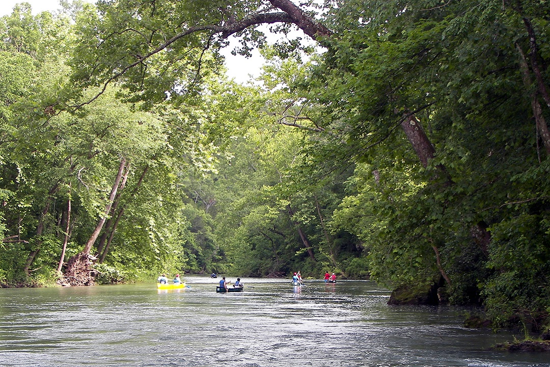
The paddle leg goes by quickly in the swift current. Watch for herons, hawks, and other wildlife on the river. About 2.5 miles from the put-in, Sinking Creek comes in on the left. The warmer water makes it a nice place to stop and enjoy the scene.
A map of the challenge is available at the Round Spring Visitor Center and the Ozark Trail Association website. You can find larger scale maps of trail sections with more details in the park brochures for Echo Bluff and Current River State Park.

Stop by the kiosks at the two state parks and Round Spring to stamp your Current River Challenge map as you complete each leg of the trip. When you have completed all three sections, bring your map to the Visitor Center to receive a sticker marking your achievement as a challenge finisher.
If you’re looking for more adventure, longer hike-and-float loops on the Ozark Trail start from the Powdermill Trailhead at Owls Bend. Over five or more days, you can hike 40 miles to Current River State Park and paddle 29 miles back to Owls Bend. It’s a bigger physical and logistical challenge but can be done. Check with the Ozark Trail Association for more information and maps.
Author: Janice Branham is a regular contributor to Terrain Magazine.
Thank you. Hope to share with my family
Thanks for this excellent information.